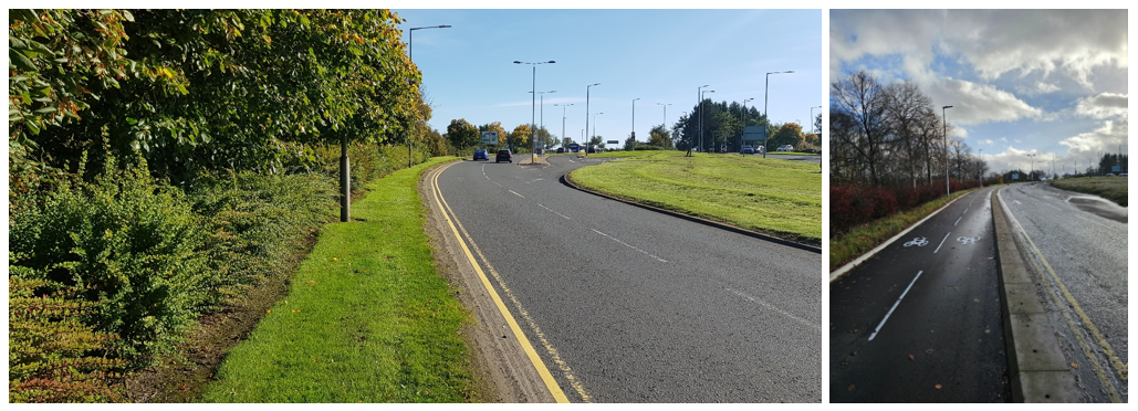
Active travel case studies
These case studies illustrate how investment in active travel significantly benefits communities.
Aberdeen City
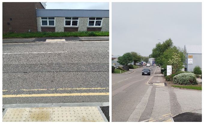
£115,717.40 of Cycling, Walking and Safer Routes 2023/24 funding has enabled more people in Aberdeen Council’s area to chose walking and wheeling for their primary mode of transport for short journeys. Responding to a request from a mobility scooter user in Greenbrae, whose access was limited on Dunmore Road, a design was prepared to provide dropped kerbs and tactile paving along the route.
The section of Denmore Road, approximately 1.5 kilometres, is mainly industrial but includes sections of retail and links to three residential areas. The route had developed without corresponding access upgrades creating an unwelcoming environment for those walking and wheeling.
As a result 26 crossing points were added, mostly along the eastern footway at side roads and access points, with separate uncontrolled crossings at regular points to aid access to the western side of the route. These improvements enhance active travel options by making the route more accessible and safer, including to those with mobility challenges and visual impairments.
The added crossings and tactile paving ensure a smoother, more navigable journey, encouraging more people to walk or wheel. The route is now family-friendly making it easier for those travelling with prams. Overall, these provisions support greater use of active travel modes, connecting people to employment, retails and public transport more efficiently.
Aberdeenshire
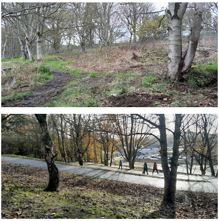
Ellon is part of Aberdeenshire Councils’ Integrated Travel Town project where there have been many active travel infrastructure improvements and soft measures to encourage behaviour change. In Ellon, the Riverside path and the Formartine and Buchan Way have both been upgraded to encourage more active travel and make the town more connected.
The Caroline Wells Woods link adds to the infrastructure provision in Ellon. A housing development to the North of Ellon had limited connectivity to the town and this key link provided a suitable route for wheelchairs, pedestrians and cyclists to visit the town centre. The path is 206m long, with a gradient of less than 5% (a design requirement for all wheeled users), and 3 metres wide throughout. This created a quicker, shorter, and more direct route to town. The route was planned to avoid all of the mature trees to preserve Caroline Wells Woods.
A survey was conducted and revealed a high demand for a new path to be constructed in the area. Residents suggested they would use active travel more frequently if infrastructure was available to use, this provided an opportunity to promote the uptake of active travel use, which is arguably best met with good quality infrastructure.
Cycling Walking and Safer Routes fund supported this scheme with funding of around £220,000.
Key Results / Outcomes
A survey was conducted to study the demand for the path to be built and there were 529 responses. Using partial post code data, 98% of those who answered the survey lived in Ellon, whereas the others may regularly visit or work there.
When asked how the Covid-19 pandemic had affected how respondents walk and cycle, 43% now walk or cycle more often. Over 25% of those surveyed would like to walk or cycle more often, however don’t have the supporting infrastructure in place to enable this.
Given that the proposed route delivers quicker and easier access between the town centre and housing developments, the survey asked whether the proposal would indeed encourage respondents to walk or cycle for shorter trips more often. There was an overwhelmingly positive response to this, 81% said they would be encouraged and 9% answering that it might encourage them to choose active travel more frequently.
Respondents were asked what purposes they would use the path for. This question allowed multiple answers, the top purposes given were for recreation (375 returns), to visit the shops (361 returns) and to visit friends (261 returns). Travelling to school was marked 96 times and commuting to work 57 times. This indicates that locals intend to use the path for social and utility journeys, and that it would have a smaller impact on those commuting to school and/or work.
The survey included 364 supportive comments showing the positive attitude of residents in the area. There were only 21 unsupportive comments which mentioned concerns about lighting and nature in the woods.
Respondents were asked how they would rate the proposal to provide a shared use path through Caroline’s Well Woods. The rating was an option scale of 1 to 5, with 1 being least useful, and 5 being most beneficial. The outcome was very favourable for the path proposal, with an average rating of 4.51 out of 5. This was made up of 472 responses (for clarity, not all survey participants chose to answer the question).
The project has been shortlisted at the Scottish Transport Awards in the Excellence in Walking, Public Realm and Cycling category.
Dumfries and Galloway
As part of the development of the new Dumfries and Galloway Royal Infirmary, Dumfries and Galloway Council decided to deliver a number of active travel infrastructure measures to enable staff, patients, and visitors to consider cycling, walking and wheeling as a viable method of transportation.
New Abbey Road/Pleasance Avenue junction was a very uninviting to active travel, there was no crossing provision, no direct active travel access with only a grass verge.
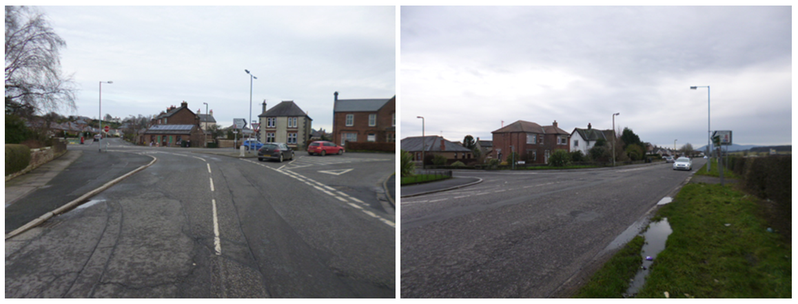
In 2023/24, with support from Sustrans Places for Everyone fund and utilising some Cycling, Walking and Safer Routes (CWSR) funding as match, the measures installed included junction improvements, new traffic signals with pedestrian and cyclist crossings, and a new segregated, foot/ cycleway. The scheme promotes active travel by creating dedicated walking and cycling infrastructure on New Abbey Road, a key route linking the hospital and Dumfries town centre. 9
In addition, this now links to the Kirkpatrick Macmillan cycle bridge and path in Troqueer and the shared-use pavements in Cargenbridge. The hospital is also connected to National Cycle Network route 7 (the Maxwelltown Railway cycle path), which runs north-south.
The total cost of the project was £1,424,608 with £69,448.53 coming from CWSR.

With the new 800m footway with segregated cycleway, and the installation of the crossings, New Abbey Road is no longer a barrier to active travel, and the improved public spaces enhances the users experience.
East Renfrewshire
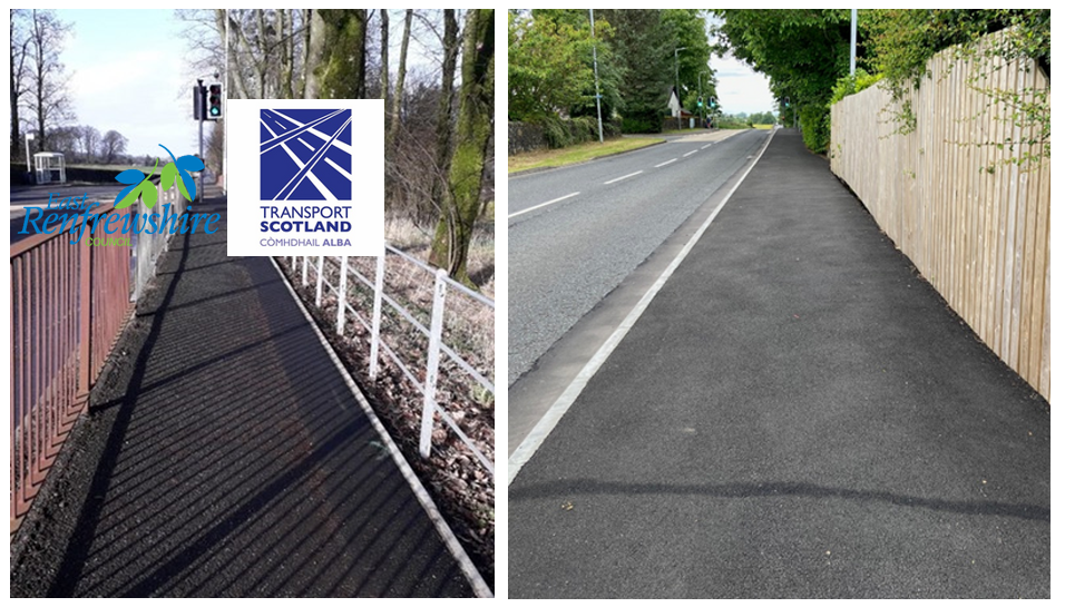
Residents of Waterfoot in had expressed concerns over a number of years to East Renfrewshire Council about road speeds and about narrow pavements. Glasgow Road is a B road with a high volume of traffic and despite there being a 30mph limit, drivers often exceeded the limit. This perceived fear created a barrier to people walking.
East Renfrewshire Council reduced the carriageway by a meter and widened the pavement by the same, creating a new kerb line. This gives pedestrians more space and makes the route more attractive for walking.
The total cost of £150k was paid for from the Council’s Cycling, Walking, and Safer Route funding for 2023/24.
East Renfrewshire Council plan to undertake surveys to assess the impact of the changes on traffic speeds.
Fife
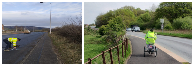
Kelty and Cowdenbeath are just over 2 kilometres apart, which is an ideal distance for active travel. The approximately £1 million project to connect these two communities was funded by Cycling, Walking, and Safer Routes in 2023/24. By constructing a dedicated off-carriageway shared pedestrian and cycle track, the project provides a safe and convenient route for those walking, wheeling and cycling.
The new active travel corridor, which includes a new toucan crossing and a buffer zone for added safety, directly connects residents and visitors to the places they need to go to, such as schools, shops, transport links, community centres, leisure centres and outdoor spaces, including the nearby Lochore Meadows Country Park.
This initiative supports Transport Scotland’s goal of transforming communities and enabling people to make walking, wheeling and cycling their mode of transport for short, everyday journeys. Promoting active travel enhances the lives of residents by providing safer, greener and more enjoyable travel options.
Community feedback has been very positive:
I wanted to thank you on behalf of Cardenden Community Council and myself as a cyclist for the fabulous new dual use path along the A909 (Kelty Junction/ Lumphinnans to Kelty ). The surface is fabulous and so safe . It’s a regular route for many, as it provides an excellent link to Lochore Meadows and to paths that link to Blairadam . An added bonus is that it links to a similar new path from the beginning of Lumphinnans”.
Moray
In 2023/24, £616,000 was provided to Moray Council for active travel infrastructure measures through the Cycling, Walking, and Safer Routes fund. Around £50,000 of the funding was used to engage with people living in two areas, Buckie and Kieth in a participatory budgeting project. The aim was to empower residents to consider various active travel infrastructure options and decide which best suited their needs.
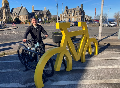
By targeting the areas of Buckie and Keith, the project aimed to foster positive connections with local stakeholders and communities. Through collaborative efforts involving the council’s Transport Team and a community steering committee, the project successfully identified and addressed those needs and focused on cycle parking and on street repair stations.
The installation of these highly visible measures significantly encourages active travel within the targeted areas. The installation of one bikeport, 15 Sheffield stands, three pumps and on street repair stations provides essential support for cyclists, and showcases cycling as a viable mode of transport to the wider community.
The project’s methodology, which included extensive public consultation and community feedback, ensured that the installations met the needs of residents. This participatory approach not only improved local infrastructure but also empowered the community and leads to a higher level of engagement in active travel.
South Lanarkshire
An East Kilbride Active Travel Study (ATS) was undertaken in 2019, engaging with the local community and seeking information on which routes they would like enhanced to make walking, wheeling and cycling a viable option. This exercise identified a number of early priority routes which included the Town Centre network. In 2023/24, Cycling, Walking and Safer Routes (CWSR) contributed £1.078 million to active travel infrastructure within the South Lanarkshire Council area, including the work in and around East Kilbride.
There were five phases and the latest phase connects the Cornwall Street corridor to Churchill Avenue. 0.8km of segregated cycle network, three controlled pedestrian/cycle crossings and 270m of upgraded footway. This provides a segregated cycle route, upgraded pedestrian and cycle crossing facilities on Churchill Avenue, as well as new planting and seating areas to boost the aesthetics of the corridor and provide a space to rest.
South Lanarkshire Council’s ambition is to fulfil the vision that active travel becomes the first preferred choice for everyday journeys and these measures provide easy access to safe, segregated routes from homes, schools and key amenities within the town.
