EIAR Addendum
Executive Summary
The purpose of this Environmental Impact Assessment Report (EIAR) addendum is to ensure that the addition of the design change Access to Oatyhill does not result in any new or additional significant effects when compared to the 2019 EIAR. This addendum considers the information contained within the 2019 EIAR, assessing whether the information is still valid, and if any new information is required which should be made available to the public through a repeat of the consultation process. The report also completes a review of the EIAR against relevant Design Manual for Roads and Bridges (DMRB) guidance updates to ensure that the assessment complies with current standards.
The Access to Oatyhill addition to the A90/A937 Laurencekirk Junction Improvement scheme comprises of a new bridge structure crossing over the East Coast Mainline Railway and associated local road realignment to accommodate the new bridge situated along the U91K road linking the area of Oatyhill with Laurencekirk (see Appendix A: Figures - Figure 1.1 – 1.4). The need for this addition is a result of the existing Oatyhill Rail Bridge requiring closure to vehicular traffic due to significant structural defects.
Descriptions of the existing environment, including Oatyhill junction, confirm that the local receiving environment remains the same as that assessed in 2019. This addendum reviews the assessments as set out in the 2019 EIAR – the conclusions from which are summarised below. The overall determination reached within this Addendum is that the inclusion of the Access to Oatyhill does not result in new or additional significant environmental effects and as such the assessment within the 2019 EIAR remains valid.
Air Quality
There are no Air Quality Management Areas (AQMAs) within the surrounding area. The Department for Environment, Food and Rural Affairs (DEFRA) air quality monitoring archive confirms the air quality as being very good with no exceedances of the national air quality objectives. The 2019 EIAR assessed air quality impacts at sensitive receptors and all were found to be negligible. The introduction of the design change and DMRB guidance and policy updates has not changed this conclusion and the assessment within the 2019 EIAR remains valid.
Cultural Heritage
There are five separate undesignated Historic Environment Records (HER) in close proximity to each other within the field west of the works at Oatyhill bridge. These cultural heritage assets are now closer to the construction works but not directly impacted. However, there is no change to the assessment of significance as these are all previous finds and the mitigation proposed (advance trial trenching of green field areas) remains appropriate. The assessment within the 2019 EIAR therefore remains valid.
Landscape and Visual Effects
The baseline landscape and visual conditions remain unchanged, with some additions to receptors for the Access to Oatyhill. This addendum concludes that the overall residual effects on landscape and visual amenity remain unchanged and that the 2019 EIAR remains valid. This addendum states the need for an updated landscape mitigation plan to encompass the lands around the Access to Oatyhill (see Appendix C: Landscape and Visual Effects: Oatyhill Access Landscape Mitigation) and a maintenance and monitoring plan.
Noise and Vibration
Chapter 8 of this addendum considers the potential impact on the noise assessment of the inclusion of the Access to Oatyhill. It incorporates the findings from the Oatyhill Farmhouse Noise Assessment Review Technical Note (see Appendix B: Noise and Vibration: Oatyhill Farmhouse Noise Assessment Review). Three new residential receptors (properties around Oatyhill) were brought into the assessment as a result of the update to the site boundary. However as there will be no change to existing traffic flows, it was concluded that there is no increase in noise on the receptors in the study area. The findings in the 2019 EIAR remain unchanged and valid.
Biodiversity
Due to time lapsed since the 2019 EIAR, the protected species surveys were repeated to ensure the assessment remains accurate. These surveys are presented in a Protected Species Surveys Report (see Appendix D: Biodiversity Protected Species Survey Report (PSSR)), the findings from which are re-assessed within this Addendum. The results of these surveys confirm that there are no substantive changes to the ecological baseline of the scheme and consequently, the potential impacts of the scheme on biodiversity are largely unchanged and the assessment within the EIAR remains valid.
Road Drainage and the Water Environment
Chapter 11 of the 2019 EIAR addresses road drainage and the water environment. Access to Oatyhill does not bring forward any new surface watercourses or groundwater aquifers. Residual effects, impacts on policy and legislation, methodology, mitigation measures and limitations and assumptions assessed within this addendum conclude that the information from the 2019 EIAR remains valid.
Population and Human Health
Chapter 11 of this Addendum applies the criteria with LA 112 Population and Human Health when reviewing the People and Communities chapter of the EIAR. The aspects of LA 112 Population – Land-use and Accessibility are considered comparable to the assessment completed for the EIAR. This concludes that the Access to Oatyhill, with the inclusion of the temporary access to Denlethen Cottage and Denlethen Wood, does not result in any new or additional significant effects on community severance, agricultural land etc.
This Addendum also completes the scoping for Human Health required in LA 112. It considers the health determinants listed therein: air quality, noise, landscape amenity, pollution and community severance. This review concludes that the A90/A937 Laurencekirk Junction Improvement Scheme, including the Access to Oatyhill, does not result in the identification of any potential adverse health outcomes for the local population and hence no further assessment of Human Health is required.
Geology and Soils
Chapter 13 of the 2019 EIAR discusses the geology and soil considerations of the proposed scheme. Whilst addressing the changes in guidance, transitioning to DMRB LA 109 and design, this addendum chapter reaffirms the baseline conditions, impact assessment, mitigation measures, and residual effects from the 2019 EIAR, with considerations for the Oatyhill area, all of which remain valid from the 2019 EIAR.
Material Assets and Waste
Chapter 14 of the 2019 EIAR addresses potential impacts on material assets and waste during the construction phase of the proposed scheme, focusing on materials, waste, and management. This Addendum chapter provides an update on materials and waste regarding design modifications for the Oatyhill access, affirming the relevance of the text within the 2019 EIAR which remains valid.
Interactions and Cumulative Effects
There is no change in assessment conclusions regarding the Intra-project conclusions from the 2019 EIAR. For Inter-project cumulative effects, the Blackmuir Avenue housing development (assessed within the 2019 EIAR) is ongoing and has the potential for some of the construction works to coincide with the junction works at Laurencekirk, as a consequence the cumulative effects from this development described in the 2019 EIAR remain valid.
Glossary of Abbreviations
- AADT Annual Average Daily Traffic
- ACAS Aberdeenshire Council Archaeology Service
- ADMS Atmospheric Dispersion Modelling System
- ALC Agricultural Land Classification
- AQMA Air Quality Management Area
- AQOs Air Quality Objectives
- ARN Affected Road Network
- AHS Auchenblae Heritage Society
- BGS British Geological Society
- BNL Baseline Noise Level
- CAMS Catchment Abstraction Management Strategy
- CAPS Cycling Action Plan for Scotland
- CDW Construction and Demolition Waste
- CERC Cambridge Environmental Research Consultants
- CIRIA Construction Industry Research and Information Association
- CO2 Carbon Dioxide
- CRTN Calculation of Road Traffic Noise
- CSM Conceptual Site Model
- DEFRA Department for Food, Environment and Rural Affairs
- DM Do-minimum
- DS Do-something
- DMOY Do-minimum Opening Year
- DMRB Design Manual for Roads and Bridges
- DSFY Do-something Future Year
- DSOY Do-something Opening Year
- EIA Environmental Impact Assessment
- EIAR Environmental Impact Assessment Report
- ELC European Landscape Convention
- EPA Environmental Protection Act
- EQS Environmental Quality Standard
- EU European Union
- GCR Geological Conservation Review
- GHG Greenhouse Gases
- GI Ground Investigation
- GWDTE Groundwater Dependent Terrestrial Ecosystems
- HAWRAT Highways Agency Water Risk Assessment Tool
- HES Historic Environment Scotland
- HEWRAT Highways England Water Risk Assessment Tool
- HDV Heavy-duty Vehicles
- HoMHC Howe O’ the Mearns Heritage Club
- IAN Interim Advice Note
- IAQM Institute of Air Quality Management
- LCA Land Capability for Agriculture
- LCT Landscape Character Types
- LGS Local Geodiversity Sites
- LDP Local Development Plan
- LMMP Landscape Maintenance and Monitoring Plan
- LNR Local Nature Reserves
- LTS Local Transport Strategy
- MAGIC Multi Agency Geographic Information for the Countryside
- MPH Miles-per-hour
- NAA National Application Annex
- NMU Non-motorised User
- NNR National Nature Reserves
- NO2 Nitrogen Dioxide
- NOx Nitrogen Oxides
- NPF National Planning Framework
- NPPF National Planning Policy Framework
- NTS National Transport Strategy
- OP Opportunity Site
- PM2.5 Particulate matter less than 2.5 microns in diameter
- PM10 Particulate matter less than 10 microns in diameter
- PROW Public Right of Way
- PWS Private Water Supplies
- RIGS Regionally Important Geological Sites
- RBMP River Basin Management Plan
- SAC Special Area of Conservation
- SNCIs Sites of Nature Conservation Importance
- SDPs Sustainable Development Plans
- SEPA Scottish Environment Protection Agency
- SMRs Sites and Monument Records
- SNH Scottish National Heritage
- SPA Special Area of Protection
- SPP Scottish Planning Policy
- SPZ Source Protection Zone
- SSSI Site of Special Scientific Interest
- SuDS Sustainable Urban Drainage System
- SWMP Site Waste Management Plan
- UNESCO United Nationals Educational, Scientific and Cultural Organisation
- WCH Walking, Cycling and Horse Riders
- WFD Water Framework Directive
Introduction
Background
In September 2016, Amey were commissioned by Transport Scotland to undertake the design and assessment for the A90/A937 Laurencekirk Junction Improvement scheme. The A90 at-grade junctions at Laurencekirk have historical issues relating to safety and delay, and the junctions have been subject to a range of measures aimed at reducing accident frequency and severity. Safety improvements were undertaken in 2005 on the A90 on the approaches to the south junction with the A937, which included the introduction of a 50 miles-per-hour (mph) speed limit and the installation of speed cameras. However, a long running campaign led by the local community, resulted in a petition to the Scottish Government being lodged in February 2009 seeking the construction of a grade separated junction at the A90/A937 southern junction. In January 2016, the Scottish Government announced £24 million for the design and construction of a new grade-separated junction at Laurencekirk as part of a package of additional investment alongside the Aberdeen City Region Deal. Appendix A: Figures - Figure 1.2 shows the proposed scheme site boundary for the A90/A937 Laurencekirk Junction Improvement works.
The proposed A90/A937 Laurencekirk Junction Improvement scheme is to comprise of the construction of a grade-separated junction approximately 600m southwest of Laurencekirk in Aberdeenshire. This will replace the existing at-grade crossing where the A937 meets the A90. The proposed Scheme will consist of a full diamond layout with dumb-bell roundabouts and four slip roads forming the A90/A937 junction to the south of Laurencekirk. Figure 1.1 within the 2019 Environmental Impact Assessment Report (EIAR) shows the location of the scheme within Aberdeenshire.
The EIAR (Volume 2 – Assessment) prepared for the proposed scheme, here after referred to as the 2019 EIAR, was prepared by Amey and issued to satisfy the requirements of the Environmental Impact Assessment (EIA) Directive (85/337/EEC). The EIA Directive 85/337/EC has been in force since 1985 and applies to a wide range of defined public and private projects within the European Union member states. Under this legislation, the national authorities can decide whether or not an EIA is needed should the scheme fall under Annex I, II or III of the legislation. The original EIA Directive has been amended three times and these amendments were codified by Directive 2011/92/EU. A review of the EIA Directive in 2014 led to an amended EIA Directive 2014/52/EU in 2014 (Ref 1.1).
The Roads (Scotland) Act 1984 (Environmental Impact Assessment) Regulations 2017 (Ref. 1.3) implements the Environmental Impact Assessment Directive 2014/52/EU Directive in Scotland in relation to construction projects for new roads and any improvement and maintenance projects for roads. The updated directive provides guidance on the topics to be included within an EIA, such as biodiversity, human health and landscape. The published 2019 EIAR set out the findings of the full EIA that was undertaken for the scheme.
As part of the Laurencekirk junction improvement works, access to an area entitled Oatyhill (currently accessed via a central reserve crossing point) was assessed as part of the 2019 EIAR with the initial intention to close the Oatyhill junction and access the area via the U91K local road over the Oatyhill Rail Bridge connecting to the A937 local realignment. The bridge has since been closed to vehicle traffic for safety reasons (although Non-Motorised Users (NMUs) can still use the structure). The existing Oatyhill major/minor priority junction joins the A90 northbound carriageway approximately 900m southwest of the existing A90/A937 junction. A central reserve opening on the A90 allows for access to the southbound carriageway towards Dundee. A field access is located directly opposite the Oatyhill junction on the southbound side. The proposed northbound diverge and southbound merge slip roads to the grade-separated junction commence approximately 200m northeast of the existing Oatyhill junction with the A90.
It is therefore proposed to close the Oatyhill junction and the associated central reserve crossing point on safety grounds. With the closure of the existing Oatyhill Rail Bridge and the proposed closure of the Oatyhill junction to the A90, an alternative means of access is required to the four Oatyhill dwellings (and Denlethen Wood) and to allow the A90/A937 Laurencekirk Junction Improvement Scheme to progress. It was concluded that this scheme should therefore involve the provision of a replacement bridge spanning the East Coast Main Line at Oatyhill, Laurencekirk. Appendix A: Figures - Figure 1.1 shows the location of the Access to Oatyhill addition to the proposed A90/A937 Laurencekirk Junction Improvement scheme whilst Appendix A: Figures - Figure 1.2 presents the site boundary area of both aspects of the scheme. Appendix A: Figures - Figure 1.3 represents the plan layout for the Access to Oatyhill aspect of the proposed scheme and Appendix A: Figures - Figure 1.4 shows the general arrangement including cross sections of the proposed structure over the East Coast Main Line.
Reason for this EIAR Addendum
This EIAR addendum has been produced to ensure that the proposed scheme is in line with current EIA standards and guidance and to ensure that the design changes relating to the Access to Oatyhill are assessed. The purpose of this addendum is also to ensure that no significant changes to the environmental baseline have occurred since publication of the 2019 EIAR and that the environmental impacts of the scheme are still accurate in 2024 considering any changes to the scheme design, baseline conditions or assessment methodology.
It should be noted that this EIAR addendum presents new assessment work only where changes to the scheme design, baseline conditions or assessment methodology are considered to result in a material change to the content of the 2019 EIAR. Where there are no changes to the chapters of the 2019 EIAR, the original conclusions reached in the 2019 EIAR remain valid (and in certain instances, unchanged).
The main text of this EIAR addendum considers each chapter of the 2019 EIAR in turn. Where relevant, some of the topic chapters have been renamed in line with updated Design Manual for Roads and Bridges (DMRB) guidance, as detailed further in the ‘DMRB Update’ Section of this addendum. This addendum is not a duplication of the 2019 EIAR and should be read in conjunction with the 2019 EIAR rather than as a standalone document.
Report Structure
The structure of this addendum has been created in line with the structure of the 2019 EIAR with regard to its main topics, headings and sub-headings. Each individual environmental discipline and their associated conclusions assessed within the 2019 EIAR has been reassessed within this addendum, taking into account each aspect of said disciplines and assessing their validity in line with the latest design and guidance/legislative updates.
The Appendices referred to within this document (notably those related to Noise and Vibration, Biodiversity and Landscape and Visual Effects) have been ordered (and Figures individually numbered) in such a way as to portray the same starting number as those contained within the sub-section to which they are referring (i.e., Biodiversity is Chapter 9 of this addendum, therefore biodiversity related Figures begin with the number 9). References have also been numbered in such a manner.
Planning Policy
Scotland’s National Planning Framework (NPF)4
The NPF4 provides the Scottish Government with a policy framework that is formulated at the local level. The NPF4 replaced the NPF3 (which was used to prepare the 2019 EIAR) in 2024 and states that the purpose of the planning system is to encourage sustainable economic growth. This policy sets Scotland’s spatial principles, regional priorities, national developments and national planning policy and thus brings together plans and strategies for transport development in Scotland (Ref 1.4).
Aberdeen City and Shire Strategic Development Plan 2020
The strategy for the growth of the Aberdeen City and Aberdeenshire areas of northeast Scotland is set out in the Aberdeen City and Shire Strategic Development Plan (2020). The main aims of the Strategic Development Plan are to (Ref 1.5):
- Make sure the area has enough homes and job opportunities to support the level of services and facilities needed to maintain and improve quality of life;
- Protect and, where appropriate, enhance our valued assets and resources, including biodiversity, the historic and natural environment and our cultural heritage;
- Help create and support sustainable mixed communities, and the provision of associated infrastructure, which will meet the highest standards of placemaking, urban and rural design, and cater for the needs of the whole population;
- Encourage opportunities for greater digital connectivity across the City Region; and
- Make the most efficient use of the transport network, reducing the need for people to travel and making sure that walking, cycling and public transport are available and attractive choices.
Aberdeenshire Local Development Plan (LDP) 2023
The purpose of the 2023 LDP is to promote four separate outcomes within the region (Ref 1.6):
- Outcome 1: A successful, sustainable place – supporting sustainable economic growth and regeneration, and the creation of well-designed, sustainable places;
- Outcome 2: A low carbon place – reducing our carbon emissions and adapting to climate change;
- Outcome 3: A natural, resilient place – helping to protect and enhance our natural and cultural assets and facilitating their sustainable use; and
- Outcome 4: A more connected place – supporting better transport and digital connectivity.
Following on from the 2017 Aberdeenshire LDP (which identified the need for an improved junction on the A90 at Laurencekirk), the 2023 LDP also mentions the progression of this scheme and states that decisions regarding the scheme are welcome.
DMRB Update
As noted, the aim of this EIAR Addendum is to ensure that the 2019 EIAR is in line with current EIA standards and assessment methodologies and to cover design changes with regard to the access to Oatyhill works. At the time of writing, the majority of the 2019 EIAR was prepared using the environmental assessment guidance documents outlined within Volume 11, Section 3 of the DMRB; guidance that was originally published in mid-1990s.
Since the publication of the 2019 EIAR, the DMRB has been updated and the majority of the guidance documents relating to the environmental assessment process have been re-issued with new and updated guidance. As a result of this, much of the guidance that was used to prepare the 2019 EIAR has been superseded and the assessment process within each technical chapter updated. For some environmental topics, this has included minor amendments to the assessment methodologies.
In addition to this, as a response to the most recent amendments to the EIA Directive, the list of environmental topics considered within the DMRB has also been updated, with some topics being renamed or consolidated with others. The full updated DMRB topic list as of November 2023 is summarised below (Ref. 1.7);
- Air Quality;
- Cultural Heritage;
- Landscape and Visual Effects;
- Biodiversity;
- Geology and Soils;
- Material Assets and Waste;
- Noise and Vibration;
- Population and Human Health;
- Road Drainage and the Water Environment; and
The amendments include updated guidance for the existing topics and the addition of one new topic; Climate. Within the 2019 EIAR, the subject of climate was not contained within the relevant DMRB guidance and advice notes utilised to draft it, instead being contained within sections such as ‘Greenhouse Gases’ (GHGs) within the Air Quality chapter. Therefore, in line with the current DMRB guidance, a new chapter on climate is to be completed in line with DMRB LA 114: Climate and should be read in conjunction with this addendum and the 2019 EIAR.
Scheme Description: Access to Oatyhill
Background
As set out in the introduction, the A90/A937 Laurencekirk Junction Improvement Scheme comprises the construction of a grade-separated junction approximately 600m southwest of Laurencekirk in Aberdeenshire. A full description of the proposed works can be found within Section 1.4 of the 2019 EIAR and the scheme location can be found within Appendix A: Figures - Figure 1.1. The proposed northbound diverge and southbound merge slip roads to the grade-separated junction commence approximately 200m northeast of the existing Oatyhill junction with the A90. It is therefore proposed to close the Oatyhill junction and the associated central reserve crossing point on safety grounds. The intention is that local access to Oatyhill would subsequently be via the U91K local road over the Oatyhill Rail Bridge connecting to the A937 local realignment.
A routine bridge inspection was carried out on the rail bridge (which is owned and maintained by Aberdeenshire Council) in 2018, with follow-up inspections in early 2020. Significant defects with the bridge were recorded and a report was provided to Aberdeenshire Council for consideration. The bridge was subsequently closed by Aberdeenshire Council on 24th July 2020 under an initial temporary restriction for three weeks, with a further temporary restriction commencing on 14th August 2020 for a period of 18 months, both maintaining emergency and pedestrian access. The closure was documented in the Temporary Restrictions of Traffic on Highways and Bridges as being due to a “weak bridge structure”. Aberdeenshire Council have indicated that strengthening of the existing bridge is not considered viable due to the poor condition of the superstructure and the limited clearance between soffit and the required headroom for passing trains.
With the closure of the existing Oatyhill Rail Bridge and the proposed closure of the Oatyhill junction to the A90, an alternative means of access is required to the four Oatyhill dwellings (and Denlethen Wood) and to allow the A90/A937 Laurencekirk Junction Improvement Scheme to progress.
The Assessment of Options for Access to Oatyhill A90/A937 Laurencekirk Junction Improvement Scheme (Ref. 2.1) was completed in 2021 and submitted to Transport Scotland. The Preferred Option was selected based on the outcome of the Assessment of Options for Access to Oatyhill Report. The assessment considered seven options developed for two access corridors, R2 and S2a. Option R2bb3 was selected as the Preferred Option (see Appendix A: Figures - Figure 1.2 and Figure 1.3).
Scheme Description
The Access to Oatyhill element of the proposed scheme comprises a new bridge structure crossing over the East Coast Mainline Railway and associated local road realignment to accommodate the new bridge situated along the U91K road linking the area of Oatyhill with Laurencekirk (see Appendix A: Figures - Figure 1.3).
The U91K realignment will tie into the existing road network further along the old trunk road on the eastern side of the existing Oatyhill bridge and tie into the existing road network and local access track towards Denlethen woods on the western side of the existing bridge. The singletrack U91K will contain 1.00m hardstrips, these will change to a carriageway running lane of 3.50m along with a 0.60m hardstanding (northern verge) and a 2.50 hard standing (southern verge) when passing over the new structure. A passing place with a width of 2.55m will be located on the eastern end of the realigned U91K just prior to the new structure, this will increase the overall road width to 8.05m (see Appendix A: Figures - Figure 1.4).
For active travel users it is anticipated that all users will share the single track U91K, with a 2.50m wide footpath provided over the structure.
The construction programme is assumed to start in 2026 and anticipated to last for approximately 18 months. This will allow the construction of the structure, local traffic management and phasing for the embankment and all road relating construction. As part of this traffic management, Denlethen Wood Community Woodland will have its vehicular access maintained from the A90 while the works progress by the construction of a temporary access road. The temporary access road (see Appendix A: Figures – Figure 1.5: Oatyhill Temporary Access to Denlethen Access - Planned Sketch) will be provided along the western boundary of the acquired land. Pedestrian access will be maintained from the existing access off the B9120 to the west of Laurencekirk. The temporary track will also provide residential, refuge and emergency access to Denlethen Cottage while the works continue until the permanent solution is in place.
Consultation
Introduction
Chapter 5 of the 2019 EIAR details the original consultation process which took place during the preparation of the EIAR. A summary of consultation responses is available in Table 5-1 of the 2019 EIAR. The issues raised by the respondents of this consultation were considered by Amey during the initial consultation process and were addressed during the preparation of the 2019 EIAR.
No further public consultation events have been held since publication of the 2019 EIAR.
Key issues Raised by Consultees During EIA Consultation
During the initial EIA consultation period, a number of responses were received from the statutory authorities. Full details of the consultation, its methodology and the key issues raised can be found within Chapter 5 of the 2019 EIAR. Most respondents were content with the information submitted as part of the planning application; however, concerns were raised regarding factors such as road drainage, compliance with pollution mitigation, local Eurasian badger (Meles meles) activity, traffic changes within the local areas, the creation of sterile land, archaeological mitigations and local pedestrians. No consultation has been undertaken at the time of publication regarding the Access to Oatyhill scheme design changes.
Existing Environment
Introduction
Chapter 1 of the 2019 EIAR describes the requirement for the proposed scheme and the existing environment surrounding the proposed area of works.
Overview of the Scheme
Section 1.4 of the 2019 EIAR provides an overview of the proposed scheme whilst Section 1.3 provides an overview of the existing environment surrounding the proposed scheme. A review of this area currently indicates that there has been no change within the area which has remained the same as described within the 2019 EIAR.
Study Area and Immediate Surrounds
A desktop review of the area reveals that the characteristics of the area have remained the same as that described within the 2019 EIAR. Appendix A: Figures - Figure 1.1 of this EIAR Addendum provides a scheme location Figure presenting the A90-A937 Laurencekirk Junction Improvement scheme including the Access to Oatyhill scheme extents. Appendix A: Figures - Figure 1.2 (Site Boundary) and Figure 1.3 (Plan Layout) present the scheme on aerial mapping providing context to the receiving environment.
With regard to Oatyhill junction, the existing major/minor priority junction joins the A90 northbound carriageway approximately 900m southwest of the existing A90/A937 junction. A central reserve opening on the A90 allows for access to the southbound carriageway towards Dundee. A field access is located directly opposite the Oatyhill junction on the southbound side. The proposed northbound diverge and southbound merge slip roads to the grade-separated junction commence approximately 200m northeast of the existing Oatyhill junction with the A90. The existing Oatyhill Rail Bridge provided access to four properties and vehicle access to Denlethen Wood via the U91K local carriageway. The wood is owned by the Forestry and Land Scotland (formerly the Forestry Commission Scotland) and maintained by Friends of Denlethen Wood and made available, as a local community woodland, for recreational activities (Ref. 4.1).
The area surrounding Oatyhill and the scheme as a whole is predominantly rural with four properties located within 500m of the proposed scheme. The closest of these properties (entitled Oatyhill) is located approximately 270m southwest of the proposed Access to Oatyhill scheme extents. The surrounding area also consists of high quality arable agricultural land and earthworks associated with the existing A90. The topography over the area is gently rolling lowland farmland.
Pockets of mixed woodland and trees are present in and surrounding the Access to Oatyhill scheme with the largest of these being the Community Woodland: Denlethen Wood, which is located adjacent to (approximately 10m north of) the proposed Access to Oatyhill addition to the scheme.
The East Coast Mainline passes through the study area with the U91K proposed to cross the railway line as a result of the proposed Access to Oatyhill scheme.
Air Quality
Introduction
Chapter 6 of the 2019 EIAR describes the likely significant effects of the A90/A937 Laurencekirk Junction Improvement Scheme on air quality. The chapter considers local air quality impacts on sensitive receptors at human exposure locations during the construction and operational phases. An assessment of the wider regional emissions impacts of the proposed scheme, once operational, is also provided within Chapter 6 of the 2019 EIAR.
Over the course of the construction phase, localised increases of Nitrogen Oxides (NOx), Nitrogen Dioxide (NO2), particulate matter less than 10 microns in diameter (PM10) and particulate matter less than 2.5 microns in diameter (PM2.5) concentrations are possible due to exhaust emissions from diesel powered vehicles and other on-site equipment (non-road mobile machinery) and road going vehicles accessing the site. The proposed scheme’s operational phase local air quality assessment considered the main pollutants arising from road transport emissions; specifically, NOx, NO2, PM10 and PM2.5. Carbon dioxide (CO2) was also considered in the initial regional assessment.
This EIAR addendum chapter provides an update to the air quality chapter and summarises the changes with regard to the updating of the DMRB, and the changes to the design with regard to access to Oatyhill.
Policy and Legislative Background
Section 6.2 of the 2019 EIAR details the relevant policies and legislative background for air quality. The 2019 EIAR was prepared using the guidance within DMRB Volume 11 Section 3 Part 1 (HA 207/07) Air Quality (Ref. 5.1). In 2019, this guidance was withdrawn and replaced by LA 105 Air Quality (Ref. 5.2). For legislation/guidance that has changed since the publication of the 2019 EIAR, Table 5-1 (below) provides details of these pieces of legislation/guidance and the associated change (where a change has occurred).
| Legislative Instrument | Superseded by (if) / Amendments | Description of update |
|---|---|---|
| National Planning Policy Framework (NPPF) 2018 | National Planning Policy Framework (NPPF) 2023 (Ref. 5.3) | No change |
| Scottish Planning Policy (SPP) | Withdrawn, replaced by Scotland's Fourth Planning Framework (NPF4) (Ref. 5.4) | N/A |
| Scotland's Third National Planning Framework (NPF3) | Scotland's Fourth National Planning Framework (NPF4) | NPF4 is the spatial expression of the Scottish Government's economic Strategy as a guide to sustainable economic growth. Air quality is dealt with throughout the framework with reference to climate change and sustainable development (Ref.: 5.5). |
| Air Quality (Scotland) Regs. 2000 Air Quality (Scotland Amendment Regs. 2002 Air Quality (Scotland) Amendment Regs. 2016 (Ref. 5.7) |
N/A | No change |
| Ambient Air Quality and Cleaner Air for Europe Directive 2008/50/EC (Ref. 5.8) | N/A | No change |
| Air Quality Standards (Scotland) Regulations 2010 | N/A | No change |
| Air Quality Standards Regulations (Amendment) 2016 (Ref. 5.9) | N/A | No change |
| Environmental Protection Act 1990 (EPA) | N/A | No change |
The UK Air Quality Strategy’s Air Quality Objectives (AQOs) set out the extent to which the Government expects standards to be achieved by a certain date (Ref. 5.10). A desktop review of the current AQOs against those provided within Table 6-2 of the 2019 EIAR indicates that these objectives remain unchanged with the exception of the PM2.5 objective of which was reduced to 10 µg/m3 in 2020. However, Table 6-2 of the 2019 EIAR states that the PM2.5 AQO is 10 µg/m3 and therefore, this Section of the 2019 EIAR remains valid and unchanged.
A desktop review of the past and current policies and legislation (Table 5-1) and the past and current AQOs indicates that no updates are required. The text within Section 6.2 of the original EIAR therefore remains valid regarding the Access to Oatyhill.
Assessment Methodology
General Approach – Construction Phase & Operational Phase
The 2019 EIAR was prepared in accordance with the Institute of Air Quality Management (IAQM) Guidance on the Assessment of Dust from Demolition and Construction (v1.1, 2014). The IAQM Guidance on the Assessment of Dust from Demolition and Construction was updated (October 2023, version 2.1) (Ref. 5.11) to reflect inconsistencies in determining sensitivity of the area to human health impacts. In the 2014 guidance table, there was no differentiation for medium sensitivity receptors based on the annual mean PM10 concentration, which led to some inconsistencies with regard to what was determined to be a ‘low’ and a ‘high’ sensitivity receptor. The relevant table within the IAQM Guidance now makes it clear that where the local annual mean PM10 concentration is between 14-16 µg/m3 (in Scotland), the surrounding area will have a ‘low sensitivity’ to health effects during demolition and construction works. A further change was made for the low sensitivity receptors to include one or more receptors. Previously it only applied when there was more than one receptor.
The 2019 EIAR was prepared in line with DMRB HA207/07 with regard to emissions from construction related traffic whilst the operational phase assessment was prepared using this guidance and the following associated interim advice notes:
- Interim Advice Note (IAN) 170/12: Updated air quality advice on the assessment of future NOx and NO2 projections for users of DMRB Volume 11, Section 3, Part 1 Air Quality (2012) (Ref. 5.12);
- IAN 174/13: Updated advice for evaluating significant local air quality effects for DMRB Volume 11, Section 3, Part 1 Air Quality (2013a) (Ref. 5.13); and
- IAN 175/13: Updated air quality advice on risk assessment related to compliance with the European Union (EU) Directive on ambient air quality and on the production of Scheme Air Quality Action Plans (2013b) (Ref. 5.14).
In 2019, this guidance was withdrawn and replaced by DMRB LA 105 Air Quality. This, however, has not altered the assessment methodology regarding emissions from construction related traffic and the operational phase; therefore Sections 6.3.1 – 6.3.10 of the 2019 EIAR remain valid and unchanged.
Study Area – Affected Roads
The 2019 EIAR was prepared utilising definitions from DMRB HA207/07 regarding the affected road network (ARN).
This guidance was superseded in 2019 with DMRB LA 105 (and the relevant Scottish National Application Annex (NAA)) of which defined the scoping area as those falling within the following criteria:
- Annual Average Daily Traffic (AADT) >=1,000; or
- 2) Heavy-duty Vehicles (HDV) AADT >=200; or
- 3) a change in speed band; or
- 4) a change in carriageway alignment by >=5m.
Section 6.3.15 of the 2019 EIAR presents the Do Minimum (Figure 6.1) and Do Something (Figure 6.2) ARN scenarios. These scenarios are not impacted by the proposed design changes and guidance updates and therefore the ARN presented within Figure 6.1 and Figure 6.2 of the 2019 EIAR remain valid and unchanged. The updates from DMRB HA207/07 to DMRB LA 105 and the introduced design changes with regard to Access to Oatyhill do not impact the validity of the 2019 EIAR; therefore there is no change in the assessment conclusion regarding Sections 6.3.11 – 6.3.15 of the 2019 EIAR.
Study Area – Construction & Operational Phase
The construction phase study area of the 2019 EIAR was determined in line with the IAQM Guidance on the Assessment of Dust from Demolition and Construction (v1.1, 2014). This guidance defined an ‘human receptor’ and an ‘ecological receptor’ as those within 350m of the boundary of the site; or 50m of the route(s) used by construction vehicles on the public highway, up to 500m from the site entrance(s). Figure 6.3 of the 2019 EIAR detailed those receptors identified within 350m of the proposed scheme extents. Whilst this guidance has since been superseded by v2.1 (2023), the determined study area for the construction phase of the proposed scheme remains unchanged as a result of the guidance updates. Regarding Access to Oatyhill, changes to the design has resulted in minor changes to the construction phase study area to encompass the immediate area surrounding the Access to Oatyhill.
The operational phase study area of the 2019 EIAR was defined according to DMRB HA 207/07 as encompassing all those receptors within 200m of the affected roads. Sensitive human receptors have been presented in Figure 6.4 of the 2019 EIAR. Whilst this guidance has since been superseded by DMRB LA 105, the determined study area for the operational phase of the proposed scheme remains unchanged as a result of these guidance updates and the proposed design changes regarding Access to Oatyhill.
Sensitive Receptors
Section 6.3.22 of the 2019 EIAR provides key representative receptors for modelling within Table 6-3 and Figure 6.4. These receptors were chosen according to the guidance in HA 207/07 and, in the interest of providing a consistent method of comparison, were used for the assessment of all stages of the proposed scheme. Changes in the study areas as a result of the change of design (i.e. Access to Oatyhill) has not changed the number of, and distance to the ‘human receptors’ identified within the 2019 EIAR. However, with regard to ecological receptors, the Denlethen Wood ancient woodland has been identified approximately 20m from the updated ARN (Ref.: 5.5).
Traffic Data
The 2019 EIAR utilised 2022 traffic data derived from 2017 data. This analysis was carried out prior to the Covid-19 Pandemic and, therefore, flows did not include any reductions as a result of the national lockdowns. The 2022 traffic flows utilised are considered conservative, and therefore; the traffic data assessment methodology within Sections 6.3.30 – 6.3.34 of the 2019 EIAR remains valid in this instance.
Construction Phase Methodology
The construction phase methodology of the 2019 EIAR was determined in line with the IAQM Guidance on the Assessment of Dust from Demolition and Construction (v1.1, 2014). Whilst this guidance has since been superseded by v2.1 (2023) and changes to the guidance methodology have been published, these changes do not affect the assessment; therefore there are no changes with regard to the assessment conclusions in Sections 6.3.35 – 6.3.37 of the 2019 EIAR.
Operation Modelling Methodology
The 2019 EIAR utilised detailed air dispersion modelling using the Cambridge Environmental Research Consultants (CERC) Atmospheric Dispersion Modelling System (ADMS) Roads v4.1 air dispersion model, following the appropriate guidance to predict annual mean concentration of NO2, PM10 and PM2.5 for the various scenarios during the operational phase of the proposed scheme. Modelling of the pollutant emissions allowed for predicted ambient pollution concentrations and annual mean emissions of NO2 and PM10 to be quantified at existing sensitive receptor locations for the following scenarios:
- Verification and baseline year (2017);
- Opening Year (2023) – without proposed scheme (Do Minimum);
- Opening Year (2023) – with proposed scheme (Do Something);
- Future Year (2030) – without proposed scheme (Do Minimum); and
- Future Year (2030) – with proposed scheme (Do Something).
The modelled scenarios provide baseline conditions analysed and generated prior to the Covid-19 Pandemic. During the Covid-19 Pandemic (following the publication of the 2019 EIAR), air quality levels improved due to a large drop in vehicle usage. Due to the introduction of more stringent policy, fleet renewal and technological improvements combining to improve air quality levels, the modelling methods, data sets, and conditions contained within Section 6.3.38 – 6.3.65 of the 2019 EIAR remain valid and the results of this can be interpreted as a worst-case baseline scenario. The 2019 EIAR operation methodology remains valid and unchanged following the inclusion of the Access to Oatyhill design change and policy updates.
Baseline Conditions
The baseline air quality conditions have not been altered due to the guidance updates and the Access to Oatyhill design changes. Aberdeenshire Council has not declared any Air Quality Management Areas (AQMAs) following the publication of the 2019 EIAR (Ref. 5.15). The 2019 EIAR baseline conditions were analysed and generated prior to the Covid-19 Pandemic. During the Covid-19 Pandemic (following the publication of the 2019 EIAR), air quality levels improved due to a large drop in vehicle usage. Due to the introduction of more stringent policy, fleet renewal and technological improvements combining to improve air quality levels, the baseline conditions, monitoring areas, methods and results contained within Section 6.4 of the 2019 EIAR remain valid and are interpreted as a worst-case baseline scenario. Therefore, the conclusions drawn using this baseline also remain valid and unchanged.
Impact Assessment
Construction Dust Assessment
The 2019 EIAR assessed and classified the dust emission magnitude for earthworks, trackout (i.e. the movement of dust and dirt) and construction as ‘large’; therefore, with the addition of the proposed Access to Oatyhill works adding to the emissions generated, it is considered that the assessment within the 2019 EIAR is unchanged and therefore remains valid.
Receptor Sensitivity
Receptor sensitivity has been determined in accordance with the method outlined in Appendix 6.1 of the 2019 EIAR. Receptors are illustrated in Figure 6.3, with distance bands to show the relative distance from the proposed scheme. Due to no additional receptors and no changes in sensitivity as a result of the design changes and guidance updates, the assessment within the 2019 EIAR is unchanged and therefore remains valid.
Dust Soiling
Dust Soiling within the 2019 EIAR was assessed in line with the IAQM Guidance on the Assessment of Dust from Demolition and Construction (v1.1, 2014). Whilst this guidance has since been superseded by v2.1 (2023), there is no change to the determination process; therefore Section 6.5.18 of the 2019 EIAR remains valid. The 2019 EIAR considered the sensitivity of the area to be ‘low’. The introduction of Denlethen Wood ancient woodland as an ecological receptor has also been assessed as an area of ‘low’ sensitivity in line with the above guidance due to the type of designation being classed as a ‘Low Sensitivity Receptor’ in line with the below guidance:
“Low sensitivity receptor:
- locations with a local designation where the features may be affected by dust deposition.
- indicative example is a local Nature Reserve with dust sensitive features.”
Sensitivity Summary
A summary of the potential impacts from construction dust within the 2019 EIAR concluded that the residual effect of the proposed development will not be significant (‘low’ impact) based on the mitigations measures to be implemented for all receptors within 350m (see Figure 6.3 of the 2019 EIAR). No further human receptors have been identified as part of the design changes that would change this outcome. The introduction of Denlethen Wood ancient woodland as an ecological receptor has also been assessed as an area of ‘low’ sensitivity in line with the updated guidance. Therefore, the text within Sections 6.5.21 – 6.5.26 remain valid, and in line the IAQM Guidance on the Assessment of Dust from Demolition and Construction (v2.1, 2023).
Construction – Traffic
The volume of construction traffic will increase slightly as a result to the design changes and additional works at Oatyhill however, the volume required will not entail a change in the findings of the 2019 EIAR. Therefore, with regard to construction traffic, the 2019 EIAR remains unaltered due to the guidance updates and design changes; the text within Sections 6.5.27 – 6.5.28 remains valid.
Operational Phase – Impact on Local Air Quality, Impact Significance & Regional Emissions
The proposed Access to Oatyhill aspect of the proposed scheme will be constructed for the benefit of the properties (four) surrounding Oatyhill. Therefore, no increase in levels of traffic will be seen as a result of these works on the A90 approaching the A90/A937 Laurencekirk Junction. The outcome as a result of the proposed works at Access to Oatyhill is perceived to be imperceptible/negligible and therefore with regard to the impact on local air quality, the findings/conclusions of the 2019 EIAR remain unaltered due to the guidance updates and design changes; the text within Sections 6.5.29 – 6.5.54 remain valid and unchanged.
Sensitivity Analysis
With regard to the Sensitivity Analysis of potential impacts prepared as part of the 2019 EIAR, the outcomes remain unaltered to the guidance updates and design changes; therefore the text within Section 6.6 remains valid and unchanged.
Greenhouse Gases
The 2019 EIAR was prepared using the guidance within DMRB Volume 11 Section 3 Part 1 (HA 207/07) Air Quality. This guidance considered greenhouses gases within its specific guidance and as such, the 2019 EIAR was prepared considering GHGs within the Air Quality Chapter. Following the revocation of this guidance, GHGs have since been assessed within DMRB LA 114 Climate (Ref. 5.16) and as such, an LA 114 Climate assessment is being completed to consider the Laurencekirk Junction and Access to Oatyhill.
Air Quality Compliance
Table 6-22 of the 2019 EIAR provides an assessment of compliance of the scheme against relevant legislation. All legislative instruments contained within this Section have been reassessed against Section 5.2 of this addendum. The proposed scheme remains compliant with these legislative instruments; therefore Section 6.7.4 of the 2019 EIAR remains valid.
Mitigation
The 2019 EIAR includes measures such as a dust management plan (in line with the latest guidance) and monitoring dust emissions on a regular basis during construction. The mitigation measures outlined for air quality do not require alteration as a result of the updated guidance or the introduction of the Access to Oatyhill element of the scheme; therefore Section 6.8 of the 2019 EIAR remains valid and unchanged.
Residual Effects
Section 6.9 of the 2019 EIAR states that with the proposed scheme in place and considering the mitigation measures as described in Section 6.8 of the document (Mitigation), all impacts on air quality are predicted to be not significant. No changes with regard to residual effects have been identified due to the guidance updates and design changes with regard to the Access to Oatyhill; therefore the text within Section 6.9 of the 2019 EIAR remains valid.
Summary
The 2019 EIAR assessed air quality impacts at sensitive receptors and all were found to be negligible, at worst case receptor locations. The regional air quality effects were found to be not significant. The introduction of design changes and policy updates has not changed this conclusion; therefore, the summary of the 2019 EIAR remains valid.
Cultural Heritage
Introduction
Chapter 7 of the 2019 EIAR considers the likely significant effects of the proposed scheme on cultural heritage assets within the study area including Archaeological remains, Historic buildings and monuments, Historic landscapes, and conservation areas. The main objectives of this chapter in the 2019 EIAR were to:
- Define and identify a study area and its baseline of known and potential cultural heritage assets;
- Assess the impacts of the proposed scheme upon the cultural heritage assets;
- Propose mitigation measures to address any potential adverse impacts on those assets; and
- Assess the residual impacts on the cultural heritage baseline with the proposed mitigation in place.
This EIAR addendum chapter provides an update to the cultural heritage 2019 EIAR chapter, summarising any changes that may have occurred since publication of the 2019 EIAR and reviewing the assessment having regard to the inclusion of the Access to Oatyhill.
Policy and Legislative Background
Section 7.2 of the 2019 EIAR details the relevant legislation, planning policy and technical guidance which was reviewed to identify all information relevant to the scheme in relation to cultural heritage. Table 6-1 (below) provides details of these pieces of legislation/guidance which have been updated or superseded since 2019 and commentary on the changes as it relates to cultural heritage.
Table 6‑1: Legislative and policy instruments assessing within the 2019 EIAR (Table 7-1), with corresponding updates and descriptions.
|
Legislative Document |
Superseded by (if) / Amendments |
Description of Update |
|
Scottish Planning Policy (SPP) 2014 (Ref. 6.1) |
Withdrawn, replaced by Scotland’s Fourth Planning Framework (NPF4) (Ref. 6.2) |
NPF4 is Scotland’s National spatial strategy. It sets out Scotland’s spatial principles, regional priorities, national developments and national planning policy. To protect and enhance historic environment assets and places, and to enable positive change as a catalyst for the regeneration of places. The 2014 SPP had similar principles when dealing with cultural heritage assets which were: protecting, enhancing and promoting access to cultural heritage, including the historic environment and that planning should take a positive approach to enabling high-quality development and making efficient use of land to deliver long-term benefits for the public while protecting and enhancing natural and cultural resources. |
|
National Planning Framework 3 (NPF3) 2014 (Ref. 6.3) |
Scotland’s NPF4 |
To protect and enhance historic environment assets and places, and to enable positive change as a catalyst for the regeneration of places. |
|
Aberdeen City and Shire Strategic Development Plan 2014 |
Aberdeen City and Shire Strategic Development Plan 2020 |
No Material changes. The development plan will make sure that development safeguards and, where appropriate, enhances the historic, natural and cultural assets that the City Region has to offer. |
|
Aberdeenshire Council Local Development Plan 2017 |
Aberdeenshire LDP 2023 |
No Material changes to Historic Environment Section. |
A desktop review of the past and current policies and legislation (Table 6-2) indicates that no updates are required relating to Cultural Heritage. The text within Section 7.2 of the 2019 EIAR therefore remains valid regarding the Access to Oatyhill.
Methodology
At the time of writing, the 2019 EIAR was prepared using the guidance outlined within DMRB Volume 11, Section 3, Part 2 Cultural Heritage (HA 208/07) (Ref. 6.4). In 2021, this guidance document was withdrawn and replaced with LA 106 Cultural Heritage Assessment (and the relevant Scottish NAA) (Ref. 6.5).
LA 106 includes some minor amendments to the cultural heritage assessment process, with the impact assessment process now following the guidance in LA 104 Environmental Assessment and Monitoring. The overall assessment methodology however is comparable to that set out in HA 208/07 and as a result, the methodology used within the 2019 EIAR remains valid.
Consultation Responses
Within Section 7.4 of the 2019 EIAR, the appropriate authorities were consulted on the Laurencekirk Junction works including: Historic Environment Scotland (HES) (Ref. 6.6), Aberdeenshire Council Archaeology Service (ACAS) (Ref. 6.7), Auchenblae Heritage Society (AHS) and Howe O’ the Mearns Heritage Club (HoMHC) with regards to concerns about cultural heritage.
HES confirmed there were no known archaeological sites that would be impacted on by the works but added there was still potential for unknown buried archaeological remains to be encountered and recommended trial-trenching along the footprint of the new road layout out with the existing carriageway.
ACAS’ response was similar and added that an archaeological watching brief/monitored topsoil strip would be required over all breaking ground works.
AHS responded to say they have no comments to make on the chosen route option.
No response had been received from HoMHC at the time of writing the 2019 EIAR which is still the case at the time of writing this addendum.
Due to the area of works assessed within the 2019 originally entailing the area surrounding the area of Oatyhill, and remaining the same since the time elapsed from the 2019 EIAR (including the addition of the bridge at Oatyhill), the response and guidance from the consulted organisations in Section of 7.4 of the 2019 EIAR will remain valid and no further consultation should be required.
Baseline Conditions
Section 7.5 of the 2019 EIAR identifies the locations of the cultural heritage receptors considered, including historic landscape areas and they are shown in Figures 7.1 and 7.2 of the 2019 EIAR. A brief summary of the cultural heritage assets identified in the 2019 EIAR is given below.
Archaeological Remains
Designated archaeological assets - There are no World Heritage Sites or Scheduled Monuments within the study area (Ref. 6.8).
Recorded archaeological assets - There are 8 no. sites recorded as archaeological remains or archaeological investigations in the ACAS Sites and Monument Records (SMRs) website (see Table 7-5 of the 2019 EIAR). Their locations are depicted in Figure 7.1 of the 2019 EIAR.
Unrecorded archaeological remains - Section 7.5.10 of the 2019 EIAR describes the potential for unknown buried archaeological remains to be present within the scheme footprint and consequently may be disturbed, damaged or destroyed by the scheme. A programme of mitigation measures is presented in Section 7.8 of the 2019 EIAR to reduce risk both to the scheme from delays and to subsurface archaeological assets, and to comply with legislative and local planning policies.
Historic buildings and structures
Listed Buildings - There are two listed buildings found within the study area for the 2019 EIAR which are: West Gates, Johnston Lodge Ref. LB37235 category C listed and Beattie Lodge Ref. LB37234 category B listed. The location of these two building is found in Figure 7.1 of the 2019 EIAR.
Undesignated historic buildings and structures - There four undesignated buildings/ structures within the study area for the 2019 EIAR which are listed in Table 7-7 of the 2019 EIAR and their locations are found in Figure 7.1 of the 2019 EIAR also.
Historic Landscapes - There are no Gardens and Designed Landscapes or Conservation Areas within the study area. The Historic and current land use types recorded within the assessed study area are detailed in Table 7-8 of the 2019 EIAR.
The baseline conditions for cultural heritage have not changed since the DMRB guidance updates and added access to Oatyhill. Although the scheme boundary has changed slightly since the addition of the proposed works at Oatyhill, the changes are within the previously assessed study area and therefore the cultural heritage assets discussed within the baseline Section of the 2019 EIAR remain valid and unchanged.
Impact Assessment
As the study area assessed in the 2019 EIAR covered the location including Oatyhill, the potential impacts of the proposed scheme on cultural heritage assets have not changed since the publication of the 2019 EIAR. The text within Section 7.6 of the 2019 EIAR remains unchanged.
Figure 7.1 of the EIAR identifies five separate undesignated HERs in close proximity to each other within the field west of the works at Oatyhill bridge. These cultural heritage assets are now closer to the works since the addition of Access to Oatyhill but still remain a sufficient distance away from the works that the impact will remain unchanged from the 2019 EIAR.
There is potential for works to encounter unknown heritage assets where the proposed work impact land not previously impacted by existing rail and road infrastructure. Where the scheme impacts subsurface remains, the nature, value and impacts on any assets will be unknown.
Impacts on Policy and Mitigation
Table 6‑2: Legislative instruments assessed in the 2019 EIAR, any relevant amendments/ redactions/ exceeding docs. and descriptions of impacts and any changes to impacts.
|
Legislative Document |
Exceeded by (if) / Amendments |
Impact |
Change to Impact |
|
Ancient Monuments and Archaeological Areas Act 1979 (Ref 6.9) |
N/A |
Scheme would not impact the Act. |
N/A |
|
Historic Environment Scotland Act 2014 (Ref 6.10) |
N/A |
Scheme would not impact the Act. |
N/A |
|
Planning (Listed Buildings and Conservation Areas) (Scotland) Act 1997 (Ref 6.11) |
N/A |
Mitigation strategies will be required to ensure that the scheme complies with the Act in relation to Listed Buildings to ensure protection of the Category C West Lodge Gates at Johnston Lodge due to close proximity during construction. |
No Change |
|
Roads (Scotland) Act 1984 |
N/A |
Production of EIA addresses requirements of the Regulations. |
No Change |
|
The Roads (Scotland) Act 1984 (Environmental Impact Assessment) Regulations 2017 |
N/A |
Production of EIA addresses requirements of the Regulations. |
No Change |
|
Historic Environment Policy for Scotland |
N/A |
Mitigation measures will be required to ensure that the scheme complies with the Act in relation to Listed Buildings to ensure protection of the Category C West Lodge Gates at Johnston Lodge due to close proximity during construction. |
No Change |
|
Scottish Planning Policy (SPP) 2014 |
Withdrawn, replaced by Scotland’s NPF4 |
Mitigation measures will be required to ensure that the scheme complies with the policy where it relates to archaeological remains. Mitigation measures will be required to ensure that the scheme complies with the policy in relation to Listed Buildings to ensure protection of the Category C West Lodge Gates at Johnston Lodge due to close proximity during construction. |
No Change |
|
National Planning Framework 3 (NPF 3) 2014 |
Scotland’s NPF4 |
Mitigation measures will be required to ensure that the scheme complies with the policies where they relate to archaeological remains. |
No Change |
|
Planning Advice Note 2/2011: Planning and Archaeology process |
N/A |
Mitigation measures will be required to ensure that the scheme complies within the policies within NPF3 where they relate to archaeological remains. |
No material change but will ensure scheme complies with the updated NPF4 policies rather than outdated NPF3. |
|
Historic Environment Scotland 2016: Managing Change in the Historic Environment: Setting |
N/A |
Scheme would create a major road system across a landscape of small farms linked by a historical network of tracks and field access lanes. In following the advance in this guidance note, the assessment has concluded that the changes to the landscape are only slightly adverse to baseline conditions. Therefore, the scheme would comply with the advice in this guidance note. |
No Change |
|
Historic Environment Scotland 2010: Managing Change in the Historic Environment: Boundaries |
N/A |
Mitigation measures will be required to ensure that the scheme complies with the advice in this guidance note in relation to Listed Buildings to ensure protection of the Category C West Lodge Gates at Johnston Lodge due to close proximity during construction. Scheme would create a major road system across a landscape of small farms linked by a historical network of tracks and field access lanes, thus coming into conflict with the advice in this guidance note. |
No Change |
|
Aberdeen City and Shire Strategic Development Plan 2014 |
Aberdeen City and Shire Strategic Development Plan 2020 |
Mitigation measures will be required to ensure that the scheme complies with the policies within the plan where they relate to archaeological remains and to ensure protection of the Category C West Lodge Gates at Johnston Lodge due to close proximity during construction. |
No Change |
|
Aberdeenshire Council Local Development Plan (LDP) 2017 |
Aberdeenshire LDP 2023 |
Mitigation measures will be required to ensure that the scheme would comply within policies HE1 and HE2. Mitigation measures will be required to ensure that the scheme would comply with the policy in relation to Listed Buildings to ensure protection of the Category C West Lodge Gates at Johnston Lodge due to close proximity during construction. |
No Material changes. Mitigation measures as set in Section 7.8 of the 2019 EIAR will be required to ensure that the scheme will comply within the policies of the updated LDP. |
A desktop review of the past and current policies and legislation and their impacts (Table 6-2) indicates that no updates are required relating to Cultural Heritage. The text within Section 7.7 of the 2019 EIAR therefore remains valid regarding the Access to Oatyhill.
Recommended Mitigation Measures
The mitigation measures outlined for cultural heritage within the 2019 EIAR remain applicable including measures such as a programme of trial trenching in greenfield and site induction for operatives to make aware of potential for buried archaeological material to be uncovered during the works. These mitigation measures will equally be applied to the extension of the works covering the area at Oatyhill. The measures outlined within Section 7.8 of the 2019 EIAR remain valid.
Residual Effects
The impact assessment and recommended mitigation measures outlined in the 2019 EIAR remain unchanged. Consequently, there are no alterations to the residual effects.
Limitations and Assumptions
The assessment limitations for cultural heritage have not changed since the DMRB update and addition of the works at Oatyhill, therefore the text within Section 7.10 of the 2019 EIAR remains valid.
Landscape and Visual Effects
Introduction
Chapter 8 of the 2019 EIAR considers the likely significant effects of the proposed scheme upon the surrounding landscape character and visual receptors. This addendum provides an update to the landscape and visual chapter and summarises any changes that may have occurred since the publication of the 2019 EIAR.
The changes for the proposal from the 2019 EIAR are related to the design changes for access to Oatyhill:
- The provision of a replacement bridge spanning the East Coast Main Line at Oatyhill, Laurencekirk.
- The proposed bridge will be offline and to the south of the existing bridge.
- The proposed bridge comprises a single span integral reinforced concrete structure.
- This can be seen on Appendix A: Figures - Figure 1.1 Location Plan, Figure 1.2 Access to Oatyhill – Site Boundary, Figure 1.3 Access to Oatyhill – Plan Layout and Proposed Oatyhill Bridge General Arrangement
Policy and Legislative Background
- Section 8.2 of the 2019 EIAR details the statutory and planning context for landscape. A review of the existing statutory and planning content indicates:
- No change in relation to Landscape in the European Landscape Convention (ELC) policy.
- Scotland’s NPF3 has at the time of writing been superseded by NPF4 (Ref. 7.1), adopted initially in February 2023, it is the national spatial strategy for Scotland incorporating spatial principles, regional priorities, national developments and national planning policy.
- NPF4’s aspirations remain the same as NPF3’s in regard to Landscape receptors, however the term landscape in general is less prominent throughout the latest revision with more focus on the climate and nature emergencies.
- NPF4 includes policies to ensure that any development will conserve, restore and enhance biodiversity so it is in a demonstrably better state than without intervention.
- NPF4 identifies an Infrastructure first policy to ‘encourage, promote and facilitate an infrastructure first approach to land use planning, which puts infrastructure considerations at the heart of placemaking’.
- No change in relation to Transport Scotland: Fitting Landscapes Scottish Government policy.
- No change in relation to Scottish Planning Policy (SPP) therefore the text from the 2019 EIAR remains valid.
- No change in relation to Scottish Natural Heritage’s Landscape Policy Framework, therefore the text from the 2019 EIAR remains valid.
- The Aberdeen City and Shire Strategic Development Plan 2018 has been superseded by the 2020 version (Ref. 7.2). Aberdeen to Laurencekirk remains one of four strategic growth areas identified and there is no change in relation to landscape considerations or receptors.
- The Aberdeenshire Local Development Plan 2017 has been superseded by the Aberdeen LDP 2023 (Ref. 7.3) which sets out a land use framework until 2032 and aims towards Aberdeen being a sustainable city at the heart of a vibrant and inclusive northeast Scotland.
- The 2023 plan lists policy NE5 – Tree’s and Woodland which emphasises the protection and ongoing management of Ancient Woodlands, however there is not anticipated to be any loss of Ancient Woodland through the latest proposals.
- The 2023 plan will be replaced by the Aberdeen Local Development Plan 2028.
Methodology
In 2020, the DMRB Volume 11 Section 3 Part 5 Landscape and Visual Effects superseded IAN 135/10 Landscape and Visual Effects Assessment and was withdrawn and replaced by LA 107 Landscape and Visual Effects (Ref. 7.4). This addendum follows the new guidance LA 107 (and the relevant Scottish NAA), methodology detailed below.
The DMRB LA 107 Landscape and Visual Effects and LA 104 Environmental Assessment and Monitoring (Ref. 7.5) that were revised and published by Highways England in February and August 2020 respectively.
LA 107 guides the assessment from baseline through to determining the magnitude of effect for landscape and visual receptors. LA 104 then further guides the assessment to determining the significance of effect for both the landscape and visual receptors. The approach documented in the 2019 EIAR remains applicable and can be seen in more detail within Section 8.3.3 of the 2019 EIAR.
The assessment considers the ‘impact’, defined as the action being taken and the ‘effect’, defined as the change resulting from that action.
Further sources of information including the following have been consulted:
- Section 8.3.6 of the 2019 EIAR which defines the study area and determines the baseline.
- Landscape Character Assessment: Guidance for England and Scotland (Ref. 7.6)
- Landscape Character Types & Webmap by NatureScot (Ref. 7.7);
- Ordnance Survey Mapping at 1:50,000, 1:25,000 and 1:10,000; and
- Aerial photography.
Baseline Conditions
There are no changes to the baseline conditions detailed within the 2019 EIAR; therefore, the text within Section 8.4 ‘Baseline Conditions’ remains valid.
The Access to Oatyhill element of the proposed scheme sits within the 2km landscape study area previously assessed in the 2019 EIAR, therefore the landscape character area, fabric and receptors remain the same. This can be seen on the following Figures from the 2019 EIAR: Figure 8.3 Landscape Character Types, Figure 8.4 Significant Landscape Assets and Figure 8.5 Visual Receptors and Viewpoint Locations
Landscape Baseline:
One new receptor (Ancient Woodland Denlethen Wood) has been identified and assessed for the proposed Access to Oatyhill. All previously identified receptors within the 2019 EIAR were reassessed using the updated guidance. The re-evaluation of receptors from the 2019 EIAR is set out below along with the assessment of new receptors for the proposed access to Oatyhill:
Receptor LCT 22 Broad Valley Lowlands – Aberdeenshire - No change from the assessment undertaken through the 2019 EIAR, as the Access to Oatyhill element of the proposed scheme sits within the same Landscape Character Area as previously identified in the 2019 EIAR Section 8.4.15.
Receptor: 35 Garvock and Glenbervie - Proposed access to Oatyhill falls within two LCT (Landscape Character Types) however the majority of the scheme sits within Garvock and Glenbervie, therefore the assessment conditions have not changed from the 2019 EIAR Section 8.4.17.
Receptor: Landscape Fabric - The overall landscape fabric remains unchanged from the 2019 EIAR therefore the assessment at Section 8.4.20 – 24 will stay the same.
Receptor: Ancient Woodland Denlethen Wood - Landscape at the proposed development site is dominated by the nearby designated ancient woodland and community woodland, Denlethen Wood.
Existing vegetation outside of this designation tends to run along the railway embankments and roadside and is not protected but contributes to the character of area as a form of visual screening of the railway and road.
The land on which the Access to Oatyhill will be developed will be arable farmland on either side of the railway track and existing access road. To the southwest of this element of the proposed scheme, there is an area of recreational use through the form of a cultivated flower field. This can be seen on Appendix A: Figures - Figure 1.3 Access to Oatyhill – Plan Layout.
There is currently an existing stone bridge (for NMU use only), which will be retained. There are currently no lighting facilities for road users and there are no formal footways or Public Rights of Way (PROWs) within the site extents.
Landscape Susceptibility: High – The Access to Oatyhill element of the proposed scheme extents sit within an area which could be defined as a buffer zone for ancient woodland. There will be a loss of existing vegetation to accommodate the proposal with screening planting for the existing railway line potentially affected. Vegetation removal would occur outside of Denlethen Wood and thus not affect the designated site. The landscape has the potential to absorb the Access to Oatyhill element of the proposed scheme with strong mitigation planting however the existing field pattern would be altered due to the scheme extents of the proposal. The overall landscape susceptibility remains high due to the close proximity to ancient woodland.
Landscape value: High – Designated ancient woodland has a high landscape value, contributing to the overall character of the area.
Landscape sensitivity: High – The receptor is of high landscape sensitivity. The Access to Oatyhill element of the proposed scheme has the potential to affect the balance of features and elements in the landscape.
Visual Baseline
Visual receptors and viewpoints
No change in visual receptors and viewpoints from the 2019 EIAR.
Residents
Residential receptors within the study area consist of four dwellings which are situated to the southwest of the proposed development approximately 0.3km at the closest point. The outlook in the direction of the Access to Oatyhill element of the proposed scheme for the properties is screened by vegetation and built form. The receptors are assessed as high sensitivity.
Recreational
Recreational receptors include users of the Denlethen Wood, which is a community woodland and designated ancient woodland and users of Route 3 Core Path – Blackiemuir Avenue / Gardenston Street and Denlethen Woods, as seen in Figure 8.4 ‘Significant Landscape Assets’ within the 2019 EIAR.
Both sets of users are assessed as high sensitivity as both users of the core path and Denlethen Wood would likely come into contact with the proposed development.
Motorist and public transport users
The sensitivity will not change from the 2019 EIAR assessment, as the receptors have not changed.
Community receptors
The sensitivity will not change from the 2019 EIAR assessment, as the receptors have not changed.
Workers
The sensitivity will not change from the 2019 EIAR assessment, as the receptors have not changed.
Assessments and viewpoints
Current viewpoints taken from the 2019 EIAR do not look directly at this area of proposed works, however Viewpoint 6 looks towards the area in which the view of the proposed works at Oatyhill are hardly discernible. Viewpoint 5 Oatyhill presents a view looking northeast and is considered representative of the views which will be experienced by recreational users accessing Denlethen Wood from the B9120.
Impact Assessment
This Section sets out what elements of the proposed scheme have the potential to affect landscape and visual receptors during construction and how the elements may impact upon such receptors.
There is only one change to the conditions detailed within the 2019 EIAR, the consideration of the Ancient Wood at Denlethen Wood; therefore, the text within Section 8.5 remains valid. As identified in the baseline, the Ancient Woodland at Denlethen Wood’s impact will be assessed in line with the latest guidance for access to Oatyhill.
Construction Impacts – Landscape Assessment
Receptor LCT 22 Broad Valley Lowlands – Aberdeenshire Costal - No change from the assessment undertaken through the 2019 EIAR.
Receptor: 35 Garvock and Glenbervie - No change from the assessment undertaken through the 2019 EIAR.
Receptor: Landscape Fabric - No change from the assessment undertaken through the 2019 EIAR.
Receptor: Ancient Woodland Denlethen Wood - Trees situated within the Ancient Woodland Denlethen Wood are not expected to be affected, however removal of existing vegetation and trees within the buffer zone of the ancient woodland will likely have a moderate adverse effect on significance on the landscape with partial loss or noticeable damage to the existing character. Effects at this level can be considered material as the Access to Oatyhill element of the proposed scheme sits within the buffer of an ancient woodland.
Construction Impacts – Visual Assessment
Residents - The visual impact assessment will not change from the 2019 EIAR assessment, as the sensitivity of residential receptors has not changed, intervening vegetation and built form will still screen views to the proposed development.
Recreational - The visual impact assessment will not change from the 2019 EIAR assessment, as the receptors have not changed.
Motorists and Public Transport Users - The visual impact assessment will not change from the 2019 EIAR assessment, as the receptors have not changed.
Community Receptors - The visual impact assessment will not change from the 2019 EIAR assessment, as the receptors have not changed.
Workers - The visual impact assessment will not change from the 2019 EIAR assessment, as the receptors have not changed.
Assessments and Viewpoints - Current viewpoints taken from the 2019 EIAR do not look directly at this area of proposed works, however Viewpoint 6 looks towards the area of Oatyhill in which the view is hardly discernible, therefore proposed development at this area is highly unlikely to be seen from Viewpoint 6. The visual impact assessment will not change from the 2019 EIAR assessment, as the receptors have not changed.
Operational Impacts – Landscape Assessment
Receptor LCT 22 Broad Valley Lowlands – Aberdeenshire Coastal - No change from the assessment undertaken through the 2019 EIAR.
Receptor: 35 Garvock and Glenbervie - No change from the assessment undertaken through the 2019 EIAR.
Receptor: Landscape Fabric - No change from the assessment undertaken through the 2019 EIAR.
Receptor: Ancient Woodland Denlethen Wood - The Access to Oatyhill element of the proposed scheme will result in the loss of some arable farmland and potential loss of some existing trees and vegetation which are located outside of the Denlethen Wood but located within the buffer zone of the designated ancient woodland.
Year 1
The magnitude and nature of effect on the landscape will be minor adverse, with slight loss or damage to existing landscape character through the loss of some key features and elements with the addition of some new uncharacteristic features within the landscape.
The significance of effect for the proposals at Oatyhill would be classed as slight as the ancient woodland at Denlethen Wood will not be affected however there is potential for the vegetation around this area to be affected which may contribute to the overall character.
Year 15
The magnitude and nature of effect on the landscape at year 15 will be negligible, where there is expected to be only very minor loss, damage or alteration of existing character, provided mitigation planting has undergone successful establishment.
The significance of effect for the proposals after Year 15 would be classed as slight due to the views from designated landscapes of importance within the area being altered from their original state (with particular regard to Viewpoint 5).
Operational Impacts – Visual Assessment
Residents - The visual impact assessment will not change from the 2019 EIAR assessment, as the receptors have not changed.
Recreational - The visual impact assessment will not change from the 2019 EIAR assessment, as the receptors have not changed.
Motorist and Public Transport Users - The visual impact assessment will not change from the 2019 EIAR assessment, as the receptors have not changed.
Community Receptors - The visual impact assessment will not change from the 2019 EIAR assessment, as the receptors have not changed.
Workers - The visual impact assessment will not change from the 2019 EIAR assessment, as the receptors have not changed.
Assessments and Viewpoints - Current viewpoints taken from the 2019 EIAR do not look directly at this area of proposed works, however Viewpoint 6 looks towards the area and Viewpoint 5 presents a view representative of the views which will be experienced by recreational users accessing Denlethen Wood from the B9120. The visual impact assessment will not change from the 2019 EIAR assessment, as the receptors have not changed.
Summary of Residual Effects
Although the updated guidance results in some changes to the classification of sensitivity for some of the landscape and visual receptors, the change is essentially terminology alone. The description of the classification remains similar resulting in the residual effects remaining the same as the 2019 EIAR.
In reference to paragraph 2.7 in LA 107 Revision 2, the effect of the proposed scheme on the landscape and visual amenity is assessed independently and the outcome is combined to a single conclusion of likely significant effect on the landscape and visual amenity. Combined effects for landscape and visual are slight adverse.
Impacts on Policy and Legislation
There are no changes to the impacts on policy and legislation as set out in the 2019 EIAR, therefore the text within Section 8.7 remains valid.
Mitigation
There are no changes to the mitigation methodology as set out in the 2019 EIAR, therefore the text within Section 8.8 remains valid.
However the published landscape mitigation plan should be updated to encompass the additional proposed work taking place at Oatyhill (see Appendix C: Landscape and Visual Effects: Oatyhill Access Landscape Mitigation).
Limitations and Assumptions
There are no changes to the limitations and assumptions as set out in the 2019 EIAR, therefore the text within Section 8.9 remains valid. However it is recommended that a Landscape Maintenance and Monitoring Plan (LMMP) is developed. This plan would set out the mitigation measure and commitments agreed to and delivered, together with any specific management needed and/or monitoring requirements over an agreed timeframe.
Noise and Vibration
Introduction
Chapter 9 of the 2019 EIAR considers the likely significant effects of the proposed Laurencekirk Junction Improvement Scheme on Noise and Vibration.
This EIAR Addendum chapter on Noise and Vibration:
- Considers the potential impact of Access to Oatyhill design changes;
- Updates national guidance on Noise and Vibration;
- Incorporates the findings of the Oatyhill Farmhouse Noise Assessment Review Technical Note (‘the Technical Note’; (Ref. 8.1, Appendix B).
Policy and Legislative Background
The policy and legislative context has not changed, therefore the text within the 2019 EIAR Section 9.2 remains unchanged and valid.
Methodology
In 2020, DMRB Volume 11 Section 3 Part 7 (HD 213/11) Noise and Vibration was withdrawn and replaced by LA 111 Noise and Vibration (and the relevant Scottish NAA) (Ref. 8.2).
Operational
The permanent operational impacts of the Laurencekirk Junction Improvement Scheme were assessed within the 2019 EIAR as the scheme fulfilled the scoping conditions set out in HD 213/11. The wording of scoping conditions within the updated LA 111 differs slightly from HD 213/11, however the thresholds remain the same as shown In Table 8-1 below:
Table 8‑1: Comparison between HD 213/11 and LA 111.
|
HD 213/11 |
LA 111 |
|
· The threshold criteria used for traffic noise assessment during the day is a permanent change in magnitude of 1 dB LA10,18h in the short term (i.e. on opening). |
· Is the project likely to cause a change in the basic noise level (BNL) of 1dB LA10,18hr in the do-minimum opening year (DMOY) compared to the do-something opening year (DSOY)? |
|
· The threshold criteria used for traffic noise assessment during the day is a permanent change in magnitude of 3 dB LA10,18h in the long term (typically 15 years after project opening). |
· Is the project likely to cause a change in the BNL of 3dB LA10,18hr in the do-something future year (DSFY) compared to the DMOY? |
|
· The study area is defined by the following process: i) Identify the start and end points of the physical works associated with the road project. ii) Identify the existing routes that are being bypassed or improved, and any proposed new routes, between the start and end points. iii) Define a boundary one kilometre from the carriageway edge of the routes identified in (ii) above. iv) Define a boundary 600m from the carriageway edge around each of the routes identified in (ii) above and also 600m from any other affected routes within the boundary defined in (iii) above. The total area within these 600m boundaries is termed the ‘calculation area’. v) Identify any affected routes beyond the boundary defined in (iii) above. vi) Define a boundary 50m from the carriageway edge of the routes identified in (v) above. |
· Does the project involve the construction of new road links within 600m of noise sensitive receptors? · Would there be a reasonable stakeholder expectation that an assessment would be undertaken? |
The 2019 EIAR’s operational noise assessment was based on traffic data sourced from the Amey Laurencekirk S-Paramics microsimulation model for a 10km section of the A90 from North Water Bridge, via the Laurencekirk Bypass, to the junction with the B967 at Fordoun. The Oatyhill Farmhouse Noise Assessment Review Technical Note (see Appendix B) aimed to refine the 2019 EIAR assessment, to include the effect of the existing adjacent 50mph zone in the ‘do minimum’ scenario (existing A90), and to determine the potential impact on the receptor of removal of the existing adjacent 50mph zone resulting from the A90 speed limit that will arise with the opening of the grade separated Laurencekirk Junction, as per the 2019 EIAR ‘do something’ scenarios. The Technical Note achieved this by using traffic speed data from a shorter length of the A90 adjacent to Oatyhill Farmhouse to make an appraisal of the existing and predicted noise levels specific to that receptor, and in particular to allow the 50mph zone and its removal to be considered as follows:
- Technical Note Do-minimum assumes that the existing speed along the 50mph speed limited section of the A90 is approximately 50mph.
- Technical Note Do-something Option 1 assumes that the average speed is approximately 60mph in both directions, which is the local average speed predicted in the traffic model with the 50mph speed limit zone removed.
- Technical Note Do-something Option 2 assumes a worst-case scenario average speed of 65mph with the 50mph speed limit zone removed.
Calculations in accordance with LA 111 and following the guidance in Calculation of Road Traffic Noise (CRTN) were used within the Technical Note to predict noise levels at Oatyhill Farmhouse and thus to determine whether the conclusions around operational impact within the 2019 EIAR remain valid.
Construction
The temporary construction impacts of the Laurencekirk Junction Improvement Scheme were assessed within the 2019 EIAR as the scheme fulfilled the scoping conditions set out in HD 213/11. The assessment methodology for construction noise and vibration has not changed as the updated guidance recommends that construction noise and vibration is assessed in line with BS 5228 Part 1 and Part 2:
- The assessment for construction noise is carried out for identified receptors within 300m of the works; and,
- The construction-related vibration study area is approximately 100m from any significant vibration-emitting activities.
Baseline Conditions
The principal urban area of Laurencekirk is situated to the west of the A90. To the east of the road, the setting is principally rural, elevated relative to the road, with scattered farms and housing.
The A90 was included in the Second Round of strategic noise mapping carried out by the Scottish Government. The Transportation Noise Action Plan produced by Transport Scotland, identified no Candidate Noise Management Areas in Laurencekirk.
The Access to Oatyhill design change involves provision of a replacement bridge spanning the East Coast Main Line, due to the existing weak structure being closed. The proposed replacement bridge will be offline and to the south of the existing bridge. Receptors have been identified using the site boundary of the selected Access to Oatyhill option. These total three residential and no community receptors within the 600m study area, as detailed in Table 8-2 (below).
| RECEPTOR | DISTANCE (M) | COORDINATES (EASTING/NORTHING) | SENSITIVITY |
|---|---|---|---|
| Dwelling at Oatyhill | 380 | 369813, 769810 | High |
| Oatyhill Cottage | 600 | 369630, 769692 | High |
| Denlethen Cottage | 525 | 370500, 769625 | High |
The traffic speeds used in the 2019 EIAR are detailed in Table 8-3 (below). These are the averages for the 10km Laurencekirk section of the A90, comprising existing national speed limit (70mph) and 50mph zones (Do-minimum scenario); and which will all be national speed limit once the scheme has been built (Do-something scenario).
| Road direction | Do-minimum - 2014 | Do-something short-term - 2023 | Do-something long-term - 2033 |
|---|---|---|---|
| Northbound | 65.4 | 65.5 | 65.1 |
| Southbound | 64.9 | 63.0 | 62.5 |
The traffic speeds used in the Technical Note are detailed in Table 8-4 (below). These are the averages for the section of the A90 adjacent to Oatyhill Farmhouse, comprising existing national speed limit (70mph) and the 50mph zones (Technical Note Do-minimum scenario); and which will all be national speed limit once the scheme has been built (Technical Note Do-something scenarios).
| Road direction | Technical Note Do-minimum (DM) | Technical Note Do-something (DS) :Option 1 - Short-term (2023 | Technical Note Do-something (DS): Option 1 - Long-term (2033) | Technical Note Do-something (DS): Option 2 - Short-term (2023; worst-case) | Technical Note Do-something (DS): Option 2 - Long-term (2033; worst-case) |
|---|---|---|---|---|---|
| Northbound | 52.1 | 60.5 | 60.2 | 65.0 | 65.0 |
| Southbound | 52.3 | 61.2 | 62.1 | 65.0 | 65.0 |
Impact Assessment
Operational
The design changes to Access at Oatyhill do not fulfil any of the scoping conditions, as there will be no change to existing traffic flows and no increase in noise to the low numbers of residents in the study area. The assessment of permanent impacts arising due to these design changes is therefore scoped out.
The changes to national guidance (DMRB) do not affect the findings of the 2019 EIAR Section 9.5 which remains unchanged and valid in respect of the anticipated operational impacts of the wider Laurencekirk Junction Improvement Scheme.
The Technical Note assesses refined traffic speed data to produce updated predicted noise levels at Oatyhill Farmhouse in the short- and long-term, for both predicted (Option 1) and worst-case (Option 2) average traffic speeds. The findings of the refined impact assessment are presented in Table 8-5, (below).
Table 8‑5: Speeds used in Technical Note model review (A90 directly adjacent to Oatyhill Farmhouse).
|
Representative Receptors and Façade |
Magnitude of Impact |
Magnitude of Impact predicted in the 2019 EIAR |
Significant change from the 2019 EIAR |
|
Option 1 Short-term Do-something |
Minor Adverse |
Minor Adverse |
No change |
|
Option 1 Long-term Do-something |
Negligible Adverse |
Negligible Adverse |
No change |
|
Option 2 Short-term Do-something |
Minor Adverse |
Minor Adverse |
No change |
|
Option 2 Long-term Do-something |
Minor Adverse |
Negligible Adverse |
Change but not significant (difference of +1.6dB) |
The assessment for Option 1 concluded that there was a Minor Adverse impact in the short term and Negligible Adverse impact in the long term, in relation to Oatyhill Farmhouse. These conclusions are the same as the 2019 EIAR, therefore the 2019 EIAR Section 9.5 remains unchanged and valid in respect of the anticipated operational impacts of Laurencekirk Junction Improvement Scheme.
The assessment for Option 2 concluded that there was a Minor Adverse impact in the short- and long-term, when considering the worst-case scenario. These conclusions are the same as the 2019 EIAR in the short-term, and in the long-term represents a change of +1.6dB which corresponds to a change of magnitude category from Negligible Adverse to Minor Adverse. As per LA 111 Table 3.58, neither Negligible nor Minor impacts are considered Significant therefore, in the worst-case scenario, the 2019 EIAR Section 9.5 remains unchanged and valid in respect of the anticipated operational impacts of Laurencekirk Junction Improvement Scheme.
Construction
There are no residential or other sensitive receptors within the study areas for construction noise or vibration anticipated to arise as a result of the inclusion of Access to Oatyhill. Assessment of construction noise and vibration has therefore been scoped out.
The changes to national guidance (DMRB) do not affect the findings of the relevant Section of the 2019 EIAR (9.5) which remains unchanged and valid in respect of the anticipated construction impacts of the wider Laurencekirk Junction Improvement Scheme
Recommended Mitigation
As there is no change to the impacts for the receptors, no additional mitigation is required beyond those stated in the 2019 EIAR Section 9.6, which remains unchanged and valid.
Residual Impacts
There is no change to the residual effects considered within the 2019 EIAR Section 9.7, which remains unchanged and valid.
Impacts on Policy and Legislation
There is no change to the impacts on policy and legislation considered within the 2019 EIAR Section 9.10, which remains unchanged and valid.
Significance of Effect
There is no change to the significance of effect considered within the 2019 EIAR Section 9.8, which remains unchanged and valid.
Limitations and Assumptions
There is no change to the limitations and assumptions considered within the 2019 EIAR Section 9.9, which remains unchanged and valid.
Biodiversity
Introduction
Chapter 10 of the 2019 EIAR considers the likely significant effects of the proposed Laurencekirk Junction Improvement Scheme on Nature Conservation and Biodiversity.
This EIAR Addendum chapter provides an update to the Nature Conservation and Biodiversity chapter and summarises any changes that may have occurred since publication of the 2019 EIAR. It should be noted that the chapter has been renamed Biodiversity, in line with current guidance.
This EIAR Addendum chapter:
- Considers the potential impact of Access to Oatyhill design changes;
- Updates national guidance on Biodiversity; and
- Incorporates the findings of updated baseline protected species surveys undertaken in 2022 and accompanying desk study for ecological records.
Policy and Legislative Background
Section 10.2 of the 2019 EIAR details the statutory and planning context in relation to biodiversity. Changes in national, regional and local planning policy since publication of the 2019 EIAR are outlined in Section 1.4 of this Addendum, some of which are relevant to this topic.
Scotland’s Third National Planning Framework (NPF3), which was used to prepare the 2019 EIAR, has been superseded by National Planning Framework 4 (NPF4) (Ref 9.1), adopted in 2023. NPF4 includes policies to ensure that any development that requires an EIA will conserve, restore and enhance biodiversity, including nature networks so they are in a demonstrably better state than without intervention. Proposals should also integrate nature-based solutions, where possible. The aim of national planning policy is to protect biodiversity, reverse biodiversity loss, deliver positive effects from development and strengthen nature networks.
The statutory and planning framework has otherwise not substantively changed since publication of the 2019 EIAR and so the text within Section 10.2 of that document remains valid.
Methodology
The study area for biodiversity has been determined based upon the potential zone of influence over which the project may have measurable ecological effects on individual ecological features. A 2km desk study area was used to identify statutory and non-statutory designated sites for nature conservation and updated biological records of protected and notable species.
Study areas for the updated protected species surveys in 2022 were based on those used for previous field surveys to inform the 2019 EIAR and these are defined for individual species and species groups in the A90/A937 Laurencekirk Junction Improvement Scheme and Access to Oatyhill Protected Species Survey Report (PSSR) (see Appendix D: Biodiversity: Protected Species Survey Report (PSSR)). The study area included the Access to Oatyhill design changes, with some minor exceptions for badger Meles meles and riparian mammals that are set out in the limitations Section of the PSSR.
The objective of the updated desk study and field surveys is to provide an up-to-date ecological baseline for assessment of potential impacts of the scheme on protected species in accordance with statutory guidance.
Chapter 10 of the 2019 EIAR was prepared using relevant DMRB assessment guidance including Interim Advice Note (IAN) 130/10 Ecology and Nature Conservation: Criteria for Impact Assessment. This guidance was withdrawn in November 2019 and replaced with LA 108 Biodiversity (and the relevant Scottish NAA) (Ref 9.2). The ecological assessment also referred to the CIEEM Guidelines for Ecological Impact Assessment (Ref 9.3) which the updated DMRB guidance draws upon.
LA 108 includes some minor amendments to the ecological assessment process. However, the overall assessment methodology within this document has not changed from previous guidance and the methodology used within the 2019 EIAR remains valid.
Consultation Responses
During the Stage 3 assessment, consultation was undertaken with appropriate authorities including Aberdeenshire Council, Scottish Natural Heritage (now NatureScot) and Royal Society for the Protection of Birds (RSPB). Chapter 10 of the 2019 EIAR details the consultation responses received, which did not raise any significant issues in relation to biodiversity. As a result, no further consultation with authorities has been undertaken for this EIAR Addendum.
Updated biological records were obtained from northeast Scotland Biological Records Centre (NESBReC) in December 2023 and these are reported in the updated PSSR (see Appendix D: Biodiversity: Protected Species Survey Report (PSSR)).
Baseline Conditions
The ecological baseline for the 2019 EIAR was determined through a combination of desk study, consultation, Phase 1 habitat survey and protected species surveys for bats (activity and static surveys), breeding and wintering birds, badger, red squirrel Sciurus vulgaris, otter Lutra lutra, water vole Arvicola amphibius and aquatic invertebrates.
The desk study and Phase 1 habitat survey were undertaken in 2017 as part of the Preliminary Ecological Appraisal (PEA) of the scheme, along with habitat suitability assessment and scoping surveys for protected species (Ref 9.4). This was followed by targeted species surveys during 2017 and 2018 which are reported in a Protected Species Survey Report (PSSR) (Ref 9.5). These baseline reports are included as technical appendices 10.1 and 10.2 within Volume 4 of the 2019 EIAR.
Designated Sites
The desk study identified one statutory designated site within the 2km study area, West Bradieston and Craig of Garvock Site of Special Scientific Interest (SSSI), and no non-statutory designated sites. The updated desk study in 2023 confirmed that there has been no change in designated sites since the previous study. There are no European sites designated for bats or birds within 10km of the scheme.
Habitats
An updated Phase 1 habitat survey has not been undertaken since the 2019 EIAR was published. However, extensive walkovers of the site during the 2022 protected species surveys confirmed that there has been no change to the habitats present within the study area of the scheme and the results of the previous habitat survey remain valid. Ancient woodland and hedgerow priority habitats are still present within the study area, which is characterised by open arable farmland with occasional woodlands and minor watercourses. As per section 10.7.2 of the 2019 EIAR, a pre-construction survey will be undertaken to ensure no major baseline changes have occurred.
Invasive Species
No non-native invasive plant species were recorded during site walkovers.
Protected Species
The results of updated protected species surveys are reported in detail in the A90/A937 Laurencekirk Junction Improvement Scheme and Access to Oatyhill PSSR (see Appendix D: Biodiversity: Protected Species Survey Report (PSSR)) (partially redacted). They are summarised here.
Breeding and wintering bird surveys undertaken during 2022-23 confirmed that the study area continues to support a variety of bird species typical of the habitats present, with most activity concentrated around field boundaries and woodlands to both the north and south of the A90 (see Appendix E: Biodiversity: PSSR Figures – Figures 9.1a, b, c & d and 9.2a & b) (partially redacted).
The bird assemblage throughout the year is similar to that recorded by previous surveys and mostly comprises common and widespread species that are not exclusively reliant on the habitats present within the study area. The surveys also recorded notable populations of Birds of Conservation Concern (BoCC) (Ref 9.6) Red listed farmland bird species including skylark Alauda arvensis, yellowhammer Emberiza citrinella and grey partridge Perdix perdix using arable fields and winter stubbles around the existing A90/A937 junction, in common with previous survey findings.
No Schedule 1 bird species, which are fully protected from disturbance while nesting, were found to be breeding in the study area. Barn owl Tyto alba was not recorded during surveys, although the study area – including old farm buildings at Oatyhill – continues to provide suitable habitat throughout the year and there are records of this species in the local area.
Surveys and incidental sightings indicated that red squirrels remain active in the study area.
Updated surveys confirmed that badgers are still active in the study area.
Updated riparian mammal surveys confirmed that otters are in the area (Appendix E: Biodiversity: PSSR Figures – Figure 9.4). Otters have previously been recorded on the Luther Water within the same catchment area. No evidence of holts or resting sites was found during the surveys. Feeding signs indicative of water vole were also found on Gaugers Burn but the presence of this species could not be confirmed based on this evidence alone. A lack of records and the negative result of previous surveys indicate that water voles are likely absent from the study area but a pre-construction survey of Gaugers Burn would be needed to confirm this.
Bat activity transect surveys confirmed that bats remain active across the study area (Appendix E: Biodiversity: PSSR Figures – Figures 9.5a to 9.5h). Nearly all the activity was attributable to common pipistrelle Pipistrellus pipistrellus and soprano pipistrelle Pipistrellus pygmaeus bats commuting and foraging along linear features including tree lines, woodlands, watercourses and the railway line around the Oatyhill rail overbridge. Levels of activity were highest along woodland edges including Denlethen Wood and beside Gaugers Burn. No rare or uncommon species were recorded during the surveys. No bat roosts have been identified within the study area, although there are known pipistrelle roosts in Laurencekirk.
The priority species brown hare Lepus europaeus was incidentally recorded in low numbers using arable fields within the study area.
Surveys on Gaugers Burn in 2018 identified this watercourse as a site of national importance for aquatic invertebrates due to its high biodiversity and the presence of two species of conservation concern. These surveys were not updated for the current assessment, but the habitat suitability of the watercourse has not changed, and it is likely to support the same assemblage.
Evaluation of Receptors
The definition of the study area has not changed since the 2019 EIAR and the Access to Oatyhill part of the proposed scheme lies within it. No new ecological receptors have been identified within the study area, with the exception of the following species newly recorded during the 2022 surveys.
|
Ecological receptor |
Resource valuation |
Justification |
|
Birds (wintering and breeding collectively) * |
||
|
Greenfinch Chloris chloris |
Local |
A widespread but declining finch of local importance due to being a Red listed species. |
|
Grey wagtail Motacilla cinerea |
Local |
A single individual of this widely distributed Amber listed species was recorded in winter. |
|
House martin Delichon urbicum |
Local |
A widespread but declining hirundine of local importance due to being a Red listed species. |
|
Kestrel Falco tinnunculus |
Local |
An Amber listed species using farmland habitat which is widespread in the local area. |
|
Lesser redpoll Acanthis cabaret |
Local |
A widespread but declining finch of local importance due to being a Red listed species. |
|
Mistle thrush Turdus viscivorus |
Local |
A widespread but declining thrush of local importance due to being a Red listed species. |
|
Moorhen Gallinula chloropus |
Local |
The survey area supports a small breeding population of this Amber listed species. |
|
Rook Corvus frugilegus |
Local |
A widespread Amber listed species with a breeding colony just outside the survey area. |
|
Sparrowhawk Accipiter nisus |
Local |
A single individual of this Amber listed species was recorded flying over the survey area during breeding season. |
|
Swift Apus apus |
County |
A widespread but declining Red listed species that was recorded in good numbers foraging over the survey area during breeding season. |
|
Priority Species |
||
|
Brown hare Lepus europaeus |
Local |
Commonly associated with arable farmland habitat which is widespread in the local area. |
*Green listed bird species have not been individually included here but are valued at the site level due to being common and widespread.
Woodpigeon Columba palumbus was recorded during previous surveys and valued at site level due to being common and widespread. It has since been moved to the BoCC Amber list and is now valued at local level due to the survey area supporting good numbers of this species throughout the year.
The evaluation of ecological resources otherwise remains unchanged from the previous assessment and the corresponding 2019 EIAR Sections remain valid.
Impact Assessment
There are no substantive changes to the ecological baseline of the scheme or to the biodiversity impact assessment methodology within LA 108.
The proposed rail overbridge forming Access to Oatyhill is within the existing study area for biodiversity and its footprint, including approach roads, is restricted to the rail boundary and to minor encroachment onto arable habitat of low ecological value. Its inclusion within the scheme design does not substantively alter the level of impact on ecological resources.
Consequently, the potential impacts of the scheme on biodiversity are largely unchanged since the publication of the 2019 EIAR. The text of the impact assessment Section remains valid unless otherwise stated here.
Birds
Birds of local or site importance were scoped out of the impact assessment as the significance of any effects was considered to be neutral given the low value of these receptors. This remains the case for woodpigeon and for the other species of local value listed in Table 9-1 which are also scoped out.
Swift Apus apus is now considered within the impact assessment along with other birds of county importance. The significance of effects for this species during the construction and operational phases of the scheme is slight, given the abundant availability of arable farmland foraging habitat for this summer visitor and that there will be no loss of potential nest sites. This is the same finding as for the other species of county importance, which are mostly Red listed farmland birds that will be subject to a loss of arable habitat.
Badger
Badger was scoped out of the impact assessment as no active setts were identified within the study area during previous surveys and limited field signs of this species were recorded, although badgers were known to be active across the wider area.
Badger is still of local importance but is now scoped into the assessment as the most recent surveys confirmed an active main sett and plenty of field evidence in and around woodland immediately to the east of the proposed junction scheme, that could be adversely affected by construction activities.
Badgers and their setts may experience indirect disturbance from noise, vibration and additional lighting during construction, along with disruption to badger foraging and commuting routes across farmland within the immediate vicinity of the scheme footprint. These impacts are probable, temporary and reversible on completion of the construction phase. Individual foraging and commuting badgers also may experience direct mortality through contact with heavy machinery or becoming trapped in excavations. The significance of the effect on the local badger population is slight.
Permanent adverse effects may arise from a minor but certain and irreversible loss of arable foraging habitat to the new junction and woodland habitat where a local access to Johnston Lodge will be created to the south of the A90 carriageway. Given the widespread availability of alternative suitable foraging habitat within the local vicinity and the likely reinstatement of arable field margins around the new junction, the significance of the effect on the local badger population is neutral. An increase in post-construction road mortality is unlikely as traffic levels on the already-dualled A90 are not expected to significantly change once the junction has been upgraded.
Otter
Updated surveys confirmed the presence of otter within the study area. Potential adverse construction impacts on water quality and through noise and lighting previously resulted in a slight significance of effect.
This assessment is unchanged given that otters are likely to use watercourses in the area only occasionally for commuting and foraging as part of a wider catchment. The conclusion of no permanent impact on otter and a neutral significance of effect post-construction also remains the same.
Brown Hare
Brown hares are present in the study area at low density as evidenced by infrequent sightings of small numbers of individuals in the arable fields. Temporary and reversible adverse disturbance impacts are probable during the construction phase as well as the potential for a low level of direct mortality, leading to a slight significance of effect for this receptor. A neutral significance of effect is predicted post-construction as permanent loss of arable habitat will be minor and this habitat is widely available in the locality.
Mitigation Measures
The ecological mitigation and compensation requirements for the scheme have not substantively changed and the corresponding Sections of the 2019 EIAR remain valid unless otherwise stated.
Birds
No additional mitigation is required for farmland birds except that any requirement for pre-construction nesting bird checks during the breeding season will be extended to include vegetation removal for Access to Oatyhill. Nesting bird checks if required will be undertaken for ground nesting birds (such as skylark) where arable habitat is impacted by the scheme. Specific mitigation measures will be detailed in a construction method statement.
Badger
Mitigation for badgers will include a pre-construction badger survey. A construction method statement will be in place for badgers to include measures such as control of noise, vibration and artificial lighting within proximity of active setts and the covering of open excavations at night. A suitably qualified ecologist will assess the requirement for a mitigation licence from NatureScot should direct impacts on newly excavated setts be unavoidable and post-construction monitoring will be implemented as directed by the ecologist.
The creation of grassed verges and embankments as part of the landscape design will create additional foraging opportunities for badger on completion of the scheme.
Otter
A pre-construction survey for otter will be undertaken. This may include trail camera monitoring of potentially suitable features. The survey will also check for water vole to confirm the absence of this species on Gaugers Burn. A suitably qualified ecologist will assess the requirement for an otter mitigation licence and post-construction monitoring should breeding or resting sites be identified that could be adversely impacted.
An otter method statement will be in place to include the surrounding watercourses with culverting works being undertaken to allow for further access. Otter fencing to a suitable specification (see for example Ref 9.7) will be installed along the A90 carriageway either side of this watercourse crossing to reduce the potential for road mortality on completion of the scheme.
Brown Hare
A construction method statement will be in place for this species to avoid unnecessary harm or disturbance. There is no requirement for post-construction mitigation or monitoring as no permanent impact is predicted.
Residual Effects
The residual effects outlined in Section 10.8 of the 2019 EIAR remain valid for the ecological receptors assessed there (including birds and otter) and for the listed wildlife legislation and policies.
In addition, the significance of residual effects for newly assessed receptors (badger and brown hare) is reduced to neutral with construction mitigation in place and no permanent impacts on their populations predicted.
Limitations and Assumptions
No significant limitations were encountered during the updated protected species surveys as set out in the PSSR (see Appendix D: Biodiversity: Protected Species Survey Report (PSSR)). The assessment limitations and assumptions have not changed due to this update, therefore the corresponding Section of the 2019 EIAR remains valid.
Road Drainage and the Water Environment
Introduction
Chapter 11 of the 2019 EIAR considers the likely significant effects of the proposed scheme on road drainage and the water environment. A number of water quality assessments was completed to support the overall DMRB assessment including an assessment of pollution impacts from routine runoff to surface water, an assessment of pollution impacts from routine runoff on groundwater and an assessment of pollution impacts from spillages.
This EIAR addendum chapter provides an update to the road drainage chapter and summarises any changes that may have occurred since publication of the 2019 EIAR.
Policy and Legislative Background
Section 11.2 of the 2019 EIAR details the statutory and planning context relating to the water environment. A review of the current statutory planning context indicates that several updates have taken place since the 2019 EIAR was published;
- The NPF4 (Ref.10.1): Replaces the NPF3 (Ref. 10.2) and now focuses on six overarching outcomes for Scotland – Just transition; Conserving and recycling assets; Local living; Compact urban growth; Rebalanced development; and Rural revitalisation, which will support the planning and delivery of sustainable, liveable and productive places. In regard to the water environment, NPF4 will continue to promote conservation and enhancement of the natural environment and planning for climate change whilst stimulating investment in natural and engineered solutions to climate change and nature restoration, blue and green infrastructure, decarbonising transport and building resilient connections.
- Water Environment (Controlled Activities) (Scotland) Amendment Regulations 2021 (Ref.10.3): Amends the Water Environment (Controlled Activities) (Scotland) Regulations 2011 (Ref. 10.4) which also contained the provision of the Water Environment (Oil Storage) (Scotland) Regulations 2006 (Ref. 10.5). The amendment incorporates the Control of Pollution (Silage, Slurry and Agricultural Fuel Oil) (Scotland) Regulations 2003 (Ref. 10.6) into the Regulations and replaces existing general binding rule 10 in Part 1 of schedule 3 with general binding rules 10A to 10D, and inserts rules 29 to 34 of that schedule, with the aim of protecting the water environment and providing a consistent approach to the measurement of rivers, burns and ditches, by reference to their bed width.
- Commission Directive (EU) 2015/1787 (Ref. 10.7): Amends Annexes II and III to Council Directive 98/83/EC (Ref. 10.8) on the quality of water intended for human consumption. It alters the monitoring requirements for spring water and bottled drinking water and makes changes to the methods of analysis to be used in monitoring.
- The Public Water Supplies (Scotland) Amendment Regulations 2017 (Ref. 10.9): Amends Public Water Supplies (Scotland) Regulations 2014 (Ref. 10.10) with the aim of ensuring that public water supply meets water quality standards. It provides direction and guidance for monitoring programmes and method of analysis for water quality parameters.
- Aberdeenshire LDP 2023 (Ref. 10.11): Replaces Aberdeenshire LDP 2017 (Ref. 10.12) whilst maintaining the same policy of ensuring that new developments protect the water environment.
All other legislation and policies in Table 11-1 of the 2019 EIAR remains valid.
Methodology
The 2019 EIAR was prepared using DMRB guidance document, Volume 11, Section 3, Part 10, HD 45/09 Road Drainage and the Water Environment (Ref. 10.13). This guidance document was withdrawn in 2019 and replaced in 2020 with LA 113 Road Drainage and the Water Environment and the relevant Scottish NAA) (Ref. 10.14), which provides minor updates to make it compliant with the new DMRB drafting rules.
Determination of baseline
The determination of baseline has not changed within the updated guidance and as a result the study area and methods used to collect baseline data within the 2019 EIAR remain valid.
In the 2019 EIAR, for the determination of baseline, a study area of 600m from the centreline of the scheme was selected, extending where appropriate to include features within the broader catchment such as surface watercourses that potentially could be impacted by the proposed scheme. The elements of the water environment considered within the baseline assessment include surface water, aquatic ecology, groundwaters and flood risk.
The sources of information for the desktop study to establish the baseline conditions included the British Geological Survey (BGS) ‘On-shore Geo-index’ (Ref. 10.15); BGS, Scotland’s Aquifers and Groundwater bodies (Ref. 10.16); Department for Food, Environment and Rural Affairs (DEFRA), Multi Agency Geographic Information for the Countryside (MAGIC) Map (Ref. 10.17); Scottish Environment Protection (SEPA) Water Environment Hub (Ref.10.18); SEPA Interactive Flood Maps (Ref. 10.19); Scotland’s Environment, Interactive Map (Ref. 10.20); and Aberdeenshire Council LDP (Ref. 10.11).
Assessment Method
LA 113 introduces minor changes to both the sensitivity criteria of water environment features and to the determination of impact magnitude categories. It provides more detailed guidance for the water assessments relating to spillage risk, routine runoff, and surface water quality. It also introduces the need for a groundwater level and flow assessment and a Groundwater Dependent Terrestrial Ecosystem assessment. Table 10-1 and Table 10-2 detail the updated categories.
Table 10‑1: Water environment sensitivity criteria.
|
Receptor value |
Description |
|
|
Very high |
Nationally significant attribute of high importance |
Surface Water Watercourse having a Water Framework Directive (WFD) classification shown in a River Basin Management Plan (RBMP) and Q95 ≥ 1.0 m3/s. Site protected/designated under EC or UK legislation (SAC, SPA, SSSI, Ramsar site, salmonid water)/Species protected by EC legislation LA 108. Groundwater Principal aquifer providing a regionally important resource and/or supporting a site protected under EC and UK legislation LA 108. Groundwater locally supports Groundwater Dependent Terrestrial Ecosystems (GWDTE) Source Protection Zone 1 (SPZ1). Flood Risk Essential infrastructure or highly vulnerable development |
|
High |
Locally significant attribute of high importance |
Surface Water Watercourse having a WFD classification shown in a RBMP and Q95 <1.0m3/s. Species protected under EC or UK legislation LA 108. Groundwater Principal aquifer providing locally important resource or supporting a river ecosystem. Groundwater supports a GWDTE. SPZ2. Flood Risk More vulnerable development |
|
Medium |
Of moderate quality and rarity |
Surface Water Watercourses not having a WFD classification shown in a RBMP and Q95 >0.001m3/s. Groundwater Aquifer providing water for agricultural or industrial use with limited connection to surface water. SPZ3. Flood Risk Less vulnerable development |
|
Low |
Low quality |
Surface Water Watercourses not having a WFD classification shown in a RBMP and Q95 ≤0.001m3/s. Groundwater Unproductive strata Flood Risk Water compatible development |
Table 10‑2: Water environment magnitude of impacts.
|
Receptor value |
Description |
|
|
Major adverse |
Results in loss of attribute and/or quality and integrity of the attribute |
Surface Water Failure of both acute-soluble and chronic-sediment related pollutants in Highways England Water Risk Assessment Tool (HEWRAT) and compliance failure with Environmental Quality Standard (EQS) values. Calculated risk of pollution from a spillage ≥2% annually (spillage assessment). Loss or extensive change to a fishery. Loss of regionally important public water supply. Loss or extensive change to a designated nature conservation site. Reduction in water body WFD classification. Groundwater Loss of, or extensive change to, an aquifer. Loss of regionally important water supply. Potential high risk of pollution to groundwater from routine runoff -risk score >250 (Groundwater quality and runoff assessment). Calculated risk of pollution from spillages ≥2% annually (Spillage assessment). Loss of, or extensive change to GWDTE or baseflow contribution to protected surface water bodies. Reduction in water body WFD classification. Loss or significant damage to major structures through subsidence or similar effects. Flood Risk Increase in peak flood level (> 100mm). |
|
Moderate adverse |
Results in effect on integrity of attribute, or loss of part of attribute |
Surface Water Failure of both acute-soluble and chronic-sediment related pollutants in HEWRAT but compliance with EQS values. Calculated risk of pollution from spillages ≥1% annually and <2 % annually. Partial loss in productivity of a fishery. Degradation of regionally important public water supply or loss of major commercial/industrial/agricultural supplies. Contribution to reduction in water body WFD classification. Groundwater Partial loss or change to an aquifer. Degradation of regionally important public water supply or loss of significant commercial/ industrial/ agricultural supplies. Potential medium risk of pollution to groundwater from routine runoff – risk score 150-250. Calculated risk of pollution from spillages ≥1% annually and <2 % annually. Partial loss of the integrity of GWDTE. Contribution to reduction in water body WFD classification. Damage to major structures through subsidence or similar effects or loss of minor structures. Flood Risk Increase in peak flood level (> 50mm). |
|
Minor adverse |
Results in some measurable change in attributes, quality or vulnerability |
Surface Water Failure of either acute soluble or chronic sediment related pollutants in HEWRAT. Calculated risk of pollution from spillages ≥0.5% annually and < 1% annually. Minor effects on water supplies. Groundwater Potential low risk of pollution to groundwater from routine runoff – risk score <150. Calculated risk of pollution from spillages ≥0.5% annually and <1% annually. Minor effects on an aquifer, GWDTEs, abstractions and structures Flood Risk Increase in peak flood level (> 10mm). |
|
Negligible |
Results in effect on attribute, but of insufficient magnitude to affect the use or integrity |
The proposed project is unlikely to affect the integrity of the water environment. Surface Water No risk identified by HEWRAT (pass both acute-soluble and chronic-sediment related pollutants). Risk of pollution from spillages <0.5%. Groundwater No measurable impact upon an aquifer and/or groundwater receptors and risk of pollution from spillages <0.5%. Flood Risk Negligible change to peak flood level (≤ +/- 10mm). |
|
Minor beneficial |
Results in some beneficial effect on attribute or a reduced risk of negative effect occurring |
Surface Water HEWRAT assessment of either acute soluble or chronic-sediment related pollutants becomes pass from an existing site where the baseline was a fail condition. Calculated reduction in existing spillage risk by 50% or more (when existing spillage risk is <1% annually). Groundwater Calculated reduction in existing spillage risk by 50% or more to an aquifer (when existing spillage risk <1% annually). Reduction of groundwater hazards to existing structures. Reductions in waterlogging and groundwater flooding. Flood Risk Creation of flood storage and decrease in peak flood level (>10mm). |
|
Moderate beneficial |
Results in moderate improvement of attribute quality |
Surface Water HEWRAT assessment of both acute-soluble and chronic-sediment related pollutants becomes pass from an existing site where the baseline was a fail condition. Calculated reduction in existing spillage by 50% or more (when existing spillage risk >1% annually). Contribution to improvement in water body WFD classification. Groundwater Calculated reduction in existing spillage risk by 50% or more (when existing spillage risk is >1% annually). Contribution to improvement in water body WFD classification. Improvement in water body catchment abstraction management Strategy (CAMS) (or equivalent) classification. Support to significant improvements in damaged GWDTE. Flood Risk Creation of flood storage and decrease in peak flood level (> 50mm). |
|
Major beneficial |
Results in major improvement of attribute quality |
Surface Water Removal of existing polluting discharge or removing the likelihood of polluting discharges occurring to a watercourse. Improvement in water body WFD classification. Groundwater Removal of existing polluting discharge to an aquifer or removing the likelihood of polluting discharges occurring. Recharge of an aquifer. Improvement in water body WFD classification. Flood Risk Creation of flood storage and decrease in peak flood level (>100mm). |
|
No change |
No loss or alteration of characteristics, features or elements; no observable impact in either direction. |
LA 113 also provides more detailed guidance for the water assessments relating to spillage risk, routine runoff and surface water quality which is undertaken using Highways England Water Risk Assessment Tool (HEWRAT).
A HAWRAT (Highways Agency Water Risk Assessment Tool) assessment was completed in the 2019 EIAR based on applicable methods outlined within DMRB (Method A: Assessment of pollution impacts from routine runoff to surface water; Method C: Assessment of pollution impacts from routine runoff on groundwater, and Method D: Assessment of pollution impacts on spillages) to assess risk to watercourse receiving the road runoff, based on the impacts from soluble pollutants and sediment-bound pollutants.
LA 113 further introduces the need for a groundwater level and flow assessment and a GWDTE assessment.
Baseline Conditions
Surface Water: Macro Environment
Section 11.4 of the 2019 EIAR details the surface baseline of the study area. Since publication of the 2019 EIAR, the status of the WFD waterbodies has been updated due to WFD requirements of which state that the status of water bodies should be updated every six years. This practice is undertaken in order to accurately monitor, update and report on the condition of watercourses over time, taking into account any surrounding environmental changes. However, no new watercourse or groundwater is observed on SEPA or BGS maps or will be introduced as a result of the addition of the Access to Oatyhill element of the proposed scheme.
As discussed within the 2019 EIAR, there are no WFD waterbodies located directly within the 600m study area, yet Gaugers Burn and Kirk Burn; both of which flow directly through the study area and are culverted under the existing A90, are hydrologically connected to Luther Water, which is classified under the WFD. Luther Water (Source to Dowrie Burn Confluence) (ID:5706) has been classified as having an overall status of good ecological potential under the WFD monitoring regime of 2020. River North Esk (Confluence with Cruick Water to Estuary) (ID: 5700) which is hydrologically connected to Luther Water has been classified as having an overall status of poor under the WFD monitoring regime of 2020.
Surface Water: Micro Environment
The 2019 EIAR states that the Gaugers Burn and Kirk Burn watercourses, and other minor unnamed watercourses flow directly through the study area. These watercourses remain unclassified under the most recent WFD monitoring regime classification in 2020; there is no information relating to the overall water quality of the watercourses.
The conclusions on private water supplies in paragraph 11.4.14 of the 2019 EIAR remains valid. There are no Type A (supplies on average >10m3 of water per day; serve >50 people and supply a commercial or public activity, regardless of volume) private water supplies (PWS) located within the 600m study area. There is a Type B PWS (supplies domestic properties only) within the study area supplying at least a single property.
Groundwater
Paragraph 11.4.20 of the 2019 EIAR details the surface baseline relating to the groundwater environment within the study area.
As discussed within the 2019 EIAR, the study area lies within the Laurencekirk bedrock and localised sand and gravel aquifers groundwater body (ID 150653) and was classified as having an overall status of good in 2017. This classification has been updated to poor under the most recent WFD monitoring regime classification in 2020.
Flooding
Paragraph 11.4.29 of the 2019 EIAR details the baseline relating to flood risk within the study area. A review of the existing conditions on SEPA Flood Maps indicate that no updates are required.
Impact Assessment
The updated importance criteria listed within LA 113 does not change the evaluation of receptors (surface water, aquatic ecology, groundwater, and flood risk) as listed within Section 11.5 of the 2019 EIAR. Surface water features within the study area are determined to be of medium sensitivity based on the DMRB criteria for assessing the sensitivity of the water environment. The sensitivity of aquatic ecology within the study area is determined to be of medium sensitivity, with no designated or hydrologically connected watercourse to any SPA, Special Area of SAC or Wetland of International Importance (Ramsar). The groundwater for the area is now determined to be of medium sensitivity (previously determined as ’high’) as the study area lies above groundwater body which was recently (2020) reclassified by SEPA from good to poor and the aquifer which underlies the area is classified by the BGS to be of moderate to very high productivity. Flood risk within the study area is determined to be of low sensitivity.
Drainage from the proposed scheme will ultimately discharge into Gaugers Burn and an unnamed watercourse to the south of Mains of Newton, both of which will discharge into Luther Water, a short distance north of the study area. The two proposed outfalls (see Figure 11.1 of the 2019 EIAR) passed the HAWRAT assessment for road runoff as the annual average concentrations for soluble pollutant do not exceed the relevant EQS and sediment levels are further within acceptable limits (see Appendix 11.1 of the 2019 EIAR).
The result of the Method D spillage assessment summarised in Table 11-2 of the 2019 EIAR show that the risk of a serious pollution incident for all the outfalls assessed has an annual probability far below 1% quoted in the DMRB LA 113 for outfalls that are not within 1km of a protected area. Therefore, the assessment identified no requirement for further measures to mitigate spillage risk.
The results of the Method C groundwater assessment (see Table 11-11 of the 2019 EIAR) show a medium risk to groundwater during operation as the overall risk score is calculated as 200 for Sustainable Urban Drainage System (SuDS) basin and 185 for swale.
The impact assessment for surface water and flooding outlined within Section 11.5 of the 2019 EIAR remains valid for both construction and operation. There will be no new effect or additional watercourses, or groundwater resource affected by the addition of the Access to Oatyhill element of the proposed scheme.
An assessment of groundwater flows and levels required in LA 113 was included within the 2019 EIAR (see Section 11.5, paragraph 11.4.20 and Tables 11-9, 11-14 and 11-15 of the 2019 EIAR). Access to Oatyhill including the provision of a replacement bridge does not change the findings of the 2019 EIAR due to the minor nature of the design change. The dominant groundwater flow path length is approximately 1km and the flow usually follows the main river body catchment. The magnitude of the temporary impacts on groundwater flows and levels during construction and operation is determined to be negligible adverse (Tables 11-9, 11-14 and 11-15 of the 2019 EIAR). No direct discharges into the groundwater environment will take place.
The conclusions on GWDTE in the 2019 EIAR remain valid (see paragraph 11.4.22 of the 2019 EIAR). There are no sites within the study area designated for groundwater and habitat surveys have also confirmed that there are no areas of wetland within the study area. It is therefore unlikely that groundwater within the area support any GWDTE.
Mitigation Measures
Section 11.6 of the 2019 EIAR details the mitigation measures for the water environment for construction and operation.
During Construction
Paragraph 11.6.3 of the 2019 EIAR lists the best practice measures which the contractor will adhere to as a minimum.
The mitigation measures outlined in the 2019 EIAR for construction and operation remain valid.
The SuDS Manual (CIRIA C697) in Paragraph 11.6.4 of the 2019 EIAR has been revised in the updated and released as version SuDS Manual (C753) (Ref.; 10.21). In delivering SuDs, there is a requirement to meet the framework set out by the Government’s ‘non statutory technical standards’ and the updated SuDs Manual (C753) complements these and further supports the cost-effective delivery of multiple benefits.
Residual Effects
Section 11.7 of the 2019 EIAR summarises the residual effects of the proposed scheme. The residual effects summarised in the 2019 EIAR remain valid.
Impacts on Policy and Legislation
Section 11.8 of the 2019 EIAR summarises the impacts of the scheme on the main plans and policies relating to the water environment.
The summary of the impacts of the scheme on polices and legislation remains valid despite the update to the relevant legislative instrument highlighted above.
Limitations and Assumptions
Section 11.9 of the 2019 EIAR details the limitations and assumptions for the road and water environment assessment.
The listed limitations and assumptions remain valid.
Population and Human Health
Introduction
Chapter 12 of the 2019 EIAR describes the likely significant effects of the A90/A937 Laurencekirk Junction Improvement Scheme on People and Communities. Since the submission of the 2019 EIAR, the DMRB guidance has been updated to LA 112 Population and Human Health (see Section 11.3. Methodology which presents a comparison between the 2019 EIAR assessment and outlines what is required by LA 112 including Human Health elements).
This addendum chapter reviews the assessment contained with the 2019 EIAR chapter having regard to the addition of the Access to Oatyhill design update and considers the Human Health requirements of LA 112.
Policy and Legislative Background
Table 11‑1: Legislative instruments assessed in the 2019 EIAR, any relevant amendments/ redactions and descriptions of any relevant updates.
|
Legislative Document |
Superseded by / Amendments |
Description of Update |
|
The Scottish Government Scottish Planning Policy 2014 |
N/A |
N/A |
|
Scotland’s National Transport Strategy (NTS) 2016 |
National Transport Strategy (NTS) 2 (2020) |
It sets out Priorities to support that Vision: reduces inequalities; takes climate action; helps deliver inclusive economic growth; and improves our health and wellbeing. |
|
The Scottish Government Designing Streets: A Policy Statement for Scotland 2010 |
N/A |
N/A |
|
Transport Scotland Cycling Action Plan for Scotland (CAPS) 2017- 2020 |
Transport Scotland Cycling Action Plan for Scotland 2022-2023 DRAFT |
It takes account of the recommendations of the Independent Review of CAPS in 2020, which was carried out by Professor Tom Rye. The CAPS review made recommendations for the future priorities for cycling for active travel in Scotland. |
|
Scottish Government Let’s Get Scotland Walking: The National Walking Strategy 2014 |
N/A |
N/A |
|
Choosing Our Future: Scotland’s Sustainable Development Strategy 2005 |
N/A |
N/A |
|
Aberdeenshire Council Local Development Plan 2017 |
Aberdeenshire Local Development Plan 2023 |
There are new Opportunity Sites for the area of Laurencekirk. |
|
Aberdeenshire Council Local Transport Strategy (LTS) 2012 |
N/A |
N/A |
|
Aberdeenshire Council Walking and Cycling Action Plan 2009 |
N/A |
N/A |
|
Aberdeenshire South East Core Paths Plan |
N/A |
N/A |
|
Equality Act 2010 |
N/A |
N/A |
|
The Scottish Government National Planning Framework 3 (NPF3) 2014 |
The Scottish Government National Planning Framework 4 (NPF4) (2023) |
It sets out Scotland’s spatial principles, regional priorities, national developments and national planning policy. |
|
Transport Scotland, Fitting Landscapes. Securing More Sustainable Landscapes, 2014. |
N/A |
N/A |
|
Aberdeen City and Shire Strategic Development Plan 2014 |
Aberdeen City and Shire Strategic Development Plan 2020 |
The development plan will make sure that development safeguards and, where appropriate, enhances the historic, natural and cultural assets that the City Region has to offer. Sustainable Development Plans are no longer a legal requirement however, the 2023 Aberdeenshire Local Development Plan (LDP) 2023 are satisfied that the 2020 version represents a spatial strategy for the region. |
Methodology
At the time of writing, the 2019 EIAR was prepared using the guidance outlined within an amalgamation of the following DMRB guidance:
- Volume 11, Section 3, Part 6: Land Use, Section 3,
- Volume 11, Section 3, Part 8: Pedestrians, Cyclists, Equestrians and Community Effects, and
- Volume 11, Section 3, Part 9: Vehicle Travellers.
In 2021, this guidance was replaced with LA 112 Population and Human Health (and the relevant Scottish NAA). LA 112 splits the assessment into two distinct Sections covering:
- Population – Land Use and Accessibility (considered to be representative of the People); and Communities assessment); and
- Human Health.
Population
The Land Use and Accessibility (Population) assessment covers the following topics;
- Private property and housing.
- Community land and assets;
- Development land;
- Agricultural land holdings; and
- Walking Cycling and Horse Riders (WCH).
Table 11-2 (below) sets out an approximate comparison between the assessment covered in the 2019 EIAR and the topics prescribed by Land-use and Accessibility.
Table 11‑2: A comparison between the 2019 EIAR assessment and topics prescribed by land-use and accessibility.
|
LA 112 Topic |
2019 EIAR (inc. Section no. and title) |
|
Private property and housing |
Private Property |
|
Community Land and assets |
Community land |
|
Development land and businesses |
Development land (inc. opportunity sites) |
|
Agricultural Landholdings |
Agricultural land |
|
Walkers Cyclists and Horse riders |
Non-motorised Users (pedestrians, cyclists and equestrians) Non-motorised Users (pedestrians, cyclists and equestrians) |
Vehicle travellers is no longer required to be covered in these assessments as per LA 112; however, to remain consistent the topics covered within this addendum are portrayed in such a way to remain in line with the initial assessment. The impact assessment process set out in LA 112 now follows the guidance in LA 104 Environmental Assessment and Monitoring. The assessment methodology and the assignment of significance does not differ substantially from that set out in HA 208/07 and as a result, the methodology used within the 2019 EIAR is considered as remaining valid and applicable.
Human Health:
- LA 112 specifies that the scoping for Human Health should consider health determinants likely to be affected by the project as follows:
- Environmental conditions relevant to human health:
- Ambient air quality and AQMA;
- Ambient noise and areas sensitive to noise;
- Sources of pollution;
- Landscape amenity; and
- Severance/accessibility and the ability of communities to access community land, assets and employment.
- Changes in accessibility/severance for communities that can influence health outcomes include reduced or increased access to open green space/recreational facilities; reduced or increased opportunities for WCH reduced or increased opportunities for accessing healthcare.
These Human Health scoping considerations are reviewed in Section 11.5. Baseline Conditions and Section 11.6. Impact Assessment of this Addendum.
Study Area
The DMRB guidance now sets out specific guidelines on defining a study area; the study area is now based on the construction footprint/boundary plus a 500m area surrounding the project boundary. For this scheme, the inclusion of the Access to Oatyhill is not considered as requiring an alteration to the study area applied to the 2019 EIAR People and Communities assessment as that varied from 500m to 2km dependent on the topic to be assessed.
Determining Baseline Conditions
The determination of baseline, which included a desk study review, field survey and consultation as set out in Section 12.4 of the 2019 EIAR for the Laurencekirk Junction Improvement Scheme has not changed. The study area remains the same and the methods of baseline collection used in the 2019 EIAR remain valid. As noted above in Table 11-2, the assessment on Vehicle Travellers is no longer considered within LA 112 but is nonetheless, for completeness, reviewed in this Addendum.
Human Health
The health determinants which require review with regard to potential effects on Human Health are set out in other chapters within the 2019 EIAR and addendum as set out in Table 11-3 (below).
Table 11‑3: Comparison of 2019 EIAR chapter numbers and the Access to Oatyhill addendum chapter numbers.
|
Topic |
EIAR Chapter |
Addendum chapter |
|
Air Quality |
6 |
5 |
|
Noise |
9 |
8 |
|
Pollution |
11 |
10 |
|
Landscape |
8 |
7 |
|
Severance / accessibility |
12 |
11 |
These chapters have been reviewed to inform the scoping for Human Health required by LA 112 and set out in Section 11.5. Baseline Conditions and Section 11.6. Impact Assessment in this Addendum.
Baseline Conditions
Population – Land-use and Accessibility
The scheme boundary has changed slightly since the addition of the proposed works at Oatyhill, but the changes are within the previously assessed study area and therefore the assets discussed within Section 12.4 Baseline Conditions of the 2019 EIAR remain valid and unchanged.
Private property
The inclusion of Access to Oatyhill does not bring forward any additional or new effects on private property, as the private properties surrounding this aspect of the proposed scheme were captured within the original study are for the overarching scheme. It is therefore considered that the baseline presented within the 2019 EIAR is unchanged and remains valid.
Public utilities
Public utilities companies were consulted in November 2017. As presented in Figure 14.1 of the 2019 EIAR, there are three utilities present within the lands covered by the inclusion of Access to Oatyhill. This will potentially require additional utility diversions. Any required diversions of public utilities will be carried out as part of the construction programme and in agreement with the utilities providers. As concluded in Section 12.4.5 of the 2019 EIAR the assessment of utilities therefore remains scoped out of further assessment.
Community land
The community facilities listed in Table 12.15 and Figure 12.1 in the 2019 EIAR remains correct and there are no new or additional community facilities impacted by the inclusion of the access to Oatyhill.
It is considered that the baseline presented within the 2019 EIAR is unchanged and therefore remains valid.
Development land
There were three Opportunity Sites (OP) within Laurencekirk outlined in the Aberdeenshire LDP 2017 which were reviewed in the 2019 EIAR (Ref. 2019 EIAR Figure 12.3). There are now eight Opportunity Sites outlined in the updated Aberdeenshire LDP (2023). In comparison to the 2019 EIAR three of the eight sites are new, the rest are sub-divisions of previous opportunity sites; opportunity sites 1, 2, 3, 4, and 8 have been assessed in the previous 2019 EIAR and the assessment for these sites of no effect or interaction with the Laurencekirk Junction including with the addition of Access to Oatyhill remain valid.
The new opportunity sites are OP5, OP6 and OP7. These are described below and presented in Plate 11-1 (below).
Opportunity site 5 (OP5)
This is a newly allocated site, lying between High Street and West Burnside. It is required that a footway connection is necessary on the north side of the A937, connecting to the existing network. OP5 has been allocated 11 homes.
This site interfaces with the northern side of the main Laurencekirk Junction Improvement Scheme although not directly with the Access to Oatyhill.
Opportunity site 6 (OP6)
This site is located in the southwest of Laurencekirk and adjacent to the A937. This site will have views of the new junction. This site does interface with the scheme.
As stated in the 2023 LDP, this is a newly allocated site. In 2016, part of the site was granted Full Planning Permission for 77 homes and 8 commercial units (classes 4, 5 and 6 totalling 7745sqm). However, the planning for this site stipulates that it cannot be carried out until the A90 grade separated junction adjacent to this site is completed.
Opportunity site 7 (OP7)
This site is located to the northwest of Laurencekirk, land west of Fordoun Road. This is a newly allocated site, which offers opportunities for self-build homes (subject to planning permission as whole).
This site has been allocated for 15 homes. At the time in which the 2023 LDP was published there had been planning permission granted for a total of seven homes for this site.
This site does not interface directly with the A90 currently, although enhanced transport provision is a key consideration of the development.
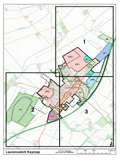
Agricultural land
As set out in Section 12.4 of the 2019 EIAR and presented in Figure 13.3, the agricultural land on either side of the proposed Access to Oatyhill is categorised by the James Hutton Institute, as having a land capability for agriculture (LCA) of classification 2. This identifies the land as high quality able to grow a wide range of crops in an area of minor physical limitations.
The Access to Oatyhill will require further minor land take – from lands to the wst and southeast of the scheme. These areas of land are owned by Kincardineshire Investment company Ltd and Reid (Mains of Newton Farm) respectfully. Both landowners are affected by the Laurencekirk Junction and were initially consulted during the 2019 EIAR. Further consultation is due to be undertaken.
Mains of Newton comprises of approximately 202 hectares of predominantly prime arable land to the south of Laurencekirk. The farm employs approximately 10 individuals (both full-time and part-time). The land take will be from predominantly high quality (LCA class 2) land.
Kincardineshire Investment Company (Holdings) Limited is currently in ownership of the agricultural land adjacent to Denlethen Wood. During the site walkover, this land was observed to be used for arable farming. Land take is potentially in areas of predominantly high quality (LCA class 2) land in an area observed to be used for intensive arable agriculture.
The total land take is outlined in Table 11-4 below.
Table 11‑4: Acquisition type, type of land, land ownership details and total land take (m2).
|
AQUSITION TYPE |
TYPE OF LAND TO BE AQUIRED |
CURRENT LANDOWNER |
AREA TO BE AQUIRED (m²) |
|
Permanent |
Agricultural Field |
Kincardine Investment Company (KIC) |
7,850 |
|
Servitude |
Agricultural Field |
Kincardine Investment Company (KIC) |
70 |
|
Permanent |
Agricultural Field |
Reid |
4,166 |
|
Servitude |
Agricultural Field |
Reid |
925 |
|
Permanent |
Road space and Verge |
AbC/ Unknown |
3,544 |
|
Permanent |
Agricultural Field |
Unknown |
1011 |
|
Servitude |
Agricultural Field |
Unknown |
1,067 |
Walkers, Cyclists and Horse Riders (Non-motorised Users)
Community Severance
Figure 12.4 in the 2019 EIAR presents the key non-motorised user routes in and around Laurencekirk. Access to Oatyhill has no effect on these key user routes and will not impact the access points present to the southwest of Denlethen Woods and otherwise will have no effect on the routes as listed in the 2019 EIAR. Similarly and as set out above, there are no new or additional community facilities affected and access to all is retained. This includes the provision of temporary access to Denlethen Cottage and the southern access to Denlethen Wood. The baseline presented in the 2019 EIAR therefore remains applicable and valid.
Journey Length
The addition of Access to Oatyhill does not alter the assessment of travel patterns and journey length presented in the 2019 EIAR. The provision of temporary access to Denlethen Cottage during construction ensures that this property and recreation users of Denlethen Wood do not experience inconvenience or excessive diversion. The baseline presented in the 2019 EIAR therefore remains applicable and valid.
Journey Amenity
A review of the existing baseline conditions and the additional Access to Oatyhill indicate that no updates are required and the text within this Section of the 2019 EIAR remains valid, with no change to baseline.
Vehicle Travellers
Section 12.4.42 of the 2019 EIAR details the baseline conditions relating to All Travellers. A review of the existing baseline conditions indicate that no updates are required and the text within this Section of the 2019 EIAR remains valid and unchanged. As noted above, the assessment on Vehicle Travellers is no longer considered within the updated DMRB guidance.
Views from the Road
Section 12.4.42 of the 2019 EIAR outlines the baseline for View from the road, the findings in this Section remain valid; the addition of the access to Oatyhill does not affect these findings.
Driver stress
Section 12.4.44 outlines the baseline for driver stress, the findings in this Section remain valid; the addition of the access to Oatyhill does not affect these findings.
Access to and from junctions
Section 12.4.47 outlines the baseline for driver stress, the findings in this Section remain valid; the addition of the access to Oatyhill however does not affect the access to and from junctions, as the Oatyhill junction will be permanently closed.
Human Health
LA 112 sets out clear scoping criteria to determine if an assessment of Human Health is necessary.
Ambient Air Quality and AQMA
Baseline data relating to air quality and the assessment of potential effects on same is set out in Chapter 6 of the 2019 EIAR and reviewed in Chapter 5 of this Addendum.
There are no AQMAs and the DEFRA air quality monitoring archive confirms the air quality as being very good with no exceedances of the national air quality objectives. The assessment within the 2019 EIAR concludes that the operational scheme will have no significant effect on the existing air quality. This Addendum (Chapter 5) confirms that the addition of the Access to Oatyhill does not alter this conclusion. It can therefore be concluded that there is no risk to human health as a consequence of air quality effects arising from the scheme.
During construction with the application of a dust management plan any effects will be temporary and not significant.
Ambient Noise and Noise Sensitive Areas
Baseline data relating to Noise and the assessment of potential effects on same is set out in 2019 EIAR Chapter 9 and reviewed in this Addendum Chapter 8.
There are no Noise Sensitive Areas (Candidate Noise Management Areas) in or around Laurencekirk and the baseline noise survey confirmed that traffic on the A90 is the primary noise source. The 2019 EIAR concludes that, in the long-term when the Laurencekirk Junction is operational, there will be not significant negligible and minor adverse effects experienced by the closest residential and other sensitive receptors within the 600m study area.
The increase in noise levels, which arises primarily as a result of increased traffic on the A90 in both the Do Minimum and Do Something scenarios and not specifically as a result of the Laurencekirk Junction scheme, being below 3dB, is not considered to raise human health issues for the receiving local population. The Addendum Chapter 8 confirms the addition of the Access to Oatyhill does not alter the conclusions reached in the 2019 EIAR. During operation, the Access to Oatyhill maintains access to the four properties in this location and as such the traffic on this local road network does not result in any baseline noise increase. Road level usage is expected to return to pre-closure levels regarding the introduction of a new access to Oatyhill structure, and access to the Denlethen Wood. The official Denlethen Wood car park remaining in situ, and the proposed closure of the A90/Oatyhill junction will allow for all vehicular traffic accessing Denlethen Wood to access the site via the U91K westbound (from Laurencekirk) thus removing traffic accessing the site via the U91K eastbound (passing Oatyhill Cottage) and in turn, not increasing traffic levels surrounding any other residential properties. It can therefore be concluded that there is no risk to human health as a consequence of noise effects arising from the scheme.
Landscape Amenity
The Landscape and Visual assessment forms Chapter 8 of the 2019 EIAR. There are no landscape designations, conservation areas or tree preservation orders in the landscape study area. The Landscape around the proposed Laurencekirk Junction is predominantly intensive agriculture with a patchwork of open fields and Denlethen Wood to the north. The main urban area is to the northeast and screened by the tree lines along Gaugers Burn.
From a visual amenity perspective, the majority of residential receptors will not experience views of the scheme and those residential receptors closest to the scheme are also screened by existing vegetation. Therefore, the principal receptor of concern with regard to Landscape Amenity are the core paths utilised by recreational users.
Viewpoint 5 Oatyhill (Ref.: 2019 EIAR Figure 8.5) presents a view looking northeast and is considered representative of the views which will be experienced by recreational users accessing Denlethen Wood from the B9120. With the proposed planting mitigation at Year 15 the effect on this view is considered to be slight adverse as the view will be permanently changed. Given the view for recreation users is transient, having no permanent daily effect, this is not considered as having an impact on ‘landscape amenity’ with regard to detrimental human health outcomes.
Viewpoint 6 A937 at Mains of Newton (Ref.: 2019 EIAR Figure 8.5) presents a viewpoint towards the area of Oatyhill in which the view is hardly discernible, therefore proposed development at this area is highly unlikely to be seen from Viewpoint 6.
Pollution
In addition to the potential for air quality and noise pollution the 2019 EIAR also assessed the potential for water pollution in Chapter 11 Road Drainage and the Water Environment. The assessment concludes that, with industry standard construction pollution control measures and a permanent drainage design which includes SuDS ponds that there will be no adverse effect on surface or ground water resources. This Addendum Chapter 10 confirms these conclusions remain valid with the inclusion of the Access to Oatyhill. Pollution as risk factor for human health can therefore be scoped out.
Severance / accessibility
As set out above, under WCH (11.5.20), the A90/A937 Laurencekirk Junction scheme, including with the Access to Oatyhill element of the proposed scheme, does not result in any community severance or impact on access to community facilities. It can therefore be concluded that there is no effect on Human Health with regard to severance and accessibility as set out in LA 112.
Human Health Scoping Conclusion
As set out in Section 11.5.27 – 11.5.38, reviewing the A90/A937 Laurencekirk Junction Improvement Scheme, including the Access to Oatyhill, against the scoping criteria set out in LA 112 for Human Health does not result in the identification of any potential adverse health outcomes for the local population and hence no further assessment of Human Health is required.
Impact Assessment
Population – Land-use and Accessibility
Construction
Private Property
The inclusion of Access to Oatyhill does not bring forward any additional or new effects on private property. Furthermore, a temporary road will maintain vehicular access to the properties at Oatyhill including Denlethen Cottage (see Appendix A: Figure 1.5: Oatyhill Temporary Access to Denlethen Access - Planned Sketch). The Access to Oatyhill aspect of the scheme will have no additional effect, therefore, it is considered that the assessment within the 2019 EIAR is unchanged and remains valid.
Community Land
As set out within the Baseline Section, there are no new or additional community facilities affected and access to all is retained, including the provision of temporary access to Denlethen Cottage and the southern access to Denlethen Wood. There are therefore no new or additional effects on Community Land and the assessment presented in the 2019 EIAR remains valid.
Development Land
No land-take is required from any of the Opportunity sites, including those previously assessed and the new sites, and there is therefore no effect on them during construction. That conclusion is not altered by the inclusion of Access to Oatyhill.
Agricultural land
- There will be additional servitudinal and minor permanent land take from both KIC and Reid (Mains of Newton) (see Appendix A: Figures – Figure 1.5: Oatyhill Temporary Access to Denlethen Access - Planned Sketch). The minor nature of this temporary (and permanent at the field edges) increase when reviewed against the extent of landholding does not alter the assessment in the 2019 EIAR 12.5 for either landowner. The assessment within the 2019 EIAR therefore remains valid.
Walkers, Cyclists and Horse Riders (NMU)
Community Severance
As set out above, with the inclusion of temporary access to Denlethen Cottage and Denlethen Wood, there is no new or additional community severance and access to all community facilities is retained. The assessment within the 2019 EIAR remains valid.
Journey Length
The provision of temporary access to Denlethen Cottage during construction ensures that this property and recreation users of Denlethen Wood do not experience inconvenience or excessive diversion. The addition of Access to Oatyhill therefore does not result in any new or additional effect and the assessment presented in the 2019 EIAR therefore remains applicable and valid.
Journey Amenity
The addition of Access to Oatyhill will not change the assessment of journey amenity during construction when viewed alongside the much larger construction effects of the Laurencekirk Junction. The assessment in the 2019 EIAR is therefore unchanged.
Vehicle travellers
The additional element of construction required for the Access to Oatyhill does not change the assessment of views from the road or driver stress set out in the 2019 EIAR.
Operation
Private Property
There are no new or additional effects on private property as a consequence of the inclusion of Access to Oatyhill. The assessment within the 2019 EIAR is therefore valid and unchanged.
Community Land
There are no new or additional effects on community land as a consequence of the inclusion of Access to Oatyhill. The assessment within the 2019 EIAR is therefore valid and unchanged.
Development Land
There is no land take from any of the Opportunity sites. During operation the A90/A937 Laurencekirk Junction facilitates both the construction and operation of each of these sites. The development plan requirements for OP6 are clear that it cannot be constructed until the junction is complete and operational. As such it is considered that there are no new or additional effects on the LDP listed Opportunity sites as a consequence of the inclusion of Access to Oatyhill.
Agricultural Land
There is additional servitudinal and minor permanent land take from both KIC and Reid (Mains of Newton) (see Appendix A: Figures – Figure 1.5: Oatyhill Temporary Access to Denlethen Access - Planned Sketch). The servitudinal and minor permanent increase in land take at field edges does not alter the overall assessment of effect as outlined in the 2019 EIAR for either landowner.
Walkers, Cyclists and Horse Riders (NMU)
At operation, the inclusion of Access to Oatyhill, which essentially retains the access which was available previously with the introduction of the new structure, does not change any aspect of the assessment for community severance, journey length or journey amenity. The existing structure will also be available for NMUs and therefore; the assessment within the 2019 EIAR therefore remains valid.
Vehicle Travellers
There is no change in the assessment of views from the road or driver stress as a result of the operation of Access to Oatyhill. The assessment in the 2019 EIAR remains valid.
Human Health
As set out in Section 11.5.39, reviewing the A90/A937 Laurencekirk Junction Improvement Scheme, including the Access to Oatyhill, against the scoping criteria set out in LA 112 for Human Health does not result in the identification of any potential adverse health outcomes for the local population and hence no further assessment of Human Health is required and therefore, has been scoped out as requiring further assessment.
Impacts on Policy and Legislation
Section 12.6 of the 2019 EIAR details impacts on policies and legislation for Population. Table 11-5 provides a review of updates to legislation and policies in line with relevance to the assessment.
Table 11‑5: Impacts on policies and legislation for Population.
|
Legislative / policy |
Relevance to assessment |
Achieves objectives |
|
The Scottish Government Scottish Planning Policy 2014 |
Section 12.6 of the 2019 EIAR remains valid. |
yes (unchanged) |
|
Scotland’s National Transport Strategy (NTS) 2016 |
Replaced by NTS 2 in 2020. Overarching objectives and relevance to scheme remain the same and therefore, section 12.6 of the 2019 EIAR remains valid. |
yes (unchanged) |
|
The Scottish Government Designing Streets: A Policy Statement for Scotland 2010 |
Section 12.6 of the 2019 EIAR remains valid. |
yes (unchanged) |
|
Transport Scotland Cycling Action Plan for Scotland 2017- 2020 |
Section 12.6 of the 2019 EIAR remains valid. |
yes (unchanged) |
|
Scottish Government Let’s Get Scotland Walking: The National Walking Strategy 2014 |
Section 12.6 of the 2019 EIAR remains valid. |
yes (unchanged) |
|
Choosing Our Future: Scotland’s Sustainable Development Strategy 2005 |
Section 12.6 of the 2019 EIAR remains valid. |
yes (unchanged) |
|
Aberdeenshire Local Development Plan 2023 |
The new Opportunity Sites for the area of Laurencekirk have been addressed. |
Yes |
|
Aberdeenshire Council Local Transport Strategy (LTS) 2012 |
Section 12.6 of the 2019 EIAR remains valid. |
yes (unchanged) |
|
Aberdeenshire Council Walking and Cycling Action Plan 2009 |
Section 12.6 of the 2019 EIAR remains valid. |
yes (unchanged) |
|
Aberdeenshire South East Core Paths Plan |
Section 12.6 of the 2019 EIAR remains valid. |
yes (unchanged) |
|
Equality Act 2010 |
Section 12.6 of the 2019 EIAR remains valid. |
yes (unchanged) |
|
National Planning Framework 4 (NPF) February 2023 |
Scottish Planning Policy (SPP), published in 2023, sets out national planning policies which reflect Scottish Ministers’ priorities for planning, development and use of land. Key Planning outcomes focus on: - Sustainable places - Liveable places - Productive places |
Yes - The new bridge at Oatyhill keeps the local population who reside at Oatyhill connected to Laurencekirk and the main road network. |
|
Transport Scotland, Fitting Landscapes. Securing More Sustainable Landscapes, 2014. (Ref 12.17) |
Section 12.6 of the 2019 EIAR remains valid. |
yes (unchanged) |
|
Aberdeen City and Shire Strategic Development Plan 2020 |
The purpose of this plan is to set a clear direction for future development of the northeast, |
Yes - Providing a path along the new bridge keeps the people residing at Oatyhill a way to travel via WCH. |
Mitigation Measures
The inclusion of Access to Oatyhill does not bring forward any new or additional significant effects with regard to Population and Human Health. The mitigation measures outlined for people and communities within the 2019 EIAR remain applicable and appropriate, therefore Section 12.7 of the 2019 EIAR remains valid.
Residual Effects
No changes regarding residual effects have been identified due to the guidance updates and design changes with regard to the Access to Oatyhill; therefore, the text within Section 12.8 of the 2019 EIAR remains valid.
Limitations and Assumptions
The assessment limitations for population have not changed since the DMRB update and addition of the works at Oatyhill, therefore the text within Section 12.9 of the 2019 EIAR remains valid.
Geology and Soils
Introduction
Chapter 13 of the 2019 EIAR considers the likely significant effects of the A90/A937 Laurencekirk Junction Improvement Scheme on geology and soils. The 2019 EIAR was prepared using guidance and methods for a Stage 3 assessment outlined in Volume 11, Section 3 Part 11 Geology and Soils of the DMRB (DMRB 11/3/11). This has since been withdrawn and replaced by LA 109 Geology and Soils (2019), for which this Addendum chapter considers these changes, alongside changes to design with regard to access to Oatyhill, providing an update and gap analysis on the geology and soils chapter. The Methodology Section within this Addendum reviews the changes to policy and guidance within LA 109 Geology and Soils.
Policy and Legislative Background
Section 13.2 of the 2019 EIAR details the relevant policies and legislative background for geology and soils. Table 12-1 provides a review of the statutory and planning context indicating details of changes and relevant information.
Table 12‑1: Review of the statutory and planning context with regard to Geology and Soils.
|
Legislative / policy |
Exceeded by / amendments |
Description of update |
|
Legislation and policies |
||
|
Environmental Protection Act 1990 |
N/A |
No change |
|
The Environment Act 1995 |
N/A |
No change |
|
Contaminated Land (Scotland) Regulations 2000 |
N/A |
No change |
|
National |
||
|
National Planning Framework 3 2014 (NPF) |
NPF 4 (Ref. 12.1) February 2023 |
NPF 4 is Scotland’s national spatial strategy that sets out spatial principles, regional priorities, national developments and national planning policy. This NPF sets out policy principals with regard to protecting carbon-rich soils, restoring peatland and minimising disturbance to soils from development (Policy 5). |
|
Land Use Strategy 2016 – 2021, 2016 |
N/A |
No change |
|
Scottish Government Scottish Planning Policy (SPP), 2014 |
An update was made in December 2020 which has since been removed following a legal challenge, so the 2014 SPP remains valid. |
N/A |
|
The Scottish Soil Framework |
N/A |
No change |
|
Local |
||
|
Aberdeen City and Shire Strategic Development Plan 2014 |
Aberdeen City and Shire Strategic Development Plan 2020 (Ref. 12.2) |
This change states that sustainable development plans (SDPs) are no longer required as part of the development plan. The Aberdeenshire LDP 2023 are however satisfied that the 2020 version represents a spatial strategy for the region and therefore, no change to assessment is required. |
|
Aberdeenshire Local Development Plan (LDP) 2017 |
Aberdeenshire LDP 2023 (Ref. 12.3) |
This features an ongoing vision of helping develop a strong and resilient economy, promoting a high quality of life and sustainable, low carbon places. The Laurencekirk junction improvement development is allocated within the LDP, thus is exempt from restricted development on prime agricultural land as per PR1.5 (Ref.: 12.4) |
Methodology
At the time of writing, the 2019 EIAR was prepared using guidance outlined in the DMRB 11/3/11 which has since been withdrawn and replaced by LA 109 Geology and Soils (2019) (and the relevant Scottish NAA) (Ref. 12.5). LA 109 details updates to the sensitivity categories of the geological receptors and additional descriptions to determine magnitude of impacts. The assessment methodology within the 2019 EIAR remains applicable, as seen in Section 13.3 of the 2019 EIAR.
Determination of baseline
The determination of baseline has not changed with the updated DMRB guidance, with baseline determined in Sections 13.3.3-13.3.6 of the 2019 EIAR.
Study Area
The study area of the 2019 EIAR was determined using professional judgement and the distance over which potential impacts could occur related to geology and ground conditions as the now withdrawn guidance of DMRB 11/3/11 did not provide a description of relevant buffer zones of study area guidelines. Figures 13.1 to 13.6 within the 2019 EIAR show a 200m buffer zone surrounding existing roads and the Laurencekirk Junction Improvement scheme as this represents likely areas of influence of the proposed scheme. The introduced design changes of the Access to Oatyhill area is within the previously assessed study area and therefore Section 13.3.1 of the 2019 EIAR remains valid and unchanged.
Desk Study
The determination of baseline within the updated DMRB guidance has not changed, and thus Section 13.3.3-13.3.5 of the 2019 EIAR which details the desktop methodology of reviewing baseline of geology and soils remains valid.
Consultation
Chapter 5 and 13.3.6 of the 2019 EIAR details the consultation process with relevant statutory and non-statutory bodies that occurred with regard to the A90/A937 Laurencekirk Junction Improvement scheme including Aberdeenshire Council, BGS, PWS, Scottish National Heritage (SNH) and SEPA in relation to geology and soils.
Aberdeenshire Council did not highlight any contaminated land issues in relation to the proposed scheme. BGS requested that if any extensive sections in bedrock are exposed during construction works, they are contacted to discuss the requirement of a site visit by a geologist to record the information. No other comments were provided, and no response received at Stage 3. SNH do not consider there to be any connectivity with any protected area of either national or international importance, therefore, had no comments. SEPA provided comments related to the water environment including compliance with SEPA’s construction site guidance, licensing, and a request to view the construction site pollution mitigation plan and further details regarding the proposed SuDS.
As the issues and comments raised by respondents were addressed during the preparation of the 2019 EIAR, and due to the Access to Oatyhill remaining within the 2019 EIAR study area, Section 13.3.6 remains valid and no further consultation is required.
Assessment methodology
Changes to assessment methodology within LA 109 include updates to the sensitivity categories of the geological receptors and additional descriptions to determine magnitude of impacts. The updated descriptions are detailed in Table 12-2 and Table 12-3.
The updated guidance removes the requirement for assessment of geomorphology, hydro morphology and landform within geology and soils.
Table 12‑2: Geology and Soils sensitivity (susceptibility and value).
|
Receptor value (sensitivity) |
Description |
|
Very high |
Geology: Very rare and of international importance with no potential for replacement (e.g. UNESCO World Heritage Sites, UNESCO Global Geoparks, Sites of SSSI's and Geological Conservation Review (GCR) sites where citations indicate features of international importance). Geology meeting international designation citation criteria which is not designated as such. Soils (Ref. 12.6): 1) soils directly supporting an EU designated site (e.g. SAC, SPA, Ramsar); and/or 2) Agricultural Land Classification (ALC) grade 1 & 2 or LCA grade 1 & 2. Contamination: 1) human health: very high sensitivity land use such as residential or allotments; 2) surface water (sensitivity criteria from Table 3.70 of LA 113): watercourse having a WFD classification shown in a RBMP and Q95 ≥1. 0 m3/s. Site protected/designated under EC or UK legislation (SAC, SPA, SSSI, Ramsar sites, salmonid water)/Species protected by EC legislation LA 108; and 3) groundwater (sensitivity criteria from Table 3.70 of LA 113): principal aquifer providing a regionally important resource and/or supporting a site protected under EC and UK legislation LA 108. Groundwater locally supports GWDTE. SPZ 1. |
|
High |
Geology: Rare and of national importance with little potential for replacement (e.g. geological SSSI, National Nature Reserves (NNR)). Geology meeting national designation citation criteria which is not designated as such. Soils: 1) soils directly supporting a UK designated site (e.g. SSSI); and/or 2) ALC grade 3a, or LCA grade 3.1. Contamination: 1) human health: high sensitivity land use such as public open space; 2) surface water (sensitivity criteria from Table 3.70 of LA 113): watercourse having a WFD classification shown in a RBMP and Q95 <1.0m3/s. Species protected under EC or UK legislation; and 3) groundwater (sensitivity criteria from Table 3.70 of LA 113): Principal aquifer providing locally important resource or supporting a river ecosystem. Groundwater supports a GWDTE. SPZ2. |
|
Medium |
Geology: Of regional importance with limited potential for replacement (e.g. Regionally Important Geological Sites (RIGS)). Geology meeting regional designation citation criteria which is not designated as such. Soils: 1) soils supporting non-statutory designated sites (e.g. Local Nature Reserves (LNR), Local Geodiversity Sites (LGS), Sites of Nature Conservation Importance (SNCIs)); and/or 2) ALC grade 3b or LCA grade 3.2. Contamination: 1) human health: medium sensitivity land use such as commercial or industrial; 2) surface water (sensitivity criteria from Table 3.70 of LA 113): watercourses not having a WFD classification shown in a RBMP and Q95 >0.001m3/s; and 3) groundwater (sensitivity criteria from Table 3.70 of LA 113): aquifer providing water for agricultural or industrial use with limited connection to surface water. SPZ3. |
|
Low |
Geology: Of local importance / interest with potential for replacement (e.g. non designated geological exposures, former quarry's/mining sites). Soils: 1) ALC grade 4 & 5 or LCA grade 4.1 to 7; and/or 2) soils supporting non-designated notable or priority habitats. Contamination: 1) human health: low sensitivity land use such as highways and rail; 2) surface water: (sensitivity criteria from Table 3.70 of LA 113): watercourses not having a WFD classification shown in a RBMP and Q95 ≤0.001m3/s; and 3) groundwater (sensitivity criteria from Table 3.70 of LA 113): unproductive strata. |
|
Negligible |
Geology: No geological exposures, little/no local interest. Soils: Previously developed land formerly in 'hard uses' with little potential to return to agriculture. Contamination: 1) human health: undeveloped surplus land/no sensitive land use proposed; 2) surface water: assessed in line with LA 113. 3) groundwater: assessed in line with LA 113. |
Table 12‑3: Geology and Soils magnitude of impacts.
|
Magnitude of impacts (change) |
Description |
|
Major |
Geology: Loss of geological feature/designation and/or quality and integrity, severe damage to key characteristics, features or elements. Soils: Physical removal or permanent sealing of soil resource or agricultural land. Contamination: 1) human health: significant contamination identified. Contamination levels significantly exceed background levels and relevant screening criteria (e.g. category 4 screening levels) SP1010 with potential for significant harm to human health. Contamination heavily restricts future use of land; 2) surface water (sensitivity criteria from Table 3.71 of LA 113): Failure of both acute-soluble and chronic sediment related pollutants in HEWRAT and compliance failure with EQS values. Calculated risk of pollution from a spillage ≥2% annually (spillage assessment). Loss or extensive change to a designated nature conservation site. Reduction in water body WFD classification; and 3) groundwater (sensitivity criteria from Table 3.71 of LA 113): loss of, or extensive change to, an aquifer. Loss of regionally important water supply. Potential high risk of pollution to groundwater from routine runoff – risk score >250 (groundwater quality and runoff assessment). Calculated risk of pollution from spillages ≥2% annually (spillage assessment). Loss of, or extensive change to GWDTE or baseflow contribution to protected surface water bodies. Reduction in water body WFD classification. Loss or significant damage to major structures through subsidence or similar effect. |
|
Moderate |
Geology: Partial loss of geological feature/designation, potentially adversely affecting the integrity; partial loss of/damage to key characteristics, features or elements. Soils: Permanent loss/reduction of one or more soil function(s) and restriction to current or approved future use (e.g. through degradation, compaction, erosion of soil resource). Contamination: 1) human health: contaminant concentrations exceed background levels and are in line with limits of relevant screening criteria (e.g. category 4 screening levels) SP1010. Significant contamination can be present. Control/remediation measures are required to reduce risks to human health/make land suitable for intended use; 2) surface water (sensitivity criteria from Table 3.71 in LA 113): failure of both acute-soluble and chronic-sediment related pollutants in HEWRAT but compliance with EQS values. Calculated risk of pollution from spillages ≥1% annually and <2% annually. Partial loss in productivity of a fishery. Degradation of regionally important public water supply of loss of major commercial/industrial/agricultural supplies. Contribution to reduction in water body WFD classification; and 3) Groundwater (sensitivity criteria from Table 3.71 in LA 113): partial loss or change to an aquifer. Degradation of regionally important public water supply or loss of significant commercial/industrial/agricultural supplies. Potential medium risk of pollution to groundwater from routine runoff – risk score 150-250. Calculated risk of pollution from spillages ≥1% annually and <2% annually. Partial loss of the integrity of GWDTE. Contribution to reduction in water body WFD classification. Damage to major structures through subsidence or similar effects or loss of minor structures. |
|
Minor |
Geology: Minor measurable change in geological feature/designation attributes, quality or vulnerability; minor loss of, or alteration to, one (maybe more) key characteristics, features or elements. Soils: Temporary loss/reduction of one or more soil function(s) and restriction to current or approved future use (e.g. through degradation, compaction, erosion of soil resource). Contamination: 1) human health: contaminant concentrations are below relevant screening criteria (e.g. category 4 screening levels) SP1010. Significant contamination is unlikely with a low risk to human health. Best practice measures can be required to minimise risks to human health; 2) surface water (sensitivity criteria from Table 3.71 in LA 113): failure of either acute soluble or chronic sediment related pollutants in HEWRAT. Calculated risk of pollution from spillages ≥0.5% annually and <1% annually. Minor effects on water supplies; and 3) groundwater (sensitivity criteria from Table 3.71 in LA 113): failure of either acute soluble or chronic sediment related pollutants in HEWRAT. Calculated risk of pollution from spillages ≥0.5% annually and <1% annually. Minor effects on water supplies. |
|
Negligible |
Geology: Very minor loss or detrimental alteration to one or more characteristics, features or elements of geological feature/designation. Overall integrity of resource not affected. Soils: No discernible loss/reduction of soil function(s) that restrict current or approved future use. Contamination: 1) human health: contaminant concentrations are below relevant screening criteria (e.g. category 4 screening levels) SP1010. Significant contamination is unlikely with a low risk to human health. Best practice measures can be required to minimise risks to human health; 2) surface water (sensitivity criteria from Table 3.71 in LA 113): no risk identified by HEWRAT (pass both acute-soluble and chronic sediment related pollutants). Risk of pollution from spillages <0.5%; and 3) groundwater (sensitivity criteria from Table 3.71 in LA 113): no measurable impact upon an aquifer and/or groundwater receptors and risk of pollution from spillages <0.5%. |
|
No change |
Geology: No temporary or permanent loss/disturbance of characteristics features or elements. Soils: No loss/reduction of soil function(s) that restrict current or approved future use. Contamination: 1) human health: reported contaminant concentrations below background levels; 2) surface water (sensitivity criteria from Table 3.71 in LA 113): no loss or alteration of characteristics, features or elements; no observable impact in either direction; and 3) groundwater (sensitivity criteria from Table 3.71 in LA 113): no loss or alteration of characteristics, features or elements; no observable impact in either direction. |
Contaminated Land and Receptors
Determination of contaminated land is detailed in Section 13.3.11-13.3.20 of the 2019 EIAR. The assessment of geo-environmental risks within the 2019 EIAR follows recommendations given with the ‘Model Procedures for the Management of Land Contamination’ (CLR11) published by the DEFRA and the Environment Agency and in Construction Industry Research and Information Association’s (CIRIA’s) Contaminated Land Risk Assessment – A Guide to Good Practice (CIRIA 552) which recommends the development of a Conceptual Site Model (CSM). CLR11 has since been withdrawn, however, CIRIA 552 remains valid, and thus the Conceptual Site Model (CSM) presented in Table 13-15 within the 2019 EIAR remains valid.
Potential sources of contamination are shown in Figure 13.5 of the 2019 EIAR, with receptors of potential contaminated land including construction site and maintenance workers, adjacent residents/workforce, end users, surface water, groundwater in superficial deposits and in bedrock water, buried concrete and services, livestock and other ecologically sensitive receptors as detailed in Section 13.3.15.
The design changes of the access to Oatyhill area is within the previously assessed study area and therefore Section 13.3.7-13.3.21 of the 2019 EIAR remains valid.
Baseline Conditions
The baseline conditions to geology and soils detailed within the 2019 EIAR are unchanged with regard to the DMRB guidance update and Access to Oatyhill design changes as the Oatyhill area is included within the previously assessed study area outlined in the 2019 EIAR (Figures 13.1-13.6). Therefore, the text within Section 13.3 of the 2019 EIAR remains valid.
Impact Assessment
The assigned sensitivities for Geology and Soils remains unchanged. Sensitivities for contamination receptors were not previously assigned.
Based on the updated DMRB guidance, human health is considered to be of low sensitivity due to the surrounding land use of highways and rail. Surface water and groundwater are assessed in Chapter 11 of the 2019 EIAR and within the Road Drainage and Water Environment Section of this addendum.
The magnitude of impacts of the scheme on geology and soils remains the same as in the 2019 EIAR due to the Access to Oatyhill study area being contained within the study area of the 2019 EIAR. Therefore, there is no change to the baseline provided within the 2019 EIAR, and as such, there are no changes to likely significant effects as outlined in in Section 13.5.11. The magnitude of impacts is not great enough to alter the assessment in the 2019 EIAR.
The magnitude of impacts from contamination was not assigned in the 2019 EIAR and instead was undertaken using a risk-based approach in line with land contamination guidance detailed in Section 13.3 of the 2019 EIAR. Based on the impact assessment methodology in LA 109, the contamination impacts are re-assessed below.
Construction Impacts - contamination
There is potential for contamination from sources detailed in Section 13.4 of the 2019 EIAR, including existing roads and infrastructure (S12), East Coast Mainline (S13) and made ground identified in exploratory positions (S14) to affect construction workers through exposure to contaminated soils adversely affecting human health. Given the location of the scheme at the Access to Oatyhill significant levels of contamination in the sub-soils is considered unlikely and risk is low. The magnitude of impact on human health is assessed to be minor.
The magnitude of impact to geology and soils during construction from spillages causing pollution of underlying soils is deemed to be minor.
There is potential for pollutants to enter groundwater or enter runoff to surface waters, adversely affecting water quality during excavations of potentially contaminated soils. The magnitude of impact on water quality is assessed to be minor.
The remaining sources of contamination detailed in Section 13.4 (mill pond; skate pond; reservoir; and cemetery) are considered to have a low, or negligible potential for contamination. Therefore, the magnitude of impact to geology and soils, groundwater and construction worker health from these sources during construction is deemed to be negligible.
Permanent Impacts - contamination
There is low potential for contamination from sources detailed in Section 13.4 to affect human health as there will be low risk of exposure once the new bridge is operational. The impact on human health is negligible.
Operational impacts on geology and soils and groundwater would be related to any spillages or contamination from routine maintenance operations. As this would be infrequent and localised to the Oatyhill access and bridge, impacts are assessed to be negligible.
Impacts on Policy and Legislation
Section 13.6 of the 2019 EIAR details impacts on policies and legislation for geology and soils. Table 12-4 provides a review of updates to legislation and policies (as noted above in Table 12-1) in line with relevance to the assessment.
Table 12‑4: Impacts on policy and legislation with regard to Geology and Soils.
|
Legislative / policy |
Relevance to assessment |
Achieves objectives |
|
Environmental Protection Act 1990 |
Section 13.6 of the 2019 EIAR remains valid. |
|
|
The Environment Act 1995 |
Section 13.6 of the 2019 EIAR remains valid. |
|
|
Contaminated Land (Scotland) Regulations 2000 |
Section 13.6 of the 2019 EIAR remains valid. |
|
|
National Planning Framework 4 (NPF) (Ref. 12.7) February 2023 |
The scheme development will result in disturbance to soils and loss of high-quality agricultural soils, contrary to Policy 5 within the NPF 4 which intends to protect carbon-rich soils, restore peatlands and minimise disturbance to soils from development. |
Yes, as the proposed development, including provision of a replacement bridge is deemed essential infrastructure for four Oatyhill dwellings. |
|
Land Use Strategy 2016 – 2021, 2016 |
Section 13.6 of the 2019 EIAR remains valid. |
|
|
Scottish Government Scottish Planning Policy (SPP), 2014 |
Section 13.6 of the 2019 EIAR remains valid. |
No (unchanged) |
|
The Scottish Soil Framework |
Section 13.6 of the 2019 EIAR remains valid. |
|
|
Aberdeen City and Shire Strategic Development Plan 2020 (Ref. 12.8) |
Soils will be reused where possible within the scheme to encourage sustainable development, namely within the strategic growth area: Aberdeen to Laurencekirk. |
Yes (unchanged) |
|
Aberdeenshire Local Development Plan 2023 |
The scheme will minimise impacts to environmental resources, such as soil as much as possible. Soils will be reused where possible within the scheme to encourage sustainable development. Laurencekirk is allocated within the LDP, thus is exempt from restricted development on prime agricultural land as per PR1.5 (Ref. 12.4) |
Yes (unchanged) |
Mitigation Measures
The mitigation measures for geology and soils remains the same as the 2019 EIAR, therefore the text within Section 13.7 of the 2019 EIAR remains valid.
Residual Effects
The residual impacts and significances of effect on geology and soils remains the same as the 2019 EIAR. The residual impacts and significance of effects on contamination were not assigned in the 2019 EIAR, and so this is presented below.
During construction, there is potential for contamination from sources detailed in Section 13.4 of the 2019 EIAR to affect construction workers through exposure to contaminated ground and soils adversely affecting human health. However, with mitigation measures in place outlined in Section 13.7 of the 2019 EIAR with regard to contaminated land, pollutant pathways, and safe working practices, the residual impact on human health is assessed to be negligible.
During operation, there remains a low-risk potential for contamination sources detailed in Section 13.4 of the 2019 EIAR, with effects on geology, soils and groundwater related to spillages and contamination resulting from routine maintenance operations. As this will be infrequent and localised to the area surrounding the Access to Oatyhill bridge, the residual impact during operation is deemed to be negligible.
Limitations and Assumptions
At the time of writing the 2019 EIAR, ground investigation (GI) results and data analysis were not available, thus this was a limitation of the 2019 EIAR. The A90/A937 Laurencekirk Junction Improvement Scheme GI report has since been finalised, with the site location enabling updated assessment as detailed within this addendum. However, GI has not been carried out at the localised area of the affected by the Oatyhill access, therefore further GI may be required, to allow land contamination to be assessed with regard to the updated DMRB (LA 109).
Material Assets and Waste
Introduction
Chapter 14 of the 2019 EIAR assesses the potential for the scheme to impact on material assets during construction through the acquisition and use of raw materials and resources, and the waste produced through surplus and general wastage. The topics which were assessed included:
- The use of material resources; and
- The generation and management of waste.
It should be noted that since the publication of the EIAR, the materials chapter has been renamed Materials Assets and Waste, in line with current guidance.
This EIAR Addendum chapter considers change in policy and guidance, alongside changes to design regarding access to Oatyhill, providing an update and gap analysis on materials and waste.
Operational impacts have not been considered within this addendum as they are considered to be minor in comparison to construction phase impacts; small quantities of maintenance materials will be required along with small quantities of waste produced such as planings. However, at this stage these are not accurately quantifiable and will be of such small quantities that no significant effects are likely therefore operational impacts have been scoped out.
Embodied Carbon Assessment has been removed from the updated DMRB Materials Assets and Waste. Therefore, no further assessment has been undertaken in this chapter. A separate DMRB LA 114 Climate assessment is being completed for the project as a whole. This will be published separately to this EIAR Addendum.
Policy and Legislative Background
The 2019 EIAR was prepared in accordance with the guidance set out in DMRB Volume 11, Section 3, Environmental Assessment, in conjunction with IAN 153/11, Guidance on the Environmental Assessment of Material Resources (Ref. 13.1). The draft guidance published by Highways England on Materials was also used, HD212/11 (Ref. 13.2). This has since been withdrawn and replaced by LA 110 Material assets and waste (2019) (Ref. 13.3).
Section 14.2 of the 2019 EIAR details the statutory and planning context relating to materials and waste. A review of the current statutory and planning context indicates that two updates has taken place since the 2019 EIAR was published:
- NPF 4 (Ref. 13.4) February 2023 - NPF 4 is Scotland’s national spatial strategy that sets out spatial principles, regional priorities, national developments and national planning policy. NPF 4 sets out policy to encourage, promote and facilitate development that is consistent with the waste hierarchy. NPF 4 states that projects should facilitate delivery of zero waste objectives by reducing the need for new materials, resource use and emissions.
- Aberdeenshire LDP 2023 (Ref. 13.5) - This features an ongoing vision of helping develop a strong and resilient economy, promoting a high quality of life and sustainable, low carbon places. After review of the LDP, there is no additional policies that are relevant with the design change as stated within the 2019 EIAR, therefore no effects are anticipated throughout this assessment.
Methodology
At the time of writing, the 2019 EIAR was prepared using guidance outlined in the material and waste Section of DMRB (formerly IAN 153/11). Since publication, the updated DMRB guidance LA 110 Material Assets and Waste (and the relevant Scottish NAA) has superseded this guidance, however, the assessment methodology within the 2019 EIAR remains applicable, as seen in Section 14.3 of the 2019 EIAR.
Determination of Baseline
The determination of baseline set out in Section 14.4 of the 2019 EIAR for the original Laurencekirk Junction Improvement Scheme has not changed. The study area remains the same and the methods of baseline collection used in the 2019 EIAR remain valid.
However, as the Access to Oatyhill design is additional to that assessed within the 2019 EIAR further assessment is required in updating the baseline information including:
- Information on types and quantities of materials required to construct the project has been provided by the engineering team, including cut and fill balance.
- Information on the amount of waste (by weight) that will be recovered and diverted from landfill either on site or off site (i.e. for use on other projects) and on the types and quantities of waste arising from the project (demolition, excavation arisings and remediation) requiring disposal to landfill has been provided by the engineering team;
- Information on the generation of hazardous waste (type and quantity).
- Information on the existing regional waste facilities has been taken from the online SEPA, waste sites and capacity tool.
Assessment Methodology
LA 110 includes the removal of structured simple and detailed assessment stages and states the assessment should be based on available information on re-useable materials, quantities of waste and location capacity of disposal sites.
The updated guidance does not include criteria for assigning sensitivity or magnitude of impacts. Criteria for assigning an overall significance is however provided. This is presented in Table 13-1 below.
Table 14-6 descriptors of effect significance from the 2019 EIAR is comparable from the table below with no significant changes on the outcome.
Table 13‑1: Significance category descriptions (DMRB, LA 110, Table 3.13).
|
Significance category |
Description |
|
Very large |
Material assets: 1) No criteria: use criteria for large categories. Waste: 1) >1% reduction or alteration in national capacity of landfill, as a result of accommodating waste from a project; or 2) Construction of new (permanent) waste infrastructure is required to accommodate waste from a project. |
|
Large |
Material assets: 1) Project achieves <70% overall material recovery / recycling (by weight) of non-hazardous Construction and Demolition Waste (CDW) to substitute use of primary materials; 2) Aggregates required to be imported to site comprise <1% re-used / recycled content; and 3) Project sterilises ≥1 mineral safeguarding site and/or peat resource. Waste: 1) >1% reduction in the regional capacity of landfill as a result of accommodating waste from a project; and 2) >50% of project waste for disposal outside of the region. |
|
Moderate |
Material assets: 1) Project achieves less than 70% overall material recovery / recycling (by weight) of non-hazardous CDW to substitute use of primary materials; and 2) Aggregates required to be imported to site comprise re-used/recycled content below the relevant regional percentage target. Waste: 1) >1% reduction or alteration in the regional capacity of landfill as a result of accommodating waste from a project; and 2) 1-50% of project waste for disposal outside of the region. |
|
Slight |
Material assets: 1) Project achieves 70-99% overall material recovery / recycling (by weight) of non-hazardous CDW to substitute use of primary materials. and 2) Aggregates required to be imported to site comprise re-used/recycled content in line with the relevant regional percentage target. Waste: 1) ≤1% reduction or alteration in the regional capacity of landfill; and 2) Waste infrastructure has sufficient capacity to accommodate waste from a project, without compromising integrity of the receiving infrastructure (design life or capacity) within the region. |
|
Neutral |
Material assets: 1) Project achieves >99% overall material recovery / recycling (by weight) of non-hazardous CDW to substitute use of primary materials; and 2) Aggregates required to be imported to site comprise >99% re-used / recycled content. Waste: 1) No reduction or alteration in the capacity of waste infrastructure within the region. |
The significance of effects on material assets and waste shall be reported in accordance with Table 13-2 below:
Table 13‑2: Significance Criteria (DMRB, LA 110, Table 3.14).
|
Significance category |
Description |
|
Significant (one or more criteria met) |
Material assets: 1) Category description met for moderate or large effect. Waste: 1) Category description met for moderate, large or very large effect. |
|
Not significant |
Material assets: 1) Category description met for neutral or slight effect. Waste: 1) Category description met for neutral or slight effect. |
Baseline Conditions
Materials and Waste Quantities
Material resources may originate offsite, with some from on-site such as excavated natural materials, or recycled road plainings. Surplus materials generated from the construction process which are unsuitable for re-use on-site are designated as waste.
The assessment has been carried out from estimated quantities of construction materials and waste based on the preferred option and professional judgement. Refer to Table 13-3 for material use and waste generated estimates.
Quantities include high-level cut and fill estimates along with estimates of materials required for structures, road pavements and areas of site clearance required.
The existing railway bridge that was within the 2019 EIAR preferred option is not being demolished as part of this project. Therefore, no further assessment is required in regard to materials and waste assessment within this addendum.
Table 13-3 presents the key material use and waste generates estimates for the construction for the preferred option:
Table 13‑3: Key material use and waste generated estimates.
|
Option Description |
Length (m) |
Volume of Cut (m3) |
Volume of Fill require (m3) |
Volume of Suitable excavated material (m3) |
Imported material (m3) |
Aggregate (m3) |
Asphalt (m3) |
Concrete (m3) |
Metal/steel (t) |
Wood (m3) |
Disposal of acceptable material (m3) |
Potential to generate hazardous waste |
|
Construction of new structure at a 30° skew to railway. |
36 |
2154 |
8559 |
6238 |
6405 |
839 |
661 |
486 |
94 |
635 |
3311 |
Slight |
Waste Infrastructure
There is insufficient information at present to accurately determine anticipated waste streams. However, registered landfills and other waste management sites have potential to be used for the treatment or disposal of waste generated as a result of the proposed Scheme that cannot be re-used on site. Therefore, the SEPA waste data has been reviewed to obtain information on the active landfill sites within Aberdeenshire.
Within the 2019 EIAR the nearest waste infrastructure in Table 14.7 remain valid. Chap (Aberdeen) Quarries LTD, Park Quarry, Kincluny Farm, Durris is the only remaining landfill that is still relevant in Figure 14.2 of the addendum.
There is only one waste facility registered for hazardous wastes in Scotland; Avondale Hazardous Landfill Site, Falkirk. This is only anticipated to remain in operation until 2023. This means the waste facility is unlikely to be able to serve the proposed Scheme. Alternative hazardous waste facilities are available in northern England, should they be required.
Potential for contamination
The information presented in Chapter 12: Geology and Soils of this addendum AND Chapter 13 of the 2019 EIAR, determines that the main sources of contamination are considered to be made ground on site, associated with the railway line, unnamed road and the A90. Due to the limited industrial history of the area, there is a low to very low risk of contamination occurring.
A residual slight significance of effect was determined for contamination in combination with mitigation and as the site has low risk and is used by a small number of receptors.
Impact Assessment
A conversion factor of 1.25 tonnes/m3 has been used to calculate the tonnes of waste produced from the volume of unsuitable excavated material provided for the Access to Oatyhill. There are no changes to likely significant effects as outlined in in Section 14.3.17. The magnitude of impacts is not great enough to alter the assessment in the 2019 EIAR.
Table 13-4 sets out the potential impacts of the preferred option in accordance with Table 13-2:
Table 13‑4: Potential impacts.
|
% overall material recovery/recycling (by weight) of non-hazardous CDW |
Reused/recycled content of imported aggregates. |
% reduction or alteration in the regional capacity of landfill |
% of project waste for disposal outside of the region |
Significance Category |
|
Between 70 – 99 |
in line with relevant regional percentage target |
<1 |
0 |
Slight |
As stated in Table 13-2, slight is not significant. Table 14-6 in the 2019 EIAR, states that Impacts are likely to be of a low magnitude, therefore not significant.
Impacts on Policy and Legislation
There is no change to the impacts on policy and legislation considered within the 2019 EIAR Section 14.6, of the 2019 EIAR which remains unchanged and valid. Table 14.12 within the 2019 EIAR still remains valid however since then there has been updated guidance provided such as NPF 4 and the Aberdeenshire’s LDP. A Site Waste Management Plan (SWMP) remains key mitigation as stated in Section 14.7.2 of the 2019 EIAR. After review of the LDP and NPF 4, there is no additional policies that are relevant with the design change, therefore no effects are anticipated throughout this assessment.
Mitigation Measures
The primary method of mitigation with regards to materials and waste is minimising the use of natural materials and maximising the re-use of site won materials. The design has been developed thus far to reduce the cost/materials/earthworks requirements where possible.
The following mitigation measures have been assumed within the assessment:
- The potential for cut-fill balance will be optimised where possible. It may be possible to re-use excavated material which is not appropriate for fill material to complete landscaping and so reducing the quantity of waste requiring removal from site. This will be undertaken in accordance with relevant guidance.
- The key material elements used within the proposed Scheme will be responsibly sourced, through environmental best practice and the use of secondary or recycled aggregates promoted.
Residual Effects
With mitigation measures implemented the residual effects on materials and waste has a slight significance. The project achieves overall material recovery/recycling of non-hazardous CDW to substitute primary materials and imported materials is in line with relevant regional percentage targets.
Waste being sent to landfill is less than 1% and the waste infrastructure has sufficient capacity to accommodate waste from the project without compromising integrity of the receiving infrastructure.
Overall, the assessment results determine that with the addition of the Access to Oatyhill the effects are not significant in terms of the effect on materials and waste as publicised within the 2019 EIAR.
Limitations and Assumptions
The limitations and assumptions detailed within Section 14.9 of the 2019 EIAR remain valid.
Additional limitations of the assessment include:
- A full detailed GI has not been undertaken for this area to date therefore the overall percentage material recovery/recycling (by weight) of non-hazardous CDW has been determined by range. It is a reasonable assumption to expect that the materials used on site will be reused for the project. The surrounding land does not anticipate containing any contaminated land or peat and all topsoil will be reused on site.
- No consideration of the effects of quarrying, handling and transportation of material or waste, as there is currently insufficient information available on construction methods, material sources and haulage routes to predict specific effects.
Interactions and Cumulative Effects
Introduction
Chapter 15 of the 2019 EIAR details the cumulative effects of the proposed scheme. Cumulative effects comprise the combined effects of reasonably foreseeable human induced changes within a specific geographical area on receptors over a certain period of time and can be both direct and indirect. Assessment of the significance of cumulative effects needs to be undertaken in the context of the characteristics of the existing environment. Cumulative effects are:
- Cumulative effects from a single project (e.g. numerous different impacts affecting a single receptor), intra-project cumulative effects; and
- Cumulative effects from different projects (in combination with the project being assessed), which individually might be insignificant but when considered together could amount to a significant cumulative effect. These are classed as inter-project effects.
Methodology
The interactions and cumulative effects chapter of the 2019 EIAR was prepared using the guidance outlined within DMRB Volume 11, Section 2, art 5: Environmental Assessment (Ref 14.1).
Since publication of the 2019 EIAR, this guidance has been withdrawn and replaced by the DMRB guidance document LA 104 Environmental Assessment and Monitoring (and the relevant Scottish NAA) (Ref 14.2). LA 104 includes some minor amendments to the cumulative effects assessment, which are summarised below;
- Type 1 effects are now referred to as effects from a single project;
- Type 2 effects are now referred to as effects from different projects; and,
- LA 104 does not include any criteria for determining the significance of cumulative effects.
Intra-project Cumulative Effects
The effects included in the assessment of intra-project Cumulative Effects from the 2019 EIAR are outlined below:
- Visual, noise and dust effects from machinery and plant during the construction phase on adjacent receptors;
- Changes in water quality and temporary habitat loss from construction compounds, culvert installation or pollution affecting wildlife.
When the type 1 cumulative effects as discussed within Section 15.3 of the 2019 EIAR are reviewed with the inclusion of Access to Oatyhill it can be concluded that no updates are required, and the assessment of cumulative effects remains valid; no additional cumulative effects are anticipated.
Inter-project Cumulative Effects
The 2019 EIAR lists numerous proposed or approved planning developments within and around Laurencekirk. A review of the text indicates that several updates on these developments can be provided since publication of the 2019 EIAR. Due to the minor nature of the additional works for Access to Oatyhill in comparison to the largescale junction works at Laurencekirk, there will be no added cumulative effect during construction and operational phases.
In-combination effects with housing development at Blackiemuir Avenue:
The 2019 EIAR included the housing development at Blackiemuir Avenue. Planning Permission for this site was granted in 2012. At the time of writing the 2019 EIAR confirmed that Phase 1 was complete and Phases 2 – 4 were to be developed. This construction project is currently ongoing and has potential for some of the construction works to coincide with the junction works at Laurencekirk, as a consequence the cumulative effects from this development described in the 2019 EIAR remain valid.
In-combination effects with development at Conveth Mains:
There are currently no updates on this development and the text within the 2019 EIAR remains valid.
In-combination effects with development on land south of High Street:
There are currently no updates on this development and the text within the 2019 EIAR remains valid.
Since publication of the EIAR, the following planning applications have been granted within, or immediately adjacent to the study area:
APP/2021/1231 Mixed Use Roadside Services Development. Mixed Use Roadside Services Development, Including Retail (Class 1), Food and Drink (Class 3), Hotel (Class 7), Rest Areas and Toilet Facilities, Petrol Filling Station (Sui Generis), Electric Vehicle Charging, Children's Play Area, Landscaping and Vehicle Parking. This planning application relates to Opportunity site 6, permission was granted in November 2021 and the works have not begun construction. This development will be constructed after the Laurencekirk and Oatyhill junction works have been completed and therefore cumulative impacts between the it and the proposed scheme are not expected.
Summary and Conclusions
The purpose of this EIAR addendum is to ensure that the addition of the design change Access to Oatyhill does not result in any new or additional significant effects when compared to the 2019 EIAR. This addendum considers the information contained within the 2019 EIAR, assessing whether the information is still valid, and if any new information is required which should be made available to the public through a repeat of the consultation process. This addendum confirms the validity of the 2019 assessments across various environmental aspects, including air quality, cultural heritage, landscape and visual effects, noise and vibration, biodiversity, road drainage and the water environment, population and human health, geology and soils, material assets and waste and cumulative effects. The report asserts that the local environment remains largely unchanged, and that the incorporation of the Access to Oatyhill does not result in any new significant impacts, thus validating previous findings. Specific updates, such as the potential for impacts on Denlethen Wood, non-designated culturally significant assets being closer to the area of works than previously accounted for, the closer proximity of potential residential noise sensitive receptors and the necessity for a revised landscape mitigation plan, are acknowledged, but the core conclusions of the 2019 EIAR remain intact.
In summary, the addendum finds that the proposed changes maintain compliance with updated guidelines and do not introduce additional risks to the surrounding environment. The reviews of the relevant DMRB chapters within this addendum reaffirm that the impacts outlined in the 2019 EIAR still apply. Consequently, the assessment confirms that the overall integrity of the 2019 EIAR for the A90/A937 Laurencekirk Junction Improvement Scheme is upheld, with no significant new effects arising from the Access to Oatyhill addition.
References
Table 16‑1: Table of references.
|
No. |
Reference |
|
1.1 |
Council Directive 85/337/EEC of 27 June 1985 on the assessment of the effects of certain public and private projects on the environment, available at: https://eur-lex.europa.eu/legal-content/EN/TXT/?uri=CELEX%3A31985L0337 |
|
1.2 |
DIRECTIVE 2014/52/EU OF THE EUROPEAN PARLIAMENT AND OF THE COUNCIL, available at: https://www.legislation.gov.uk/eudr/2014/52/2020-01-31/data.xht?view=snippet&wrap=true#:~:text=Member%20States%20shall%20adopt%20all,assessment%20with%20regard%20to%20their |
|
1.3 |
The Roads (Scotland) Act 1984 (Environmental Impact Assessment) Regulations 2017, available at: https://www.legislation.gov.uk/sdsi/2017/9780111034941 |
|
1.4 |
Scottish Government National Planning Framework 4 available at: https://www.gov.scot/publications/national-planning-framework-4/pages/2/ |
|
1.5 |
Aberdeen City and Shire Strategic Development Plan, available at: https://www.aberdeencity.gov.uk/sites/default/files/2023-01/AberdeenCityShireSDPA2020.pdf |
|
1.6 |
Aberdeenshire Local Development Plan 2023, available at: https://www.aberdeenshire.gov.uk/planning/plans-and-policies/ldp-2023/ |
|
1.7 |
Highways England (2019). Design Manual for Roads and Bridges (DMRB) available at:, available at: https://www.standardsforhighways.co.uk/dmrb |
|
2.1 |
Amey Consulting: Environmental Assessment of Options for Access to Oatyhill |
|
4.1 |
Denlethen Wood information, available at: https://forestryandland.gov.scot/visit/denlethen |
|
5.1 |
DMRB Volume 11, Section 3, Part 1 ‘Air Quality and Volume 11, Section 3. Part 7, IAN 170/12, available at: https://www.thenbs.com/PublicationIndex/documents/details?Pub=HA&DocID=309580 |
|
5.2 |
Highways England (2019). Design Manual for Roads and Bridges (DMRB) LA 105 - Air Quality, available at:, available at: https://www.standardsforhighways.co.uk/tses/attachments/10191621-07df-44a3-892e-c1d5c7a28d90?inline=true |
|
5.3 |
Revised National Planning Policy Framework, available at: https://www.gov.uk/government/collections/revised-national-planning-policy-framework |
|
5.4 |
Planning: NPF4 – an emerging housing issue | Law Society of Scotland, available at: www.lawscot.org.uk |
|
5.5 |
Scottish Government National Planning Framework 4 available at: www.gov.scot |
|
5.6 |
Scottish Government Ancient Woodland Inventory Map, available at: https://map.environment.gov.scot/sewebmap/?dsid=AWI |
|
5.7 |
The Air Quality (Scotland) Amendment Regulations 2016, available at: https://www.legislation.gov.uk/sdsi/2016/9780111030837/contents |
|
5.8 |
Ambient Air Quality EC Directives, available at: https://environment.ec.europa.eu/topics/air/air-quality_en |
|
5.9 |
The Air Quality Standards (Scotland) Regulations 2010, available at: https://www.legislation.gov.uk/ssi/2010/204/contents/made |
|
5.10 |
Air Quality Standards, Scotland, available at: https://www.scottishairquality.scot/air-quality/standards |
|
5.11 |
IAQM guidance, available at: https://iaqm.co.uk/guidance/ |
|
5.12 |
DMRB Volume 11, Section 3, Part 1 ‘Air Quality and Volume 11, Section 3. Part 7, IAN 170/12, available at: https://www.thenbs.com/PublicationIndex/documents/details?Pub=HA&DocID=309580 |
|
5.13 |
DMRB Volume 11, Section 3, Part 1 ‘Air Quality and Volume 11, Section 3. Part 7, IAN 174/13, available at: https://www.thenbs.com/PublicationIndex/Documents/Details?DocId=303887 |
|
5.14 |
DMRB Volume 11, Section 3, Part 1 ‘Air Quality and Volume 11, Section 3. Part 7, IAN 175/13, available at: https://www.thenbs.com/publicationindex/documents/details?Pub=HA&DocId=303888 |
|
5.15 |
Scotland’s Air Quality Management Areas, available at: https://www.scottishairquality.scot/laqm/aqma |
|
5.16 |
Highways England (2019). Design Manual for Roads and Bridges (DMRB) LA 114 - Climate, available at:, available at: https://standardsforhighways.co.uk/search/d1ec82f3-834b-4d5f-89c6-d7d7d299dce0 |
|
6.1 |
Scottish Planning Policy 2014, available at: https://www.gov.scot/publications/scottish-planning-policy/pages/2/ |
|
6.2 |
Planning: NPF4 – an emerging housing issue | Law Society of Scotland, available at: www.lawscot.org.uk |
|
6.3 |
National Planning Framework 3, available at: Scotland's Third National Planning Framework (www.gov.scot) |
|
6.4 |
DMRB Volume 11 Section 3 Part 2 - HA 208/07 – Cultural Heritage, available at: ha20807.pdf (environment-agency.gov.uk) |
|
6.5 |
Highways England (2019). Design Manual for Roads and Bridges (DMRB) LA 106 – Cultural Heritage, available at:, available at: https://www.standardsforhighways.co.uk/tses/attachments/8c51c51b-579b-405b-b583-9b584e996c80?inline=true |
|
6.6 |
Historic Environment Scotland, available at: Historic Environment Scotland | Àrainneachd Eachdraidheil Alba |
|
6.7 |
Aberdeenshire Council Archaeology Service, available at: Aberdeenshire Council Archaeology Service - Aberdeenshire Council |
|
6.8 |
Historic Environment Scotland, PastMap, available at https://pastmap.org.uk/ |
|
6.9 |
H.M. Legislation, Ancient Monuments and Archaeological Areas Act 1979, available at http://www.legislation.gov.uk/ukpga/1979/46/pdfs/ukpga_19790046_en.pdf |
|
6.10 |
H.M. Legislation, Historic Environment Scotland Act 2014, available at http://www.legislation.gov.uk/asp/2014/19/pdfs/asp_20140019_en.pdf |
|
6.11 |
H.M. Legislation, Planning (Listed Buildings and Conservation Areas) (Scotland) Act 1997,available at http://www.legislation.gov.uk/ukpga/1997/9/pdfs/ukpga_19970009_en.pdf |
|
7.1 |
Scottish Government National Planning Framework 4 available at: https://www.gov.scot/publications/national-planning-framework-4/ |
|
7.2 |
Aberdeen City and Shire Strategic Development Plan, available at: http://publications.aberdeenshire.gov.uk/dataset/b5991364-41ff-4827-b5d4-06aa48c0616a/resource/27bcc9ff-8b5f-4dc3-b322-519f9800ac2c/download/abdnandshirestrategicdevplanfinal2020.pdf |
|
7.3 |
Aberdeenshire Local Development Plan 2023, available at: https://storymaps.arcgis.com/stories/27f01f5e60544ece88580ca32dc4beb5 |
|
7.4 |
Highways England DMRB (Design Manual for Roads and Bridges) LA 107 Landscape and Visual Effects, available at: https://www.standardsforhighways.co.uk/search/bc8a371f-2443-4761-af5d-f37d632c5734 |
|
7.5 |
Highways England DMRB LA 104 Environmental assessment and monitoring, available at: https://www.standardsforhighways.co.uk/search/0f6e0b6a-d08e-4673-8691-cab564d4a60a |
|
7.6 |
Naturescot Landscape Character Assessment, available at: https://www.nature.scot/professional-advice/landscape/landscape-character-assessment |
|
7.7 |
Naturescot Landscape Character Types Webmap, available at: https://www.nature.scot/professional-advice/landscape/landscape-character-assessment/scottish-landscape-character-types-map-and-descriptions |
|
8.1 |
Amey Consulting: Oatyhill Farmhouse Noise Assessment Review Technical Note |
|
8.2 |
Highways England (2019). Design Manual for Roads and Bridges (DMRB) LA 111 - Noise and Vibration, available at: https://www.standardsforhighways.co.uk/dmrb/search/cc8cfcf7-c235-4052-8d32-d5398796b3641 |
|
9.1 |
Scottish Government (2023) National Planning Framework 4. Available at: https://www.gov.scot/publications/national-planning-framework-4/ |
|
9.2 |
National Highways (2020) Design Manual for Roads and Bridges, LA 108 Biodiversity. Available at: http://www.standardsforhighways.co.uk |
|
9.3 |
Chartered Institute of Ecology and Environmental Management (CIEEM) (2018) Guidelines for Ecological Impact Assessment in the UK and Ireland: Terrestrial, Freshwater, Coastal and Marine. |
|
10.1 |
Scottish Government, National Planning Framework 4, available at https://www.gov.scot/publications/national-planning-framework-4/ |
|
10.2 |
Scottish Government, National Planning Framework 3, available at: https://beta.gov.scot/publications/national-planning-framework-3/ |
|
10.3 |
UK Government, Water Environment (Controlled Activities) (Scotland) Amendment Regulations 2021 available at: https://www.legislation.gov.uk/ssi/2021/412/contents/made |
|
10.4 |
UK Government, Water Environment (Controlled Activities) (Scotland) Regulations (CAR) 2011 as amended, available at: http://www.legislation.gov.uk/ssi/2011/209/contents/made |
|
10.5 |
Water Environment (Oil Storage) (Scotland) Regulations 2006, available at: https://www.legislation.gov.uk/ssi/2006/133/contents/made |
|
10.6 |
Control of Pollution (Silage, Slurry and Agricultural Fuel Oil) (Scotland) Regulations 2003, available at: https://www.legislation.gov.uk/ssi/2003/531/contents/made |
|
10.7 |
European Commission Directive (EU) 2015/1787, available at: https://eur-lex.europa.eu/legal-content/EN/TXT/?uri=uriserv%3AOJ.L_.2015.260.01.0006.01.ENG |
|
10.8 |
European Commission Council Directive 98/83/EC, available at: https://eur-lex.europa.eu/legal-content/EN/TXT/?uri=CELEX:31998L0083 |
|
10.9 |
The Public Water Supplies (Scotland) Amendment Regulations 2017, available at: https://www.legislation.gov.uk/ssi/2017/281/contents |
|
10.10 |
UK Government, The Public Water Supplies (Scotland) Regulations 2014, available at: https://www.legislation.gov.uk/sdsi/2014/9780111024782/contents |
|
10.11 |
Aberdeenshire Local Development Plan 2023, available at: https://www.aberdeenshire.gov.uk/planning/plans-and-policies/ldp-2023/ |
|
10.12 |
Aberdeenshire Council, Aberdeenshire Local Development Plan 2017, available at: https://www.aberdeenshire.gov.uk/planning/plans-and-policies/archive-information/ |
|
10.13 |
The Design Manual for Roads and Bridges, Volume 11, Section 3, Part 10, available at: http://www.standardsforhighways.co.uk/dmrb/vol11/section3/hd4509.pdf |
|
10.14 |
The Design Manual for Roads and Bridges, LA 113 – Road drainage and the water environment, available at: https://www.standardsforhighways.co.uk/tses/attachments/d6388f5f-2694-4986-ac46-b17b62c21727?inline=true |
|
10.15 |
British Geology Survey Geology of Britain Viewer, available at: https://mapapps2.bgs.ac.uk/geoindex/home.html?_ga=2.233442396.354141758.1666698046-1478664029.1666698046 |
|
10.16 |
British Geology Survey Scotland’s Aquifers and Groundwater bodies, available at: https://www2.bgs.ac.uk/groundwater/waterresources/ScotlandsAquifers.html |
|
10.17 |
Department for Food Environment and Rural Affairs (DEFRA), Multi-Agency Geographic Information for the Countryside (MAGIC) Map, available at: https://magic.defra.gov.uk/magicmap.aspx |
|
10.18 |
Scottish Environment Protection (SEPA) Water Environment Hub, available at: https://www.sepa.org.uk/data-visualisation/water-environment-hub/ |
|
10.19 |
SEPA, Interactive Flood Map, available at: https://map.sepa.org.uk/floodmap/map |
|
10.20 |
Scotland's Environment, Interactive Map, available at: https://map.sepa.org.uk/floodmap/map |
|
10.21 |
SuDS Manual (C753), available at: https://www.ciria.org/CIRIA/CIRIA/Item_Detail.aspx?iProductCode=C753 |
|
12.1 |
Scottish Government National Planning Framework 4 available at: https://www.gov.scot/publications/national-planning-framework-4/pages/2/ |
|
12.2 |
Aberdeen City and Shire Strategic Development Plan, available at: https://www.aberdeencity.gov.uk/sites/default/files/2023-01/AberdeenCityShireSDPA2020.pdf |
|
12.3 |
Aberdeenshire Local Development Plan 2023, available at: https://www.aberdeenshire.gov.uk/planning/plans-and-policies/ldp-2023/ |
|
12.4 |
Aberdeenshire Local Development Plan 2023, page 74, Prime Agricultural Land, available at: https://www.aberdeenshire.gov.uk/planning/plans-and-policies/ldp-2023/ |
|
12.5 |
Highways England DMRB (Design Manual for Roads and Bridges) LA 109 Geology and Soils, available at: LA 109 - Geology and soils (standardsforhighways.co.uk) |
|
12.6 |
National Soil Map of Scotland, available at: https://map.environment.gov.scot/Soil_maps/?layer=6 |
|
12.7 |
Scottish Government National Planning Framework 4 available at: https://www.gov.scot/publications/national-planning-framework-4/pages/2/ |
|
12.8 |
Aberdeen City and Shire Strategic Development Plan, available at: https://www.aberdeencity.gov.uk/sites/default/files/2023-01/AberdeenCityShireSDPA2020.pdf |
|
12.9 |
Aberdeenshire Local Development Plan 2023, available at: https://www.aberdeenshire.gov.uk/planning/plans-and-policies/ldp-2023/ |
|
13.1 |
Guidance on the Environmental Assessment of Material Resources IAN 153/11 (withdrawn), available at: https://www.standardsforhighways.co.uk/tses/attachments/e31f04e2-ffc2-4608-bc2e-dc3268d9aa15?inline=true |
|
13.2 |
The Special Waste Regulations 1996, available at: www.legislation.gov.uk/uksi/1996/972/contents/made |
|
13.3 |
Highways England DMRB (Design Manual for Roads and Bridges) LA 110 Material Assets and Waste, available at: LA 109 - Geology and soils (standardsforhighways.co.uk) |
|
13.4 |
Scottish Government National Planning Framework 4 available at: https://www.gov.scot/publications/national-planning-framework-4/pages/2/ |
|
13.5 |
Aberdeenshire Local Development Plan 2023, available at: https://www.aberdeenshire.gov.uk/planning/plans-and-policies/ldp-2023/ |
|
14.1 |
The Design Manual for Roads and Bridges, Volume 11, Section 2, Part 5 Assessment and Management of Environmental Effects, available at: http://www.standardsforhighways.co.uk/ha/standards/dmrb/vol11/section2/ha20508.pdf |
|
14.2 |
Highways England DMRB LA 104 Environmental assessment and monitoring, available at: https://www.standardsforhighways.co.uk/search/0f6e0b6a-d08e-4673-8691-cab564d4a60a |