A82 Tarbet to Inverarnan
Overview
The Scottish Government's Strategic Transport Projects Review identified a number of measures to reduce congestion and improve traffic flows along several sections of the A82.
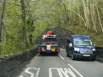
The route between Tarbet and Inverarnan runs adjacent to the west bank of Loch Lomond and the River Falloch for 17 km (10.6 miles).
It is located within the Loch Lomond and The Trossachs National Park in an area of outstanding natural beauty. It is a complex site that is physically constrained, with the loch on one side, and steep terrain and railway on the other.
The study commission is considering issues including:
- the impact of widening the road
- opportunities to improve visibility and reduce the levels of accidents
- improving drainage
- pedestrian and cycle access
- stopping opportunities, including lay-by provision
- delivering journey time reliability
- reducing disruption from road maintenance and improving resilience

How to get involved
Transport Scotland and Jacobs Fairhurst Joint Venture are working closely with Loch Lomond and The Trossachs National Park, Argyll and Bute Council, NatureScot, Scottish Environment Protection Agency, Network Rail, community councils and other key stakeholders in undertaking the study.
We are also talking to groups representing all users of the A82.
If you would like to provide feedback/comments or if you have any questions please get in touch, you can contact the project team by email at A82upgrade@jacobs.com or alternatively by post to:
A82 Tarbet to Inverarnan
Jacobs Fairhurst Joint Venture
95 Bothwell Street
Glasgow, G2 7HX
Community engagement and story map
Community engagement is extremely important to us and it continues to be a vital part of our work as we develop the preferred route alignment design. To help us keep you informed of the project’s progress, and to give you an insight into the work that goes into a complex engineering major infrastructure project such as this, we have developed a dedicated interactive Story Map to help share more information with you.
Having considered the changes to communication preferences due to the COVID-19 pandemic, over the coming months this Story Map will form a key part of our ongoing engagement with the local community, key stakeholders and the general public.
We hope that you find this Story Map useful and informative, and that it helps to answer any questions you may have about the proposed A82 Tarbet to Inverarnan scheme.
For the best experience we recommend viewing this interactive story map using a desktop/laptop. The Story Map is compatible on handheld devices, such as mobile phones and tablets, however some of the maps may not work as expected and images may be altered or cropped. Alternatively, you can access the PDF version which can be found at the end of the Story Map should you experience any issues.
Our story map is also compatible with most web-browsers available, however if you do experience any issues we recommend using Google Chrome for the best results.
We will continue to update the Storymap over the coming months to help share information about the work being undertaken as part of the project development.
If you have any questions in the meantime, you can find some additional information in our frequently asked questions or alternatively please contact the project team by email at A82upgrade@jacobs.com.
Engagement with Stakeholders for A82 Tarbet to Inverarnan Scheme
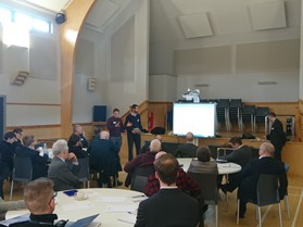 As the design work continues for the A82 Tarbet to Inverarnan scheme, Transport Scotland, supported by its consultants Jacobs Fairhurst Joint Venture, have hosted a series of engagement workshops with a wide range of stakeholder organisations in Arrochar.
The workshops set out the developing route alignment and sought feedback from those attending on the design and assessment work carried out to date. They also provided an opportunity for the project team to understand the views of the stakeholder groups and to consider some of the opportunities and options that will inform the developing route alignment.
Regular engagement with key stakeholders is continuing as we progress the detailed development and assessment of the preferred option, which is being informed by our enhanced understanding of the specific complexities associated with improving this iconic route.
DMRB Assessment Process
The design and assessment of Trunk Road schemes is guided by the Design Manual for Roads and Bridges (DMRB). This involves a 3 stage assessment process, examining and assessing a number of options leading towards the identification of the preferred alignment at the end of DMRB Stage 3.
Following the identification of the preferred corridor, alternative routes within this corridor were examined during DMRB Stage 2. Assessment work was concluded in September 2015 with the selection of the online upgrade as the preferred route option.
At the end of DMRB Stage 2 public exhibitions were held at Arrochar, Crianlarich, Oban and Fort William. They gave an overview of the route option assessment work Transport Scotland has taken forward for the A82 Tarbet to Inverarnan upgrade project and presented the preferred route option.
At DMRB Stage 1, a number of transport planning objectives were set and a preferred route corridor was identified.
DMRB Stage 3 Assessment - Preferred Route Development
We're currently taking forward the development and assessment of the preferred route option through DMRB Stage 3.
This stage of the assessment process includes:
- Development of the scheme design;
- Consultation with stakeholders, affected landowners and the general public;
- Development of suitable mitigation measures to reduce impacts on the environment;
- Environmental impact assessment of the scheme design and preparation of the Environmental Impact Assessment Report;
- Consideration of mitigating disruption to road users and the local community during construction of the scheme;
- Identification of the land required for the scheme and preparation of draft Orders.
Carriageway Width Review
 The DMRB Stage 2 assessment recommended consideration of both a 6m and 7.3m carriageway width (both with 1.0 metre hardstrips) during Stage 3. The assessment of these options was completed followed by a ministerial announcement that the 7.3m wide carriageway option had been selected for further development and assessment.
Surveys
A number of surveys, including a detailed ground investigation survey, have been carried out to date to inform the assessment and development of the preferred route option. These have included:
- Topographic and bathymetric surveys
- Seasonal ecology surveys (including bats, otters, birds and bryophytes)
- Noise assessments
- Vegetation surveys
- Traffic surveys
- Woodland and invasive plant surveys
- Mapping of both major and minor watercourses
- Peat probing at a number of selected locations along the route, with samples taken for testing.
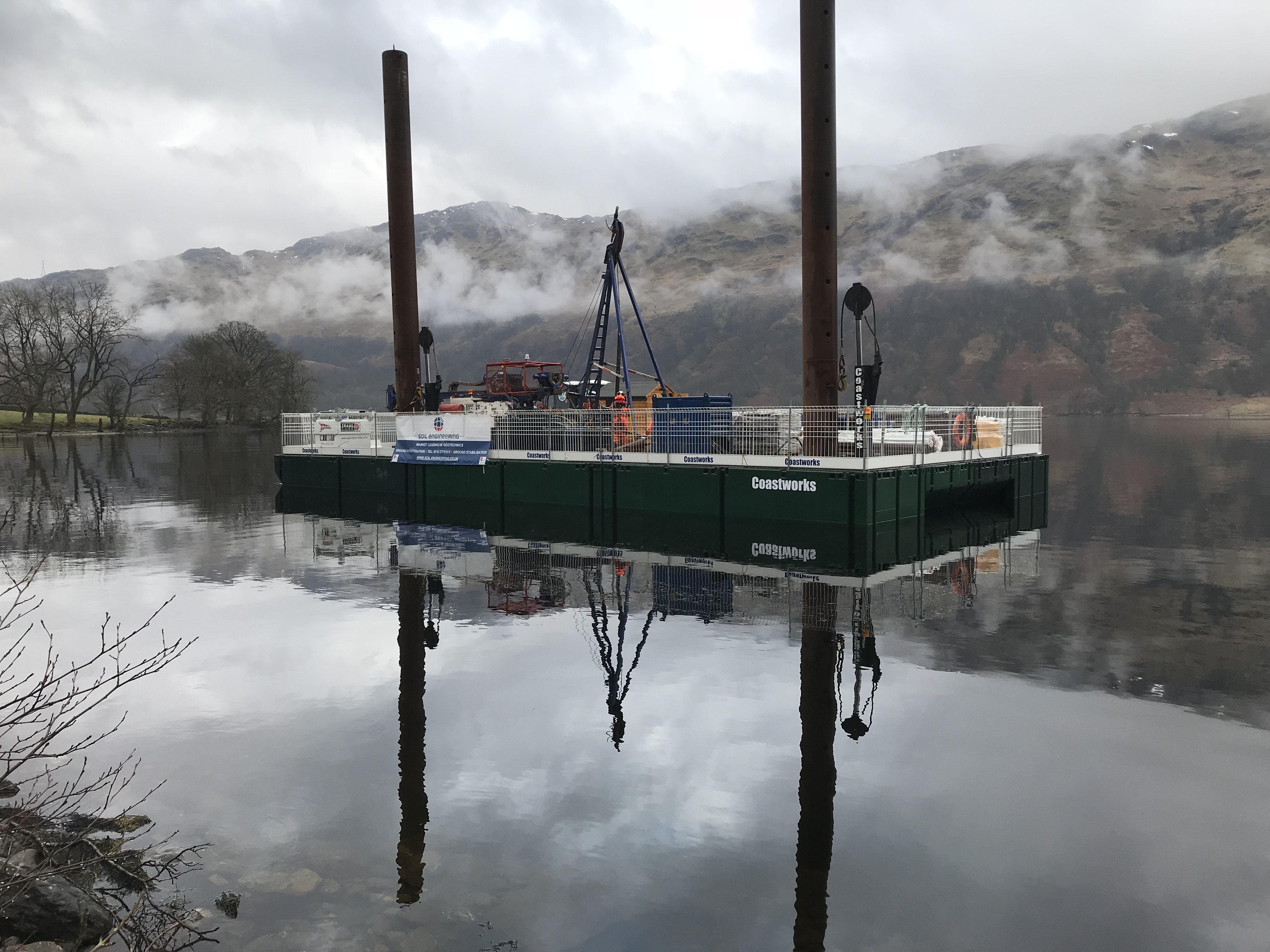 The detailed ground investigation surveys were carried out along the proposed A82 route corridor during 2018 and consisted of drilling land and overwater exploratory holes.
This provided vital information on the challenging ground conditions and geology of the site and is being used to inform the detailed development and assessment of the preferred route option.
DMRB Stage 2 Assessment - Preferred Route Identification
Design, assessment and survey work for the DMRB Stage 2 Assessment was completed in September 2015 with the identification of a preferred route option. The work looked at a range of issues, including:
- environmental impact
- ground investigation
- traffic impact
- economic assessment
- value for money
The study followed an objective led approach informed by consideration of the problems and constraints.
A number of route options and sub options were considered and sifted. Four route options were then developed for assessment as follows:
- Route Option 1 – an online route
- Route Option 2 – an online route with inland sections
- Route Option 3 – an online route with over-loch sections
- Route Option 4 – an option with fewest bends
Based on the route options assessment process, Route Option 1 – online upgrade – was identified to be taken forward as the preferred route option. Further consideration is also to be given to the following, as part of the design and development of the preferred route option (DMRB Stage 3 assessment process):
- Inclusion of two short off-line sections near Ardvorlich
- The alignment will be developed to reduce impact on properties and landowners
- The alignment will also be adjusted to assist construction and reduce delays to road users
- A carriageway width of 6 metres and 7.3 metres (both with 1 metre hardstrips) will be considered
Computer generated fly through of the indicative prefer route
DMRB Stage 2 Assessment Report
DMRB Stage 1 Assessment - Route Corridor Assessment
The Design Manual for Roads and Bridges (DMRB) Stage 1 assessment to identify a preferred corridor agreed specific Transport Planning Objectives (TPO) that best defined what the scheme is trying to achieve.
The five TPOs developed were:
- To improve journey times for A82 trunk road users between Tarbet and Inverarnan (based on observed post Pulpit Rock scheme).
- To reduce personal injury accident numbers and their severity on the A82 between Tarbet and Inverarnan to be closer to or better than national KSI (Killed or Seriously Injured) rates.
- To provide appropriate stopping opportunities for visitors and for all trunk road users on the A82 between Tarbet and Inverarnan taking account of the unique setting of the route within the National Park.
- To seek to provide opportunities for enhanced access by sustainable modes of travel along the A82 corridor between Tarbet and Inverarnan.
- To reduce disruption to road users resulting from the undertaking of maintenance activities on the A82 between Tarbet and Inverarnan.
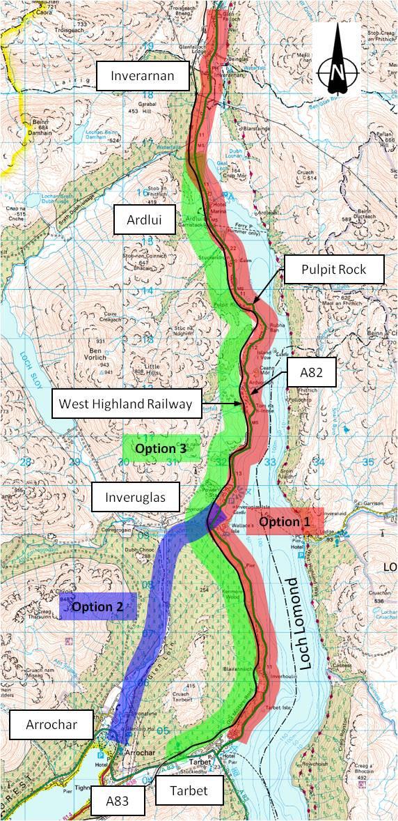 A wide range of route corridors were identified and following an initial sifting process using the above objectives, the three most feasible route corridors were narrowed down to:
- Route Corridor 1 - the existing A82 route corridor
- Route Corridor 2 - a route corridor from Arrochar to Inveruglas along Glen Loin to where it joins the existing A82 route corridor
- Route Corridor 3 - a route corridor above and to the west of the West Highland Rail line
An assessment of the engineering challenges, environmental effects and traffic and economics concluded that Route Option 1 (A82 on-line, the ‘red route’ - see plan above) was the preferred corridor.
Other options, such as a straight line tunnel through the hillside or a submerged tunnel in the loch were also considered, but sifted out at an early stage because they failed to meet all of the objectives. It is also notable that the £4 billion estimated cost of the tunnels was considerably higher and would have provided a significantly lower economic return than the other options.
The project advanced to DMRB Stage 2, with the assessment and identification of a preferred route within the corridor.
DMRB Stage 1 Assessment Report
- View DMRB Stage 1 Assessment Report - February 2014 – Volume 1 - A82 Tarbet To Inverarnan
- View DMRB Stage 1 Assessment Report - February 2014 – Volume 2 - Drawings - Part 1 - A82 Tarbet To Inverarnan
- View DMRB Stage 1 Assessment Report - February 2014 – Volume 2 - Drawings - Part 2 - A82 Tarbet To Inverarnan
- View DMRB Stage 1 Assessment Report - February 2014 – Volume 2 - Drawings - Part 3 - A82 Tarbet To Inverarnan
- View DMRB Stage 1 Assessment Report - February 2014 – Volume 2 - Drawings - Part 4 - A82 Tarbet To Inverarnan
Frequently asked questions
Answers to frequently asked questions on this project are shown below. If you can't find an answer to your question, you can contact our project team at A82upgrade@Jacobs.com.
Background
The A82 trunk road forms a strategic link in Scotland's transport network, connecting the Highlands and Islands to Glasgow and the Central Belt. The route is vital in helping to support economic growth and development in the north and west of Scotland. The A82 is also a key tourist route providing access to Loch Lomond and The Trossachs National Park, Fort William, and the Highlands and Islands.
The proposed 17km scheme, which begins south of the village of Tarbet and ends just to the north of Inverarnan, includes carriageway widening and substantial improvements to the current substandard trunk road alignment.
The Scottish Government’s ‘Strategic Transport Projects Review’ (STPR) in 2008 set out the future investment programme for transport in Scotland for the next two decades. This included several measures to reduce congestion and improve traffic flow along a number of sections of the A82 trunk road.
Jacobs Fairhurst JV was commissioned by Transport Scotland to undertake the necessary works to complete a Design Manual for Roads and Bridges (DMRB) Stage 1, Stage 2 and Stage 3 Scheme Assessment for the proposed upgrade of a section of the A82 Trunk Road between Tarbet and north of Inverarnan.
We are now in the process of finalising the development and assessment of the preferred route option as part of the DMRB Stage 3 assessment process.
Key Messages
The project’s key messages and the sub-messages that support them:
We are committed to upgrading the A82 Tarbet to Inverarnan trunk road, improving road safety and journey time reliability
- The upgraded road will operate more effectively, and be easier to maintain, reducing disruption to road users, local businesses, and communities.
- The improved road cross section and route alignment will help reduce the number and severity of accidents.
- A shared cycleway / footway will provide a safe route for pedestrians and cycle users and improve access to leisure and recreation in the national park.
- Parking laybys will offer safer opportunities for road users to take a short break from their journey.
We will create a resilient transport corridor that responds to the key climate change challenges
- The proposed scheme will improve resilience to storm events, reducing the level of disruption due to flooding, landslides and rockfall events.
- Improved drainage provision will allow the route to operate more effectively and safely during periods of adverse weather.
We will provide enhancements to the settlements along the route, improving connectivity and enhancing access to sustainable travel
- Improved bus laybys in Tarbet and a parking layby at Ardlui rail station will enhance access to public transport.
- The communities of Tarbet, Inveruglas, Ardlui and Inverarnan will be linked with a segregated walking and cycling route.
- Within the communities, footpaths and informal crossing points will be provided to allow pedestrians to safely access local amenities.
We will continue to engage with directly affected communities and businesses
- We updated our project website on 05 October 2021 sharing the assessment work and developing design of the preferred route option.
- We have launched an interactive Story Map which will be developed and added to as the design develops and this will keep local communities and road users informed of progress on the project.
- We invite feedback from stakeholders and the public to capture their views of the existing route and their comments on the developing scheme design.
- Ongoing input from stakeholders is of vital importance to us to help obtain local and wider background information.
Frequently asked questions
Q1 Why is the A82 Tarbet to Inverarnan work required?
Improvements to this section of the road were identified in the Strategic Transport Project Review (STPR, 2008). The STPR sets out the Scottish Government's 29 transport investment priorities over the period to 2032. Improvements to this section of the A82 trunk road were included within Intervention 3 (Targeted Programme of Measures to Improve Road Standards between Glasgow and Oban/Fort William (A82)). The commitment to improve the A82 is also contained in the Scottish Government’s Infrastructure Investment Plan published in February 2021.
The need for the scheme is fundamentally related to ensuring safety for all road users and to provide improvements in accessibility and journey time reliability.
Q2 What are the current issues facing the A82 Trunk road from Tarbet to Inverarnan?
The existing trunk road between Tarbet and Inverarnan is generally below standard width, often narrowing to below 6m with no paved boundary and sub-standard verges running along the roadside. This section of the route is characterised by tight bends and reduced forward visibility, while being tightly constrained between Loch Lomond and the River Falloch to the east, and steep hillsides and the West Highland Line railway to the west.
There is a lack of safe stopping opportunities and the road is difficult to maintain without the implementation of road closures that cause significant disruption. Existing watercourse crossings and drainage facilities are inadequate, and the operation of the road can be disrupted due to flooding, landslides and rockfall events.
The Communities along the route have poor access to public transport and a lack of safe walking and cycling routes.
Many of these issues contribute to this section of the A82 having a high accident rate, with the proportion of accidents above the national average rate for Killed and Seriously Injured severity.
Q3 When will work commence and when will the new road be open?
Transport Scotland and its consultants are finalising the development and assessment of the preferred route option with a view to preparing draft Orders in 2022 for formal comment. Delivery of the scheme itself can only commence if the scheme is approved under the relevant statutory procedures and thereafter a timetable for progress can be set.
Q4 What are the benefits of the scheme?
The proposed scheme will benefit all road users by improving safety and providing improvements in accessibility and journey time reliability.
Wider benefits include employment opportunities during construction, reductions in costs for businesses that operate along the route and improved access to market for goods and labour.
Improvements in perceptions of ‘remoteness’ experienced by residents in North West Scotland through improvements in journey time reliability could increase repeat visits to the area, boosting tourism and bolstering investor confidence.
Q5 How will the project be funded?
We will consider funding options as we progress through the project development. There are a range of options available for funding road projects depending on the cost of the project and we will consider the funding option that is most appropriate.
Q6 Why is the A82 being ignored when compared to other trunk roads?
The Scottish Government is committed to improving this vital route which connects the central belt to the Highlands and Islands. Between 2007 and 2020 the Scottish Government has invested £121.1 million in maintaining and improving the A82, with several maintenance improvement schemes being completed on the A82 in recent years.
As part of the Scottish Government’s commitment to improve the route, Transport Scotland has been progressing route option assessment work for the Tarbet to Inverarnan section and the outcome of work is presented in our Story Map. This will give local communities and road users the opportunity to view the developing scheme design and provide vital feedback as we further develop the design of the preferred route option.
Q7 How will environmental impacts be mitigated?
Environmental assessment work undertaken as part of the DMRB Assessment process has helped to shape and influence the design development.
Environmental assessment and engineering design have been carried out in parallel to provide appropriate interaction between environmental standards and the development objectives. This process has allowed key environmental impacts to be effectively considered and mitigated, helping to reduce the schemes environmental effects throughout the design development process. Where reasonably practicable, potential adverse environmental impacts during scheme construction and operation can be mitigated or prevented through this iterative approach.
The Story Map provides more further information on the residual environmental impacts and scheme mitigation.
Q8 How is the Scottish Government addressing climate change in relation to roads?
The Scottish Government is committed to tackling climate change and to the reduction of greenhouse gas emissions from all parts of the transport system to help meet our climate change ambitions. The National Transport Strategy (NTS), which sets the direction for transport over the next 20 years, makes clear that our transport system will help deliver our ambitious climate change agenda and net-zero 2045 emissions target. Future transport investment decisions will be made considering the Sustainable Travel Hierarchy which prioritises walking, cycling and public and shared transport options in preference to the use of single occupancy private cars.
The Scottish Government is phasing out the need to purchase a petrol or diesel- powered car or van by 2030, a full five years ahead of the UK. A sustainable, low carbon transport network brings many additional benefits to communities and businesses. The Scottish Government is committed to maximising these co-benefits which means that individual transport projects should not be assessed in isolation but in combination with other projects and Scottish Government policies.
The Scottish Government needs to balance the extensive changes required to meet a target of net-zero greenhouse gas emissions with its duty to ensure that Scotland has a high quality and resilient transport system that meets the needs of the Scottish people.
Q9 How will the environmental impact of the road scheme be minimised?
Once a preferred route has been identified an Environmental Impact Assessment (EIA) Report will be published. The EIA considers the likely environmental impacts of the proposed scheme by comparing it with the expected conditions that would occur without the introduction of scheme. The EIA gives consideration to potential impacts associated with increased traffic, consumption of material resources, and the production and management of waste during construction of the proposed scheme.
By applying key material and waste management principles, the impacts on natural resources and need for permanent disposal of wastes and materials will be reduced. Proposed mitigation measures will be considered to minimise materials use, while maximising re-use and recycling of materials to ensure all materials and waste are handled according to the regulatory requirements. These will be implemented through several plans addressing different aspects of construction site management, including a Site Waste Management Plan (SWMP) and a Construction Environmental Management Plan (CEMP).
Q10 This section of the A82 provides a diversion route to the A83 – how will this be managed going forward?
Transport Scotland understands the importance of the A82 Tarbet to Inverarnan scheme, together with the need to prioritise works to provide a medium and long-term solution to the challenges at the Rest and Be Thankful. We are currently considering ways that the A82 Tarbet to Inverarnan scheme could be packaged, taking cognisance of proposals for the A83 Access to Argyll, to introduce flexibility in how the works could best be managed across the A82 and the A83 concurrently to minimise disruption and impact on the surrounding road network. The A82 between Tarbet and Tyndrum will provide a diversion route during A83 closures at the Rest and Be Thankful, and any delays and diversions for motorists as a result of the A82 Tarbet to Inverarnan scheme will be mitigated through co-ordinated construction work and operational activity on the A83.