Environmental Impacts and Mitigation
Introduction
The following subsections summarise the likely significant effects of the proposed scheme on the environment, including relevant details of embedded mitigation (design measures which are integrated into the proposed scheme for the purpose of avoiding or reducing environmental effects) and essential mitigation (mitigation critical for the delivery of the proposed scheme which can be acquired through statutory powers). Full details of each assessment, including the detailed methodology, baseline conditions, potential impacts, mitigation and residual effects are presented in the individual chapters of the EIAR (Volume 1: Main Report). Chapter 22 (Schedule of Environmental Commitments) of the EIAR collates and details the mitigation measures from each technical chapter and outlines any legislative and monitoring requirements. Chapter 23 (Summary of Significant Residual Effects) collates and summarises all residual environmental effects assessed as significant following the incorporation of mitigation measures.
Air Quality
An air quality assessment based on computer modelling of current (2023) and future road traffic and air quality conditions was undertaken. In addition to other parameters, the assessment used forecast road traffic data for the base year (2023), peak construction year (2030) and proposed year of opening (2036) (year 2036 reflects the entire A9 Dualling rather than the proposed scheme completion end date of 2032). A construction risk assessment was also undertaken, which concluded that while the air quality impacts of road traffic during construction would not be significant and required no further assessment, mitigation would be required to address fugitive dust and particulate matter emissions during construction.
The local air quality assessment of road traffic impacts during operation of the proposed scheme focused on the pollutants nitrogen dioxide (NO2) and particulate matter with a diameter of less than 10µm (PM10) and 2.5µm (PM2.5) at 28 worst-case human health receptors. A further 438 ecological receptors were modelled across 38 transects for the consideration of the potential impacts of the proposed scheme on the deposition of nitrogen at designated Ancient Woodland habitats.
The results for the operation phase show that in the proposed year of opening (2036), there would be no exceedances of Air Quality Objectives for NO2, PM10 or PM2.5 at any of the modelled worst-case locations resulting in human health impacts with or without the proposed scheme.
Potentially significant residual effects were identified for nitrogen deposition on Ancient Woodland, and impacts were consequently assessed in Chapter 12 (Biodiversity), which concludes that such residual effects are considered to be slight adverse and not significant.
Cultural Heritage
The baseline for the cultural heritage assessment comprised 134 archaeological remains, 123 historic buildings and 16 historic landscape types.
An important historic building in the baseline is Dunkeld and Birnam Station, including Footbridge, which is a Category A Listed Building. The station is currently partially severed from Birnam by the existing A9. Measures to re-integrate the station and town, and to reduce the impact on setting of the station, were embedded in the design of the proposed scheme. Measures to better integrate the proposed scheme into Murthly Castle Garden and Designed Landscape (GDL), included on the Inventory of Gardens and Designed Landscapes, were also embedded in the design of the proposed scheme.
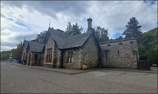
Essential mitigation includes archaeological investigations and surveys. The resulting reports will be made available to the public through the Perth & Kinross Historic Environment Record and the National Record of the Historic Environment. Essential mitigation for Dunkeld and Birnam Station also includes measures to allow the form, materials and architectural style of the embedded mitigation measures to provide a visual connection with the station. The design of the measures will be developed in consultation with Historic Environment Scotland, Perth & Kinross Council and Perth and Kinross Heritage Trust.
With mitigation measures in place, significant residual adverse effects are predicted for Dunkeld and Birnam Station, Dunkeld and Birnam Station Signal Box (a Category B Listed Building), Birnam Conservation Area and Murthly Castle GDL. Slight beneficial effects on Dunkeld and Birnam Station and Birnam Conservation Area have also been predicted.
Interpretation boards providing information on the history of Dunkeld and Birnam Station and Murthly Castle GDL will also be provided.
Landscape
An assessment of the impact on the landscape up to 5km from the proposed scheme was undertaken following applicable guidance. Sensitive receptors were identified as sites designated for their landscape qualities including the River Tay (Dunkeld) National Scenic Area (NSA), four Landscape Character Types and four Local Landscape Character Areas.
Construction activities associated with the proposed scheme, including the removal of roadside vegetation, the alteration of existing roadside landform and rock outcrops and the construction of structures and earthworks, would have potential impacts on the landscape. Potential impacts would also arise from the operation of the additional carriageway and associated infrastructure in addition to the changed appearance of the landscape and the associated change in the perception of the River Tay (Dunkeld) NSA.
To mitigate potential impacts, mitigation measures have been developed through the iterative design process, including the careful alignment of the proposed scheme and positioning and design of certain elements to avoid or reduce potential impacts on landscape features.
Specific mitigation measures include woodland planting to integrate the proposed scheme into the landscape. Whilst there is a focus on planting, mitigation measures will also influence the design of structures such as the River Tay Bridge, and SuDS features. Where exposure of rock cuttings is anticipated, such as between The Hermitage and Dalguise Junctions, any exposed rock faces will be sculpted to provide a rugged, naturalistic appearance to reflect the character of the surrounding rock and fit with the landscape.
The assessment of residual effects on landscape receptors has taken into account mitigation, considering the proposed scheme in the winter of the year of opening (when planting has been implemented but has not established) and in the summer, 15 years after opening (when the proposed planting would be reasonably established).
Direct effects from the construction and operation of the proposed scheme on four Local Landscape Character Areas, one Landscape Character Type and landscape elements of the River Tay (Dunkeld) NSA are predicted to result from carriageway widening and construction of earthworks and structures (particularly those associated with proposed grade separated junctions) which would alter landcover and landform and result in loss of woodland along the route.
In the winter of the year of opening, it is predicted that the proposed scheme would have significant residual adverse effects on three Local Landscape Character Areas (Strath Tay: Lower Glen, Lowland River Corridor: Strath Tay, and Strath Tay: Dunkeld and Birnam (Settlement)) due to the need to create embankments and rock cuttings, road widening, structures, new junctions and other infrastructure and associated loss of natural topographic features, mature and established woodland and some farmland.
As planting establishes and the proposed scheme becomes more integrated into the landscape, it is predicted that residual adverse effects would reduce. By the summer, 15 years after opening, it is assessed that residual adverse effects on one Local Landscape Character Area (Strath Tay: Lower Glen) is predicted to remain significant after 15 years due largely to the Birnam and Dalguise junctions and cumulative losses of established woodland along the route corridor. It is predicted that the proposed scheme would have significant residual beneficial effects on one Landscape Character Type (Lowland Hills – Tayside) by the summer 15 years after opening following the establishment of areas of mixed and broadleaved compensatory woodland planting at Muir of Thorn.
There would be no significant risk to the integrity of the River Tay (Dunkeld) NSA. Significant residual effects during the winter of the year of opening are predicted on some of the NSA’s Special Landscape Qualities, however, these are no longer assessed as significant by the summer 15 years after opening, following establishment of the mitigation planting.
Visual
The visual impact assessment considered the likely effects the proposed scheme would have on views experienced by people from buildings, outdoor public areas, local roads and routes used by pedestrians, cyclists and equestrians.
The existing A9 is already a notable feature in views across and along the valley of the River Tay, although established forestry plantations and mature woodland areas on either side of the valley help to provide some screening of the road and vehicles on it, while the largely wooded hills enclosing the valley generally limit more distant views towards it.
As part of the design, landscape mitigation measures were also developed to reduce visual impacts. These include embedded mitigation measures developed through the iterative design process (such as the vertical and horizontal route alignment), grading out of embankment and cutting slopes to blend with existing landforms, steepening of slopes and introduction of retaining walls to minimise woodland loss, and new planting to screen the proposed scheme and help further integrate it with the surrounding landscape. The landscape design also considered opportunities to maintain or enhance existing open views of the surrounding landscape, where these are currently a key landscape/visual characteristic. The effectiveness of any new woodland/scrub/boundary planting is expected to increase over time as vegetation matures.
Visual effects of the proposed scheme have been compared against the existing baseline views, in which the A9 is already visible from a number of locations. Impacts would typically occur where a receptor is close to the proposed scheme, or where open views are possible towards it, for example where existing roadside planting is removed. In some locations impacts would be limited by screening provided by existing landform, built elements and vegetation. Visual impacts would generally be associated with physical aspects of the proposed scheme, or from the movement of traffic upon it.
People at 73 building locations and 35 outdoor locations are predicted to experience significant residual adverse visual effects during construction. During operation, in the winter of the year of opening, people at 43 building locations and 28 outdoor locations are predicted to experience significant residual adverse visual effects due to the loss of existing roadside vegetation and the increased prominence of new road infrastructure (including earthworks, bridges and retaining walls). There would also be significant residual effects on drivers’ views from the road in the winter of the year of opening at Strath Tay: Lower Glen LLCA (ch850 to ch8280).
As with impacts on the landscape, visual impacts will reduce over time as planted vegetation matures. By the summer, 15 years after opening of the proposed scheme, mitigation planting – mostly in the form of new woodland and scattered individual trees that would have become established – is predicted to have reduced impacts such that people’s views at three building locations and five outdoor locations experience significant residual adverse effects. There would no longer be significant effects on drivers’ views from the road.
Biodiversity
An ecological impact assessment was undertaken in accordance with relevant published guidance to determine potential significant impacts and associated effects of the proposed scheme on biodiversity resources including terrestrial and freshwater species, habitats and ecosystems.
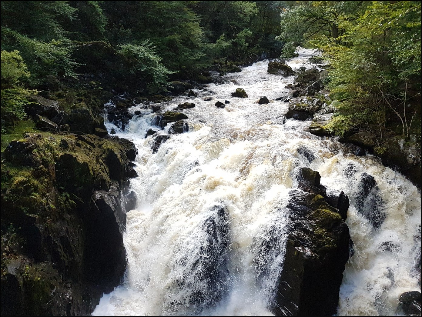
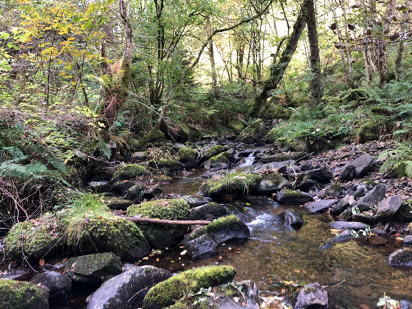
Biodiversity resources that could potentially be impacted by the proposed scheme include habitats, particularly the River Tay Special Area of Conservation (SAC) and ancient woodland (AWI) within the vicinity of the proposed scheme, and aquatic and terrestrial species such as freshwater pearl mussel, Atlantic salmon, lamprey species, otter, beaver, badger, red squirrel, bats and reptiles.
Through the iterative design process, mitigation measures including replacement planting, habitat creation, provision of artificial nest/roost structures, crossing structures and mammal-resistant fencing were identified to avoid or reduce potentially significant adverse effects.
Opportunities for delivering positive effects for biodiversity, and biodiversity net gain, have also been considered as part of the assessment, adopting a bespoke approach to the application of England’s Statutory Biodiversity Metric for the proposed scheme.
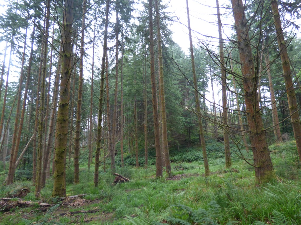
A significant residual adverse effect is anticipated as a result of the permanent loss of 29.02ha of woodland listed on the AWI (ancient woodland) as a result of the proposed scheme. Compensatory planting of 34.58ha of ancient woodland is proposed, and whilst this cannot fully mitigate for the permanent loss of the biodiversity and intrinsic importance of ancient woodland, it will provide larger and more connected networks of woodland along the A9.
Woodland planting extending to 16.61ha is also proposed to mitigate for permanent loss of 13.76ha of other woodland habitat and, during the growth phase of landscape planting, a significant residual adverse effect is predicted due to loss and fragmentation of habitat. However, this impact would be temporary, albeit long-term in nature and, once cover is established, no significant residual effects are predicted. Woodland will be planted as early in the construction phase as possible to reduce the delay between habitat loss and habitat creation. Planting would be undertaken in advance of the proposed scheme being constructed, where possible.
The micro-siting of outfalls away from ecologically sensitive areas and the incorporation of robust silt and pollution controls will ensure that there will be no residual significant effects on the internationally important River Tay SAC or the critically endangered freshwater pearl mussels.
The proposed scheme will result in no net loss of biodiversity resources and is expected to deliver a net positive effect for biodiversity through habitat creation (on- and off-site), including woodland and habitat mosaics providing habitat for a range of protected species, management of non-native woodland and invasive species, and provision of additional nest sites for birds, bats, pine marten and red squirrel. Significant residual beneficial effects are also predicted on a variety of protected species, including bats, badger, pine marten and red squirrel due to the new Murthly Estate Bridge structure reducing habitat fragmentation between Dalpowie Plantation and Birnam Wood.
Geology, Soils, Groundwater and Land Contamination
The assessment has been informed by consultation and desk-based assessments, including the review of ground investigation data. This process established that no designated Geological Receptors, Sites of Special Scientific Interest (SSSI) and Geological Conservation Review sites fall within the study area. One Special Area of Conservation (SAC) was noted within the study area associated with the River Tay, although not designated for its geological features. No groundwater dependant terrestrial ecosystems (GWDTE) nor Groundwater Abstractions were identified in proximity to the proposed scheme. However, an area of bog and bog woodland was recorded at the Muir of Thorn to the south of the proposed scheme. These habitats have the potential to constitute GWDTE, however no further surveys were undertaken as these areas will not be impacted by construction activities.
The impact assessment was designed to assess the significance of both direct and indirect (groundwater dewatering) effects from the proposed scheme. Minor groundwater dewatering impacts are predicted, and as such the residual effect on groundwater flow is expected to be of Slight adverse significance. The construction of new structures and associated sheet pile walls and other piles could potentially create new vertical or horizontal flow paths for pollutant migration, as such the residual effect on groundwater quality is expected to be of Slight adverse significance. Both the superficial aquifers and bedrock aquifers may be at risk of water quality impairment due to accidental spillage during both construction and operation phases, the impact is expected to be of Slight to Large adverse significance. As part of the construction of the proposed scheme, removal of peaty soils is expected to be limited resulting in a potential impact of Slight significance. There will be direct and indirect disturbance of potential sources of land contamination, with potential impacts ranging between Moderate to Neutral significance. Following the implementation of mitigation measures, residual effects remain but none are considered significant.
In relation to land contamination issues, mitigation is expected to reduce residual adverse effects to Slight significance during construction and Neutral significance during operation. Localised adverse residual effects of Slight significance are expected on groundwater flow within superficial and bedrock deposits. Implementation of mitigation in relation to the protection of the groundwater environment against pollution incidents is expected to reduce the potential impacts on groundwater quality and associated receptors to a residual adverse effect of Slight and Neutral significance (respectively). Residual adverse effects on surface water receptors from indirect dewatering are expected to be Neutral to Slight significance.
Overall, the residual effects on geology, soils, groundwater and land contamination are predicted to be not significant.
Material Assets and Waste
This assessment considered the impact of the construction of the proposed scheme on material assets, including primary materials and manufactured construction products, and waste generation; and potential effects on available waste management infrastructure (i.e. available landfill capacity).
Potential effects on material assets and waste when the proposed scheme is operational were scoped out of this assessment as they were considered to be not significant (by quantity) in the context of the proposed scheme and DMRB guidance specifies that the environmental assessment is only to report on the first year of operational activities (i.e. proposed year of the scheme opening).
Throughout the design process, a number of mitigation measures were embedded in the scheme design to reduce the consumption and use of material assets and the production and disposal of waste.

With good practice application of responsible sourcing methods, the waste hierarchy, implementation of Site Waste Management Plans and inclusion of targets that support the delivery of the Zero Waste Plan targets, the residual environmental effects relating to the consumption and use of material assets and production and disposal of waste have been assessed as slight adverse (not-significant) and moderate adverse (significant) respectively after the application of essential mitigation measures.
The significant residual effects are due to the potential use of available non-hazardous landfill capacity in the study area, as well as the use of non-hazardous landfill capacity outside of the study area. The transportation of waste to more distant landfill locations is likely to be necessary because many more local sites are currently scheduled to have stopped accepting waste by the start of constructing the proposed scheme in 2028.
Noise and Vibration
The potential noise and vibration impacts and effects of the proposed scheme on noise and vibration sensitive receptors have been assessed.
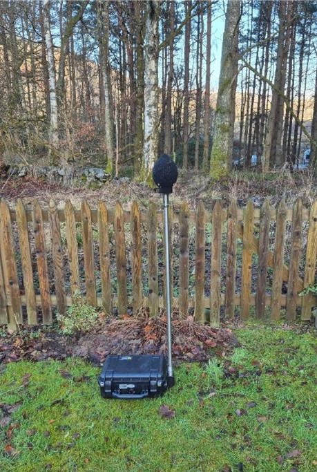
Construction noise modelling and construction vibration calculations were undertaken at sample locations representative of the nearest noise and vibration sensitive receptors to the proposed scheme. Operational noise modelling was undertaken for all noise sensitive receptors within the operational noise study area.
As part of the assessment, a baseline noise survey was undertaken at nine locations to gain an understanding of the existing noise climate within the vicinity of the proposed scheme, validate baseline noise modelling results and to provide data for public consultation purposes.
The construction noise assessment identified six individual or groups of noise sensitive receptors which had the potential to experience significant construction noise effects. Standard mitigation measures across A9 Dualling projects have been proposed to reduce construction noise levels. With the implementation of these measures, it is anticipated that the potential for significant residual adverse construction noise effects will remain at three individual or groups of noise sensitive receptors, but these would be minimised as far as practicable.
The construction vibration assessment identified three individual or groups of vibration sensitive receptors which had the potential to experience significant construction vibration effects. Specific mitigation measures have been proposed to reduce vibratory compaction and sheet piling vibration levels. With the implementation of these measures, it is anticipated that no vibration sensitive receptors would experience significant residual adverse construction vibration effects.
The operational noise assessment identified five noise sensitive receptors which had the potential to experience significant adverse operational noise effects. An acoustic barrier has been proposed as a specific mitigation measure to reduce operational noise levels such that significant residual adverse operational noise effects are not experienced at four of these receptors. It is not considered practicable to reduce operational noise levels at the remaining noise sensitive receptor, and therefore a significant residual adverse operational noise effect is anticipated at one noise sensitive receptor.
The operational noise assessment identified 65 noise sensitive receptors which have the potential to experience significant beneficial operational noise effects.
Population – Land Use
An assessment of the impacts of the proposed scheme was conducted on land use resources comprising private property and housing, community assets, development land, businesses, agricultural land holdings and other land.
The assessment considered both construction impacts and operational impacts of the proposed scheme on 671 residential dwellings, 27 community assets, 130 businesses, 13 permitted planning applications, three development land allocations, and ten primary agricultural land holdings.
To mitigate potential effects, embedded, standard and project specific mitigation measures were developed through an iterative design process and included reducing land-take and developing measures to maintain access to housing and businesses, community assets, community land and agricultural holdings, with revised access arrangements and tie-ins to the road network.
Land must be acquired for the proposed scheme’s construction and operation, and to provide essential mitigation, including:
- 06ha from three private property and housing receptors;
- 38ha from four community land and community asset receptors;
- 53ha from six business receptors including demolition of seven buildings/structures (one of which is a residential property associated to the business);
- 10ha from seven agricultural land holdings; and
- 26ha from other land.
With proposed mitigation in place, significant residual effects are reported for:
- three private property and housing receptors, with both adverse and beneficial effects assessed with further beneficial effects to other private property and housing at Birnam, Little Dunkeld and Dunkeld;
- access to private property and housing at Birnam Glen (during construction only) and which is assessed as adverse;
- two community land and community asset receptors, with both adverse and beneficial effects assessed;
- one development land receptor, which is assessed to be adverse;
- eight business receptors, with both adverse and beneficial effects assessed; and
- seven agricultural land holding receptors, all of which are assessed to be adverse.
Population - Accessibility
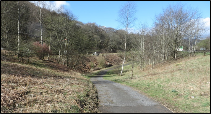
The assessment considered the impact of the proposed scheme on walkers, wheelers, cyclists, and horse-riders (WCH) and considered outdoor areas and paths including core paths, rights of way, National Cycle Routes (NCRs), equestrian routes and local paths within 500m of the proposed scheme. A total of 60 paths were identified as well as six crossing points where paths cross the existing A9.
The assessment took into account mitigation embedded in the proposed scheme design, such as new footways.
The proposed scheme design maintains existing use while providing safer access across the A9 for WCH within the study area. With the proposed scheme in place, significant adverse impacts have been largely avoided in key areas as a result of the provision of underpasses and maintaining existing WCH routes.
During construction, significant residual adverse effects for 14 paths (including NCR77) are predicted due to a decrease in amenity value and diversion lengths. In particular, people accessing three outdoor areas (Birnam Hill, River Tay and River Braan) will experience temporary but significant residual adverse effects during construction.
Significant residual adverse effects are predicted in relation to paths and access to Ring Wood and the River Braan during operation of the proposed scheme. Significant residual adverse effects are predicted for eight paths, (including National Cycle Route (NCR)77) due to decreased amenity value and/or changes to journey length.
No significant residual effects on public transport are anticipated during construction or operation. Slight residual beneficial effects are predicted for bus services due to a decrease in traffic congestion, thereby leading to fewer delays and improved journey times on the A9.
Human Health
The assessment on human health focused on the communities of Dunkeld, Little Dunkeld, Birnam and Inver, and focussed on the following health determinants:
- community, recreational and education facilities and severance/separation of communities from such facilities;
- landscape amenity and green/open space and severance/separation of communities from such facilities;
- healthcare facilities and severance/separation of communities from such facilities;
- community identity, culture, resilience and influence;
- spatial characteristics of the transport network and usage, including the surrounding road network, Public Rights of Way (including bridleways), cycle ways, non-designated public routes and public transport routes;
- air quality;
- noise and the ambient noise environment;
- sources and pathways of potential pollution;
- road safety; and
- flood risk.
The significant negative health effects identified relate to construction impacts on noise and the ambient noise, and road safety for vulnerable groups. Disruption of the transport network could have a wider impact on people in the area through safety concerns for commuting or recreational walkers, wheelers, cyclists or horse riders (WCH). Temporary diversions of pedestrians and cyclists may increase the likelihood of collisions with traffic if not appropriately managed and the presence of construction works could also result in a reduction in perceived safety. This localised disruption to pedestrian and cycle routes, as well as to traffic on the A9 and connected road network, would potentially affect access to community, recreational and education facilities, green/open space and healthcare facilities. These are interrelated impacts on transport and access to community and recreational resources. Construction noise and traffic would also affect local amenity.
In terms of population health, construction noise impacts could result in a temporary change in quality-of-life with many of those exposed being in residential properties or those wanting to enjoy the outdoor natural heritage of the area. Vulnerable groups may include those with autism spectrum disorder or who have mental health conditions, or shift workers trying to sleep during the day, who are more likely to have a high sensitivity towards noise. The identified pathways to health outcomes from these impacts include reduced physical activity, social interaction and loss of amenity, which may have a negative impact on physical and/or mental health and social wellbeing. While the general population is relatively healthy and likely to be able to adapt, vulnerable groups may have less capacity to adapt to the construction phase impacts and are more likely to suffer adverse health outcomes in the short-term.
Mitigation for impacts on traffic, accessibility, land use, noise and air quality are identified in those topic related chapters of the EIAR, while standard mitigation in the form of the appointment of a Community Liaison Officer, a liaison team and dedicated helpline, is considered particularly important in supporting the affected communities.
For the operation phase, vulnerable groups have the potential to significantly benefit from accessibility and safety improvements to the A9 road and some local routes for WCH. These improvements are expected to reduce physical barriers as well as safety concerns, which may help vulnerable groups in particular to better access community and health facilities, and areas of recreational value. This should support better health and wellbeing. Potential negative effects of the operation stage relate to risks of windblown soil dust and fibres identified in the geology and soils assessment (Chapter 13) and an increase in flood risk for a small number of properties (Chapter 19) which would have potential consequential effects on the health and wellbeing of those affected. However, with proposed mitigation in place these impacts would be reduced to not significant, removing the likelihood of significant health effects.
While there would be significant negative effects on health during the construction stage in the short term for those most affected by noise and disruption, during operation, the significant effects are expected to be positive, relating to improved safety and accessibility.
Road Drainage and the Water Environment
Impacts of the proposed scheme on the surface water environment have been assessed, specifically considering the aspects of flood risk, hydromorphology, surface water quality and surface water supply.
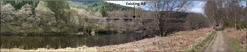
The largest watercourse within the study area is the River Tay and together with parts of the River Braan forms part of the River Tay Special Area of Conservation (SAC). The proposed scheme is partially located within the functional floodplain of the River Tay, and in sections within close proximity to the River Tay. This has been a key constraining factor in the design of the proposed scheme.
The impact assessment was informed by consultation, desk-based assessments, site walkovers and surveys. Hydraulic assessments were undertaken for the 16 watercourses that cross the scheme, including hydraulic modelling of the four principal watercourses (the River Tay, River Braan, Inchewan Burn and the Mill Stream) and three minor watercourses (WF09, WF13 and WF16). Hydraulic calculations on nine other minor watercourses were undertaken to assess potential impacts on flood risk.
Significant potential impacts from the proposed scheme in the absence of mitigation include increases in fluvial flood risk, alterations to flows and sediment processes within watercourses and deterioration in water quality within receiving watercourses from construction and operational runoff.
Mitigation during construction would be delivered through a Construction Environmental Management Plan (CEMP), which would include measures for flood risk, hydromorphology, surface water quality and surface water supply.
With the implementation of mitigation measures during construction, residual effects on all receptors would be reduced to either Neutral or Slight adverse significance. The proposed scheme has been designed so that it would not increase flood risk at key receptors (property and infrastructure).
During the operational phase, mitigation measures include the use of Sustainable Drainage Systems (SuDS), compensatory flood storage, scour protection and erosion monitoring to protect affected watercourses.
With the implementation of proposed mitigation, residual effects during operation would be of Neutral or Slight significance. The exception to this relates to significant effects on hydromorphology on two watercourses (WF11 (River Braan) and WF13). Compensation measures of de-culverting and offsite restoration are proposed to offset these impacts.
Climate
The effects of the proposed scheme on climate, resulting from estimated changes in emissions of greenhouse gases (GHGs), as well as the potential impacts of future climate change on the proposed scheme have been assessed in accordance with DMRB guidance.
The proposed scheme is expected to result in an increase to GHG emissions both during its construction and operation phases because of the required consumption of materials, fuel and energy, as well as the disturbance or removal of carbon stores such as soil and vegetation.
The significance of the proposed scheme’s potential effects on climate was assessed using professional judgement and based on the perceived likelihood of the scheme affecting either the UK or the Scottish Government’s ability to meet their respective carbon emissions reduction targets. Based on a comparison of the estimated change in GHG emission as a result of the proposed scheme with the relevant UK carbon budgets and Scottish carbon reduction targets, the scheme’s effect on climate is assessed to be not significant. Despite this conclusion, however, a number of measures are proposed in order to further mitigate the increase in GHG emissions associated with the proposed scheme.
The proposed scheme will potentially be affected by climate change related impacts during both its construction and operation (e.g. as a result of increased rainfall during winter and more intense rainfall events). Mitigation measures embedded within the scheme design, as well as the application of standard good practice mitigation measures during construction and maintenance operations, are considered likely to reduce the risk of disruption during the construction phase, as well as climate related impacts on the proposed scheme during its operation. With these mitigation measures in place, the effects of these impacts on climate are assessed as not significant.
Cumulative Effects
An assessment was conducted of the potential for the combined effects of a number of different environmental effects on single receptors, as well as the potential for cumulative effects of the proposed scheme in combination with other reasonably foreseeable developments.
Potential for cumulative effects due to the combined effect of a number of different environmental effects (adverse and beneficial) of the proposed scheme on a single receptor/resource were assessed, based on the findings of the topic chapters in the EIAR. Significant cumulative effects on 22 people/property receptors are expected to result from a combination of residual visual, land-take and/or beneficial noise effects of the proposed scheme. These receptors are Ballincrieff, Oakwood, Tomcroy House, Barbed Wire and Poppies, Rowanlea, Dowiestone, 6 Perth Road, Carse-na-Tay, Shian, Wychwood, Hollybank, 1 Station Cottages, 8 Station Road, 10 Station Road (Tirohia), 12 and 13 Birnam Terrace, Sunnybank Cottage and Niel Gow Cottage (all residential properties), Dunkeld & Birnam Station, The Merryburn Hotel, Craigvinean Surgery and Dunkeld & Birnam Recreation Club.
The combination of projects forming the A9 Dualling programme from Perth to Inverness were identified as having the potential to have a cumulative effect. No other reasonably foreseeable developments were identified that may contribute to a significant cumulative effect in combination with the proposed scheme.
The potential for significant cumulative effects due to construction activities was identified at five visual receptor locations (building locations) and seven visual receptor locations (outdoor locations). Additionally, significant cumulative effects on waste were identified due to the proposed scheme’s potential use of the available non-hazardous landfill capacity within the Tayside, Central and Fife Local Authority Region as well as the use of non-hazardous landfill capacity outside this area.
The potential for significant cumulative effects was identified during operation on the Strath Tay: Lower Glen Local Landscape Character Area (LLCA), the Strath Tay: Mid Glen LLCA, the River Tay (Dunkeld) National Scenic Area (NSA), five visual receptors (building locations), six visual receptors (outdoor locations) and on habitat on the Ancient Woodland Inventory (AWI). The potential for cumulative effects principally arises due to the combined effects of the proposed scheme with the A9 Dualling: Tay Crossing to Ballinluig project in the vicinity of the Tay Crossing where the two projects adjoin. Effects relate to the presence of road infrastructure, loss of vegetation and in the case of AWI habitat, the loss of irreplaceable woodland.
Key References
- National Highways, Transport Scotland, Welsh Government, Department for Infrastructure (2025). Standards for Highways Design Manual for Roads and Bridges (Accessed February 2025).
- Perth & Kinross Council (PKC) (2019). Perth and Kinross Local Development Plan 2 (PKC LDP2) (Accessed February 2025).
- Scottish Executive (2006). The National Transport Strategy (Accessed February 2025).
- Roads (Scotland) Act 1984 (Accessed February 2025).
- Scottish Government (2011). Infrastructure Investment Plan.
- Scottish Government (2014). National Planning Framework 3 (Accessed February 2025).
- Scottish Government (2017). Guidance on applying the waste hierarchy (Accessed March 2025).
- Scottish Government (2023). National Planning Framework 4 (Accessed February 2025).
- The Roads (Scotland) Act 1984 (Environmental Impact Assessment) Regulations 2017 (Accessed February 2025).
- Scott Wilson (2004). A9 Perth to Blair Atholl - Route Improvement Strategy Study. Scott Wilson (Scotland) Ltd, December 2005.
- Transport Scotland (2009). Strategic Transport Projects Review (STPR) – The Final Report (Accessed February 2025).
- Transport Scotland (2013). A9 Dualling Programme: Strategic Environmental Assessment – Environmental Report (June 2013). Non-technical Summary (Accessed February 2025).
- Transport Scotland (2020). National Transport Strategy 2 (Accessed February 2025).
- Transport Scotland (2023a). A9 dualling Pert to Inverness: Delivery Plan (Accessed February 2025).
- Transport Scotland (2023b). A9 Dualling Programme Outline Business Case – November 2023
- Transport Scotland (2024). A9 Dualling - Pass of Birnam to Tay Crossing - Design Manual for Roads and Bridges (DMRB) Stage 2 Scheme Assessment Report